Posted in Beauty, General, Hike, Nature, Outdoors, Photo, Snow, tagged Great Smoky Mountains National Park, Hike, Mt. Cammerer, Outdoors, Snow on March 12, 2020|
Leave a Comment »
We haven’t had much of a winter this year. If it has reached the teens more than twice, I don’t remember it. But I went on a hike with one of my great nephews (in both senses). He had never been to Mt. Cammerer in the Great Smoky Mountains National Park and I had never been there coming from Cosby Campground. It was 20 degrees when I left the house and the top of the mountain is about 4000 feet higher. I suspect from the reported low on a mountain of similar height closer to home that the Mt. Cammerer saw 15 or lower. It also snowed 1/2 inch, clinging to the branches and needles. It was still below freezing on the north slopes when we reached the top around 11:30, indicated by the hoar frost on the branches and ground frost columns in the bare spots. There was quite a chilling wind when we began, but when we arrived on top the air barely stirred and the sun warmed the rocks to a comfortable lounging temperature for lunch. We felt so good that I suggested that we consider going back another way that would add mileage- 3 miles by my estimate. I was wrong and the hike extended out to 16 miles total. The way back along Lower Cammerer Trail was an easy grade on smooth ground. We hiked at our own paces in places and together conversing at others. There was so much to clear the mind of stress and consider God’s goodness in our lives and in creating the world. I have yet to hear how my partner fared for soreness, but I had relatively little. It was an overall pleasant day.

-
Beginning point in Cosby Campground

-
Good flow from abundant rainfall

-
Mid-sized Yellow Poplar
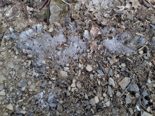
My sister-in-law gives an excellent explanation of how this frost forms (click here) and my great-nephew had a a better camera to capture the effect. I am always fascinated by how it elevates pebbles and flat rocks.
-
Ground Frost

-
Still Fresh

-
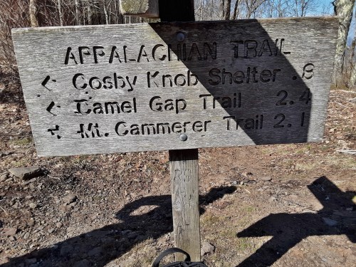
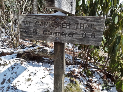
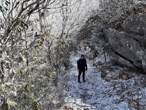
Which way?

-
Ground Frost

-
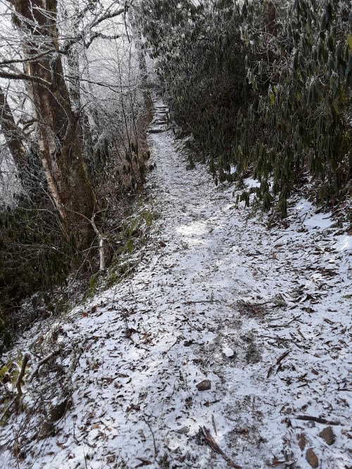
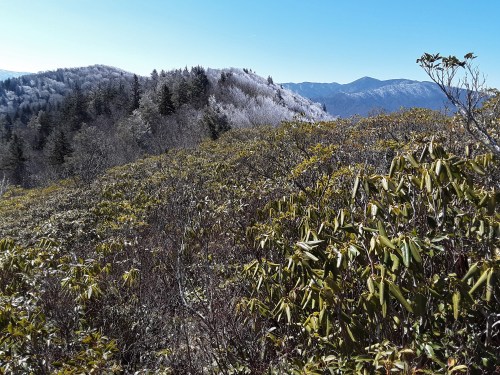
Snow Line

-
Main Ridge north of Low Gap toward Mt. Cammerer, GSMNP

-
Still well below freezing on the north slopes

-
Treetop and Beard Frost

-
Took some wind to produce that

-
Such intricate outline

-
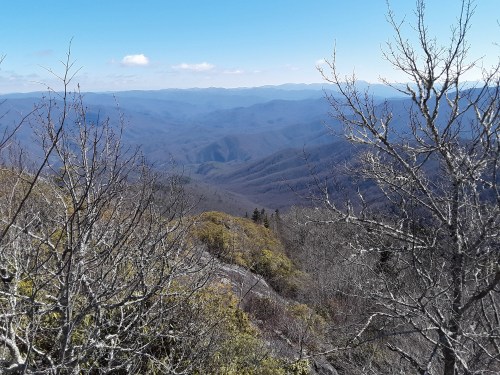
English Mountain in the background

-
Good to see in a warm, snowless year
-
Pleasant experience, good reminiscing

-
Mt. Sterling! rain gauge?


-
Restored Mt. Cammerer Firetower
The next two pictures show how intense the short-lived snow shower must have been. It would have been an adventure, though not so fun, to have been at this location during the snowfall.


Many names of mountains have changed. The benchmark says Sharp Top, but the internet says it used to be called White Top because of white rocks jutting out. Mt. Cammerer is the name given it after the early Park Commissioner who helped to secure the parklands.

-
BM Sharp Top, 1928. Why do they rarely include the elevation?
-
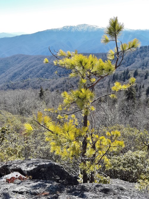
Pine tree on a south facing slope with limited soil

The following two images I borrowed from my great-nephew’s site (with permission) to highlight the immensity of the scene and the smallness of us sojourners. John Piper says that we were made for something bigger than ourselves, meaning God. The proper response to the bigness and beauty of creation is worship of the Creator.


-
I-40 and the Pigeon River
-
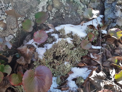
Galax, lichen, and snow

-
Time to head down
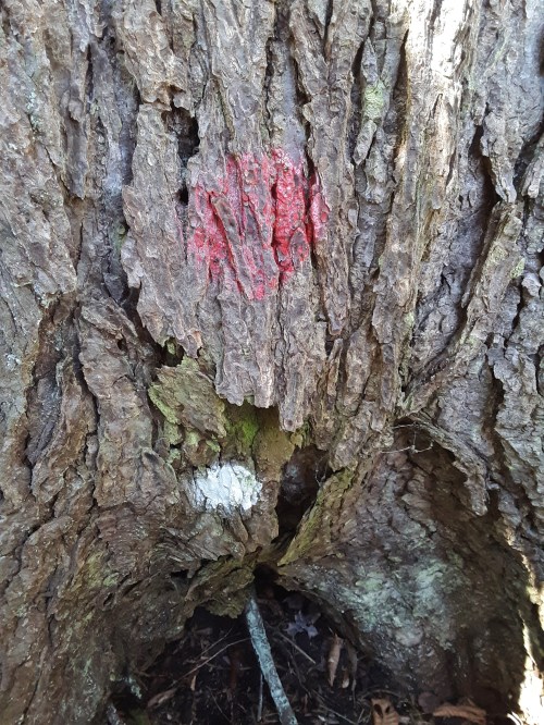
The Hemlock Woolly Adelgid has decimated Eastern Hemlocks in recent years. The Park Service treats some of the larger ones that are left. Evidently the treatment has to be repeated (For details click here.) to save the trees. Are the two paint marks two successive treatments?
-
Treated Hemlock

-
Treated Hemlock next to the untreated one

-
Christmas Fern

-
Barely over halfway point
-
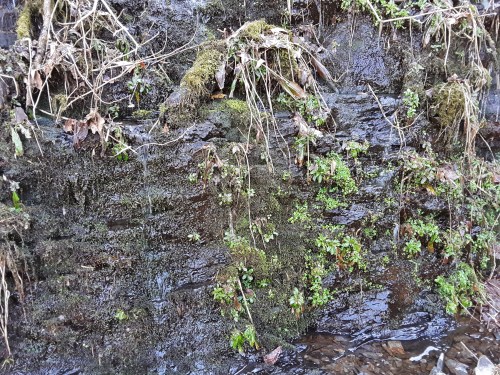
Seep
-
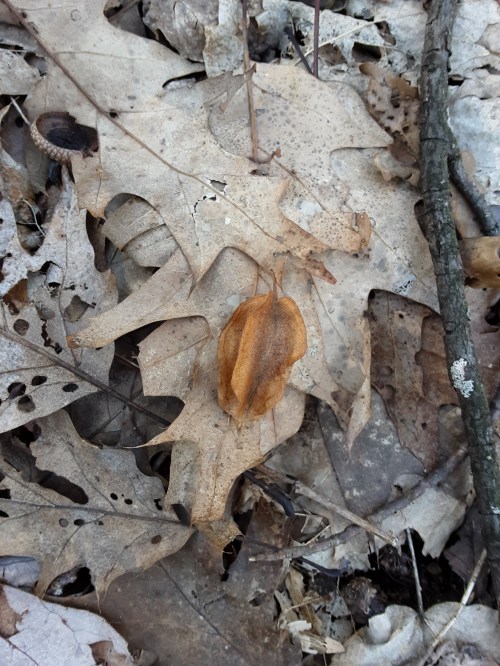
Mountain Silverbell seedpod on oak leaves
-
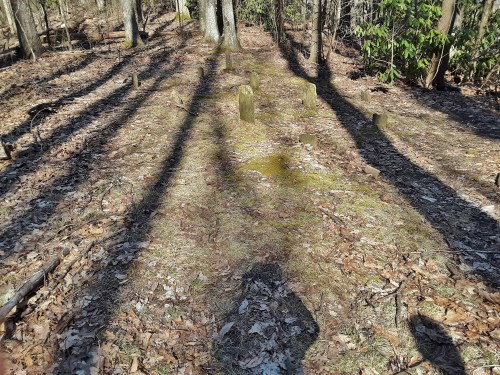
Cemetery

-
The only marked stone and probably the newest at 1912.
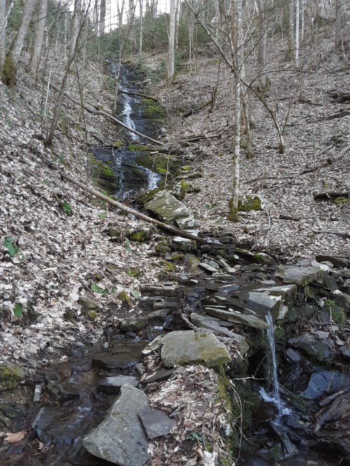
Many of the draws showed more evidence of high flows than the black width of drainage way here.
-
The high water must have been something.

-
Cruising the easy way in a north facing woods with little underbrush.

-
Was the bridge nearly toppled by high water or poorly set to begin with? Bridges across the wider streams are a welcome and easy passage.
With all of the amazing things that cameras can do, I am still amazed at what the eye does better. The following scene revealed 360 degrees of mist penetrating rays to the eye, but several attempts with the camera failed to show any of it. It does show how low the sun was. With the driving to and from home, the hike, and the time on top, I was gone from home for 13 1/2 hours. It was well worth it.

-
Almost there
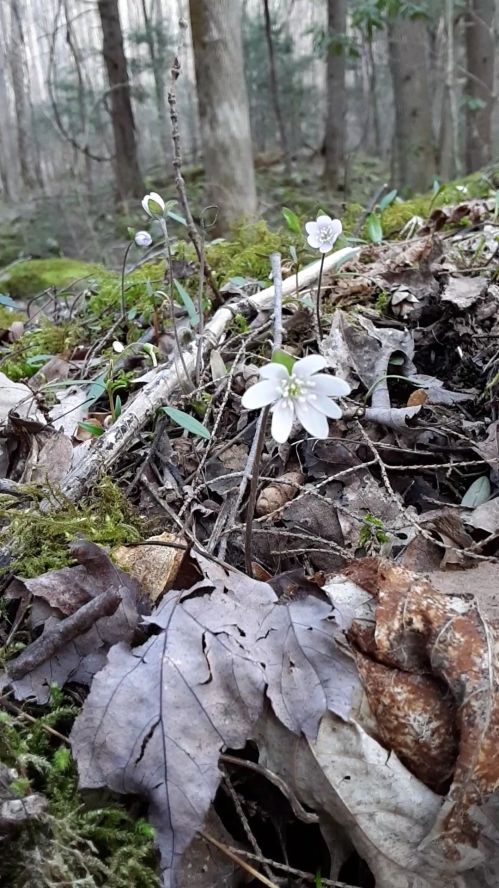
My sister-in-law helped me identify this little beauty on a short detour we took off of the main trail. After the late winter snow and cold up above, it was a surprising harbinger of Spring after a brief brush with winter.
-
Trail detour Hepatica
Read Full Post »
