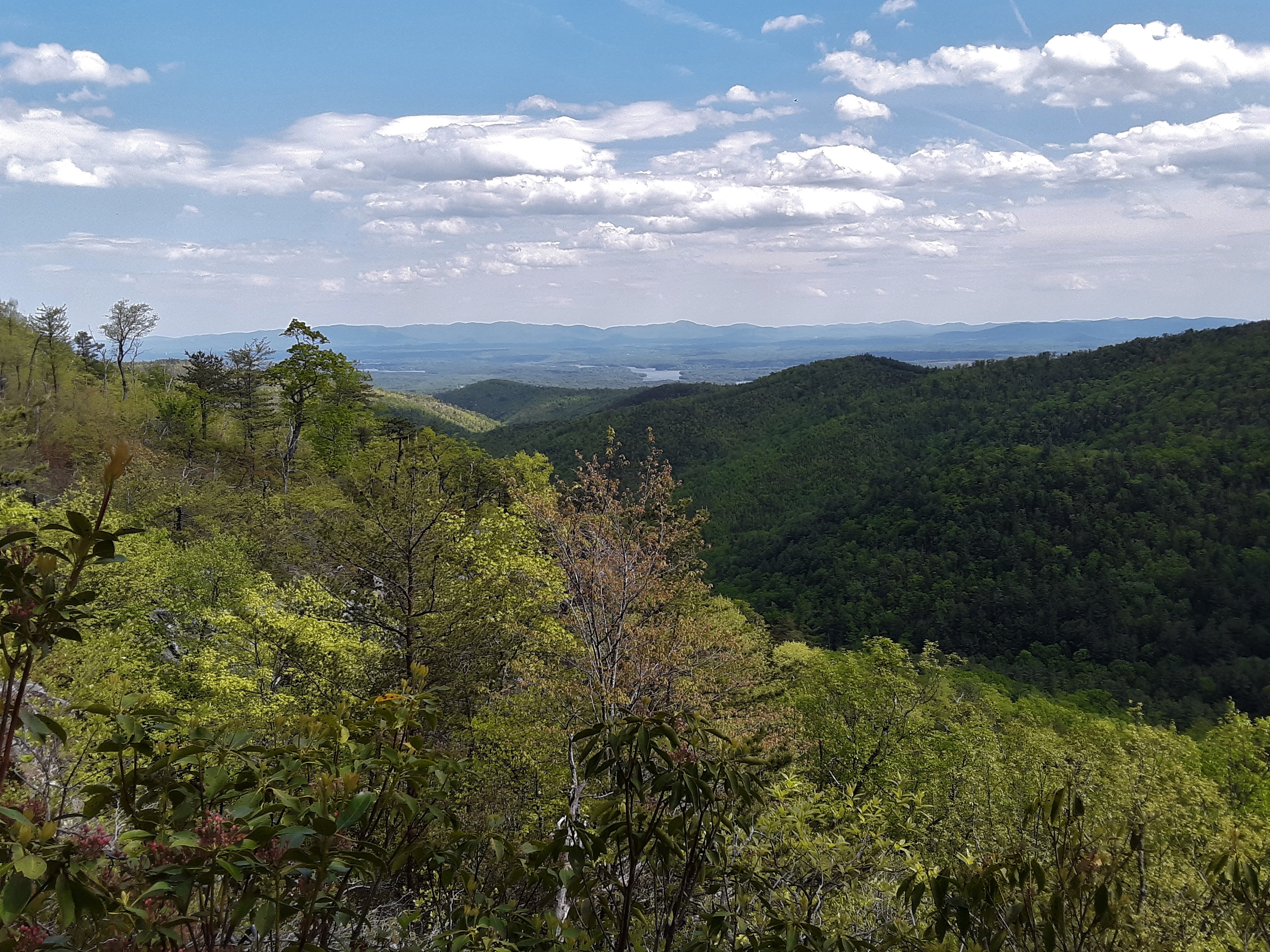
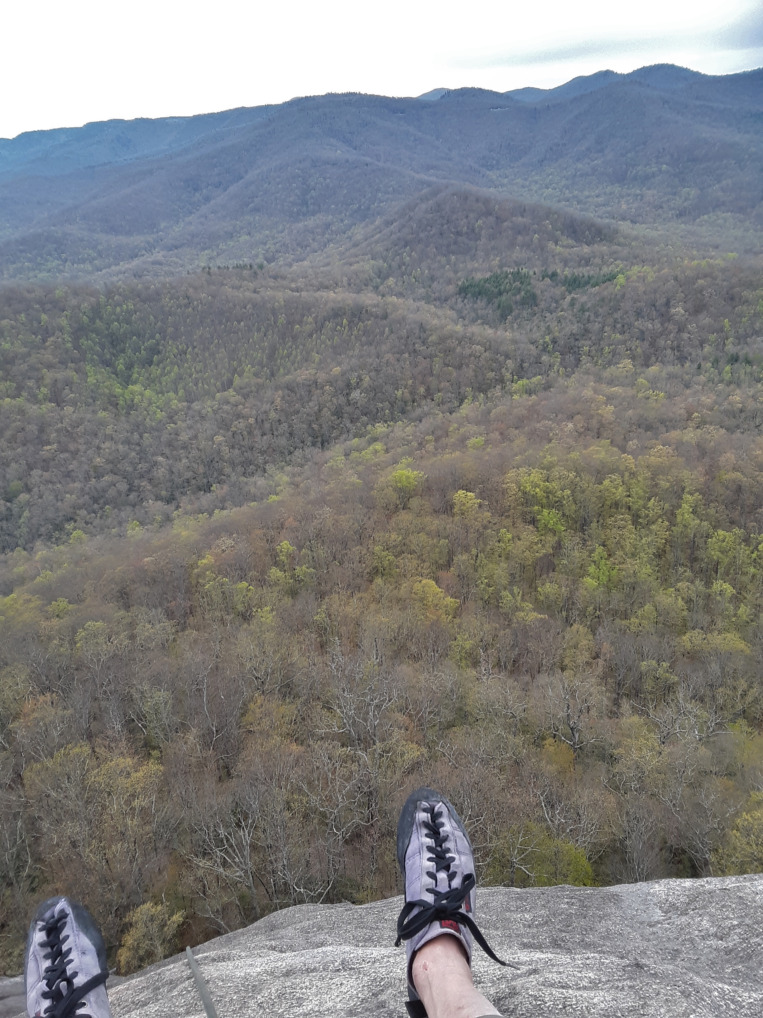
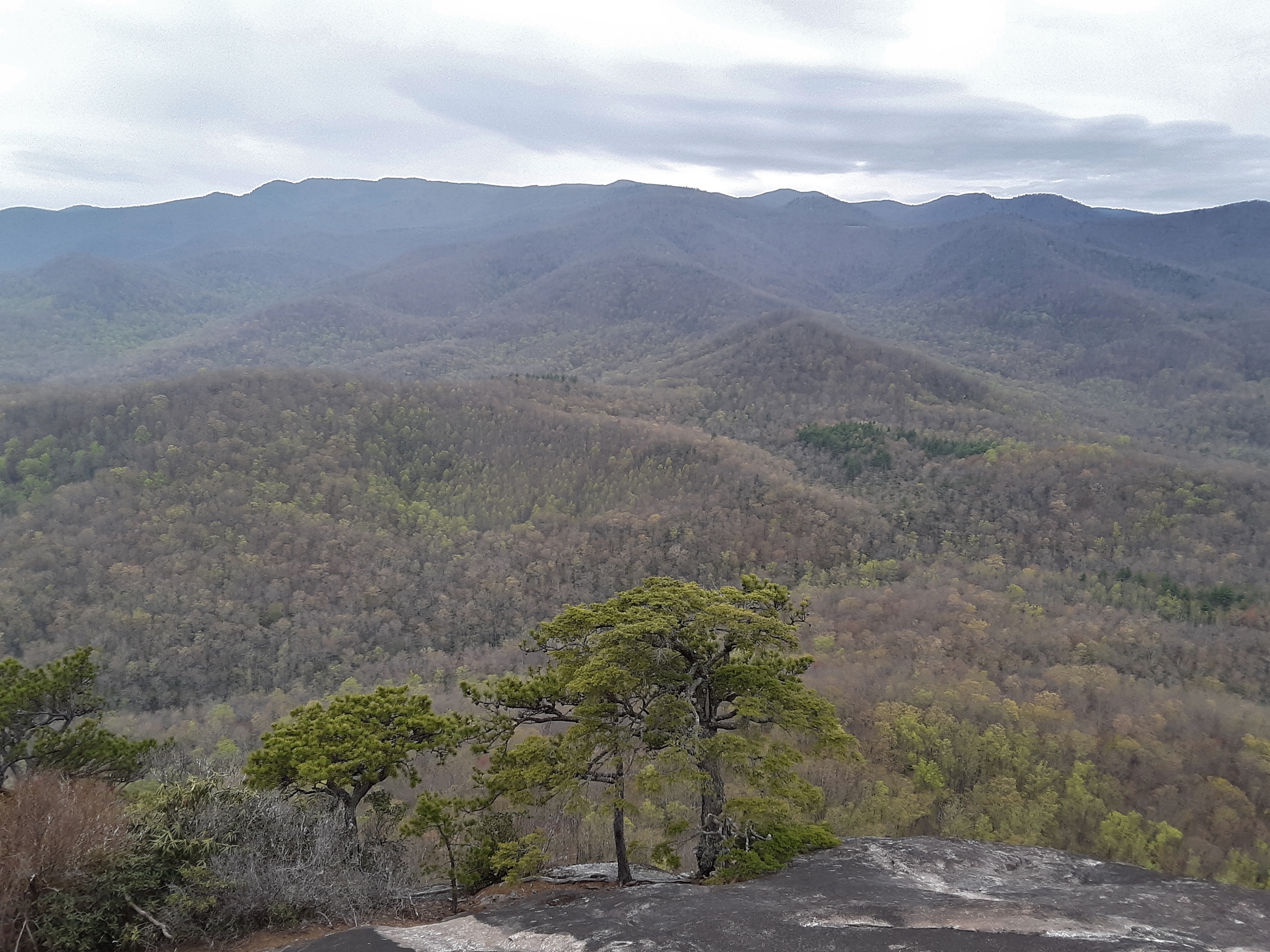
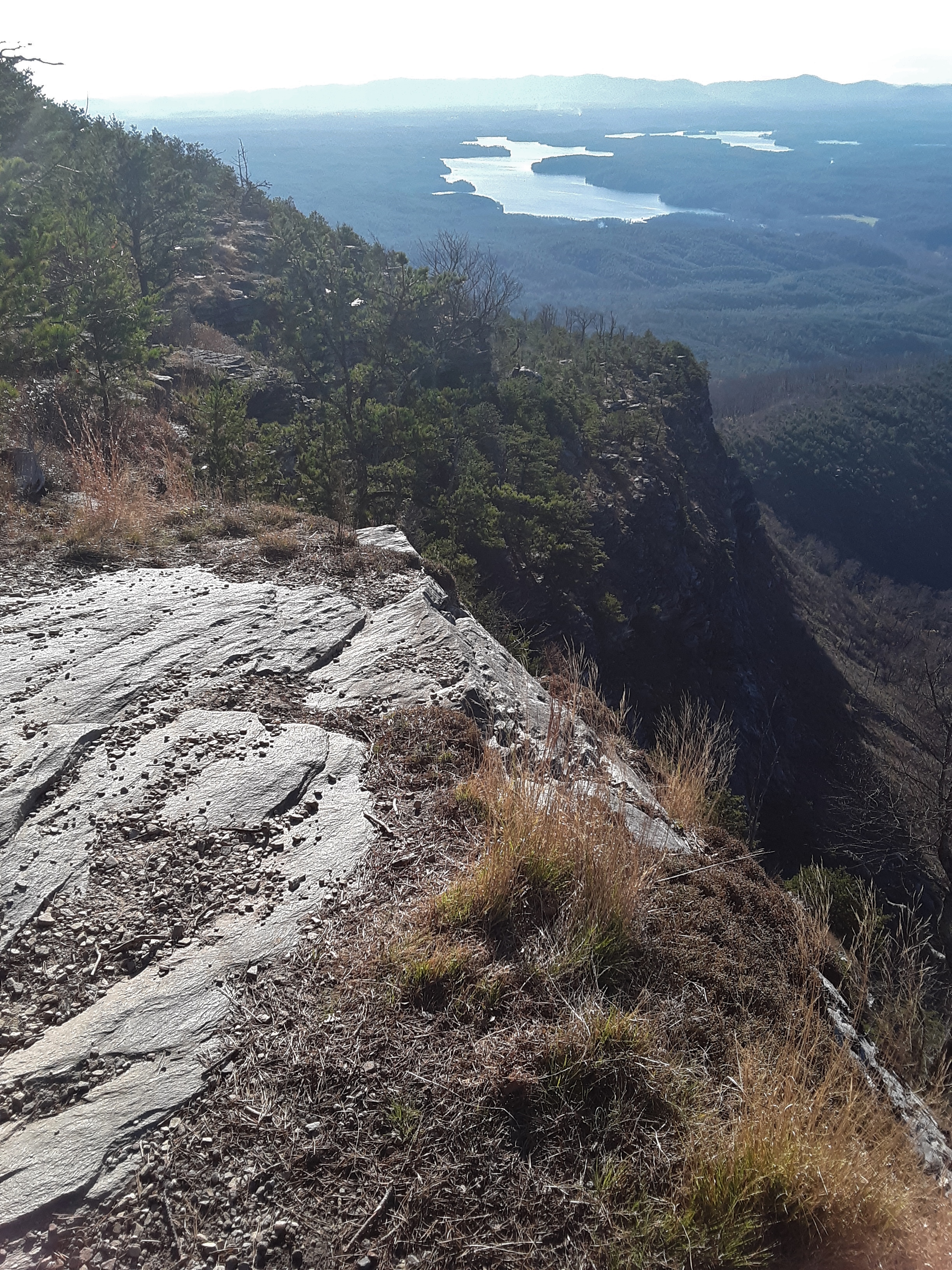
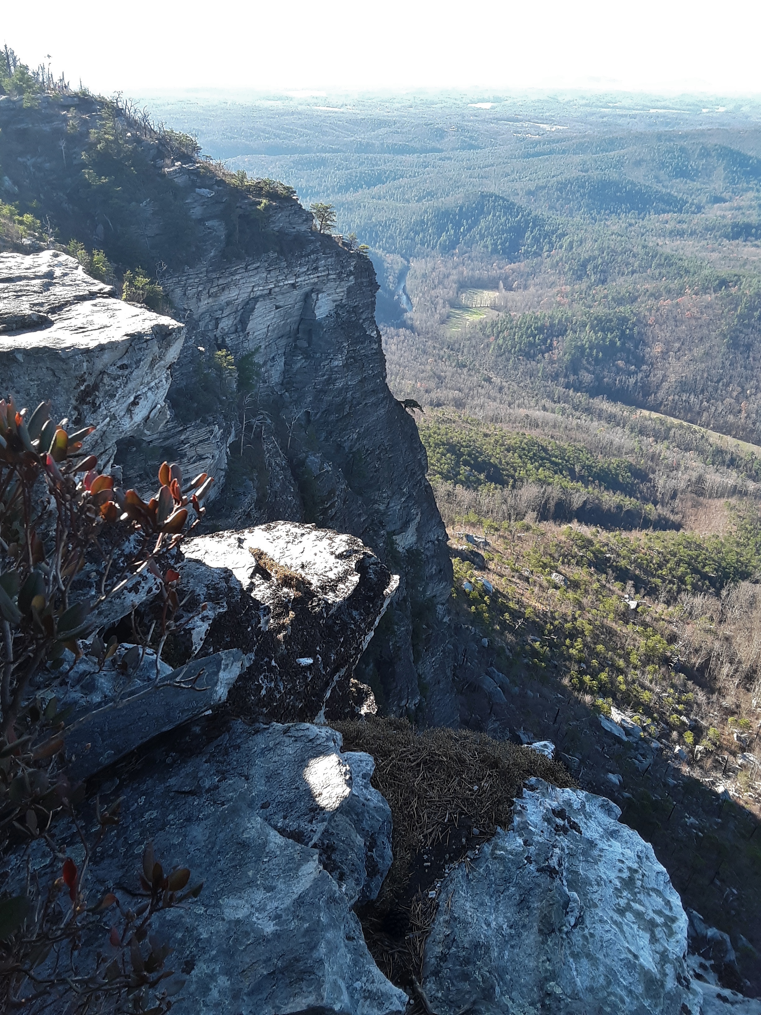
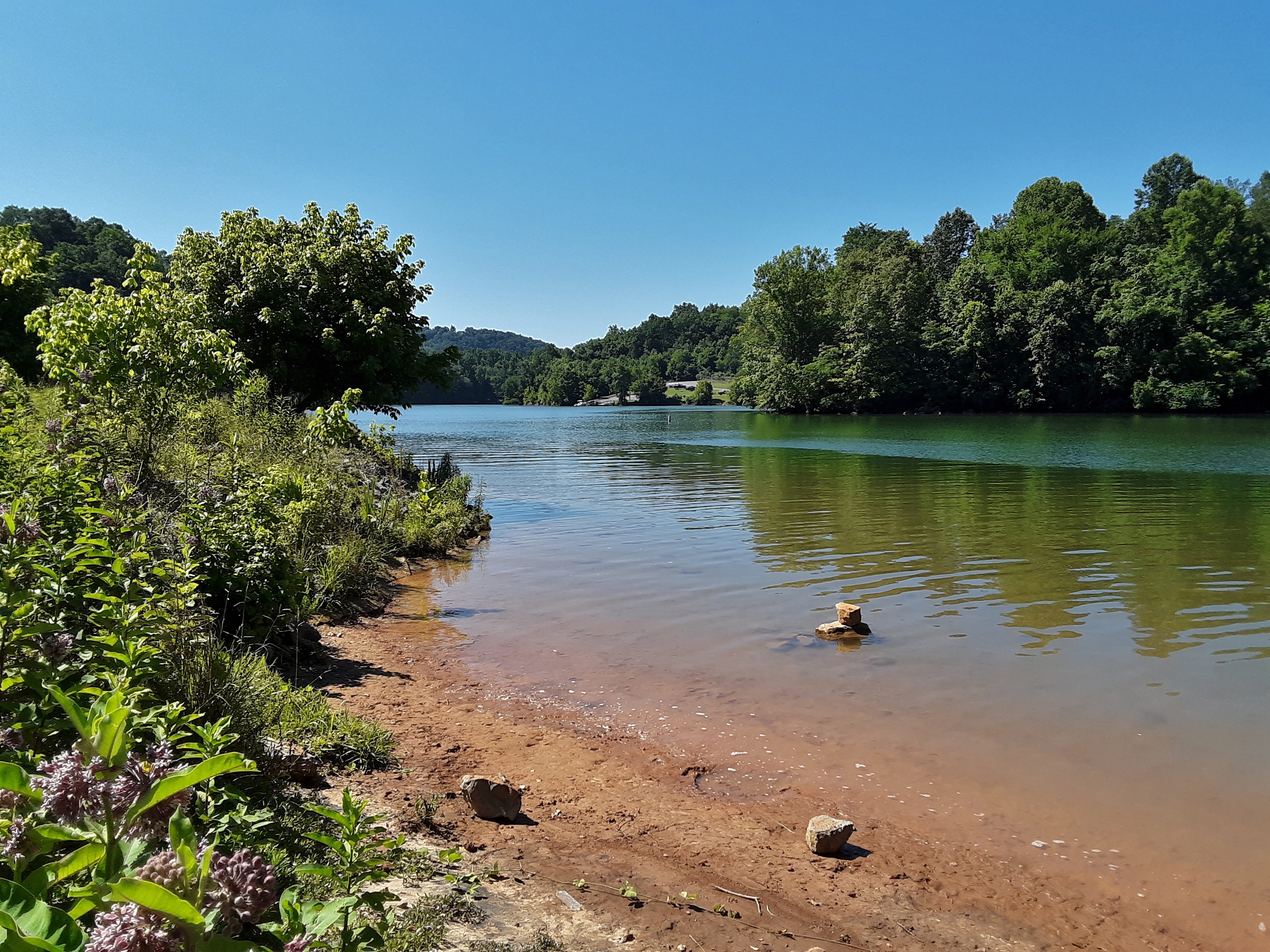
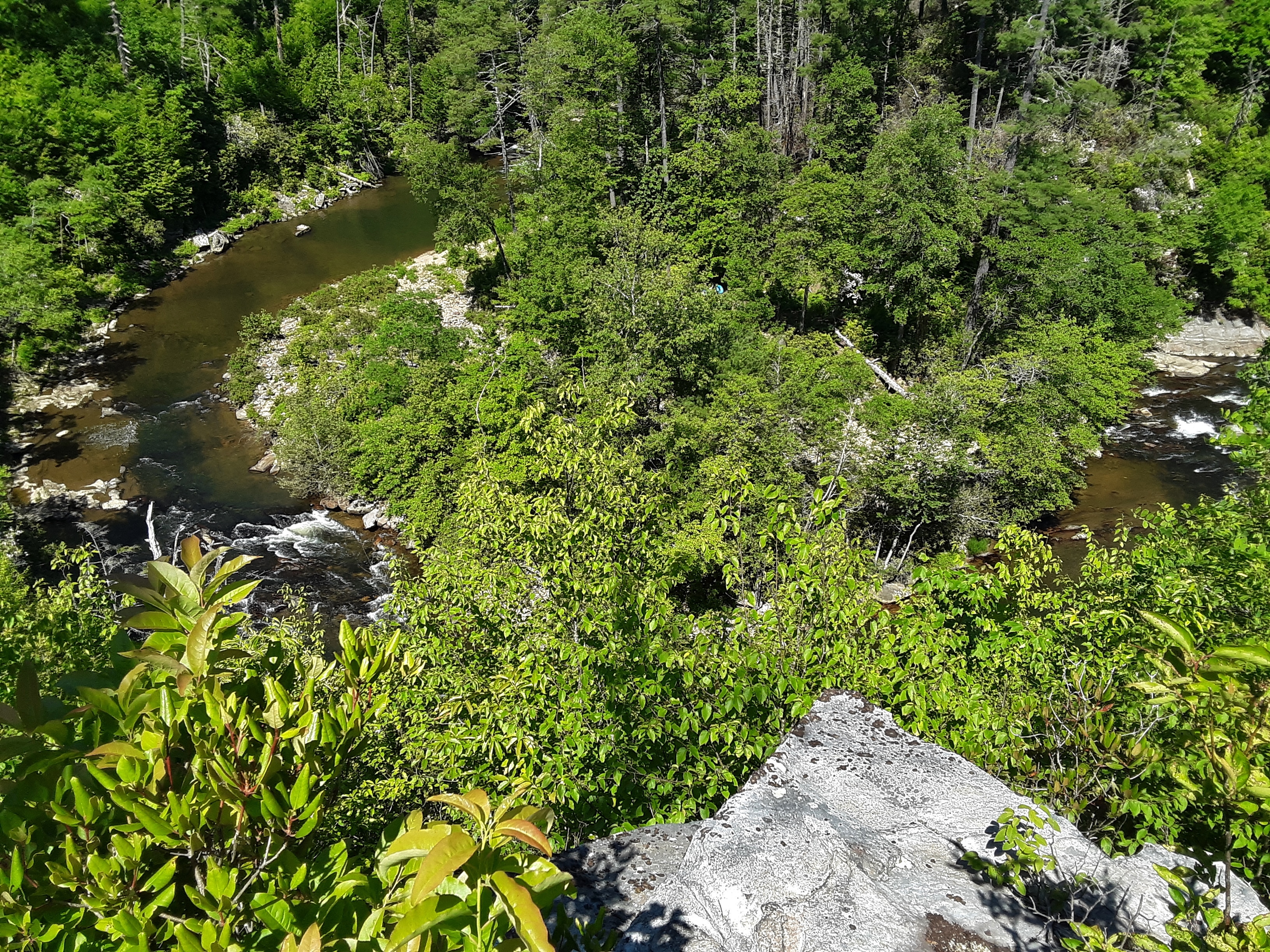
The sun was out, the breeze was cool, the sky was clear, then variably and partly cloudy, and the climbing was good. Showing someone climbs on a crag is fun, and I even climbed one I had not climbed. We got in ten pitches in seven hours. It wasn’t a record pace, but we weren’t in a hurry. I never get tired of this view from the top of Black Fork Cliffs. It is in my county and yet it seems worlds apart, so secluded and isolated.
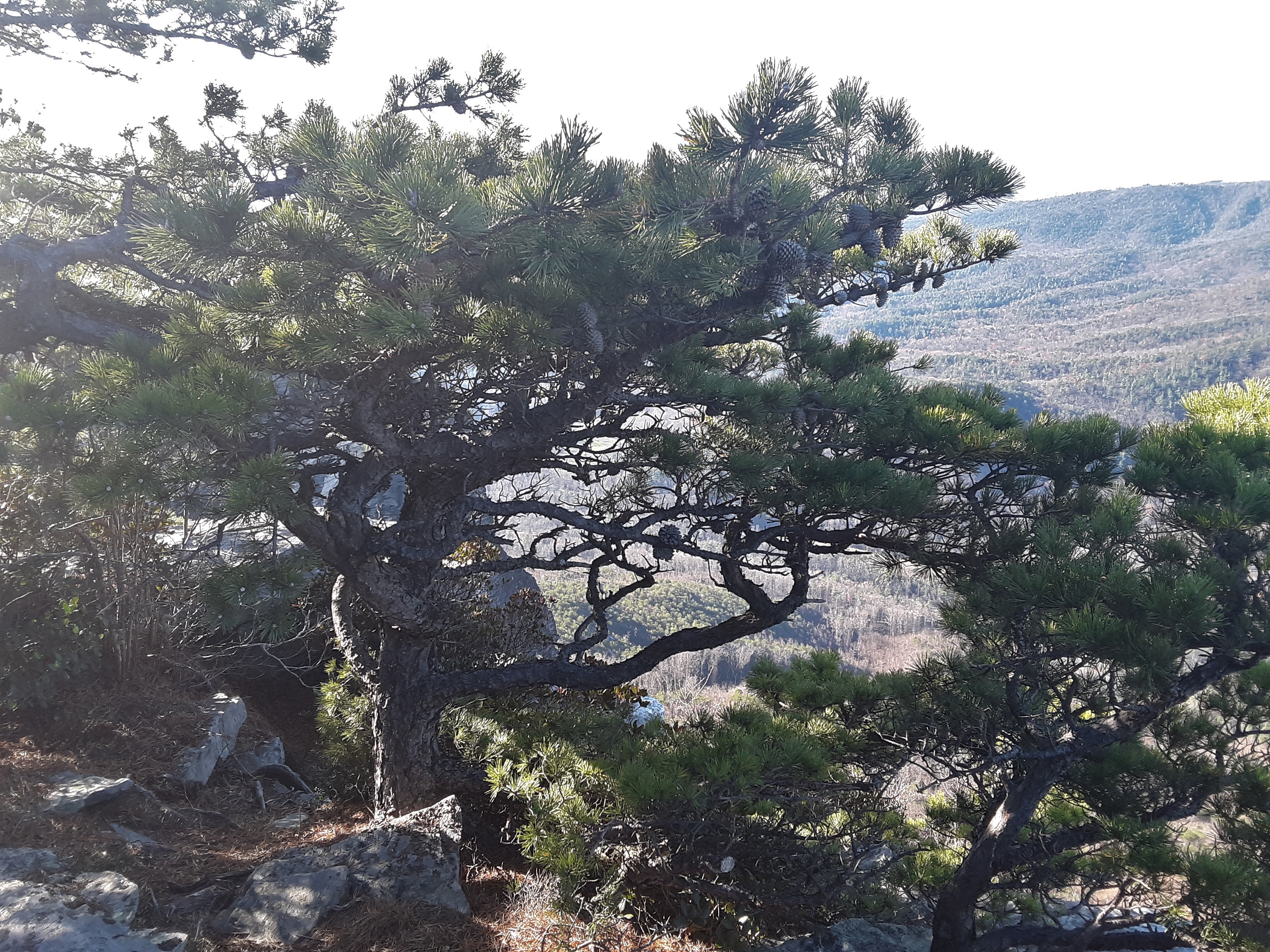
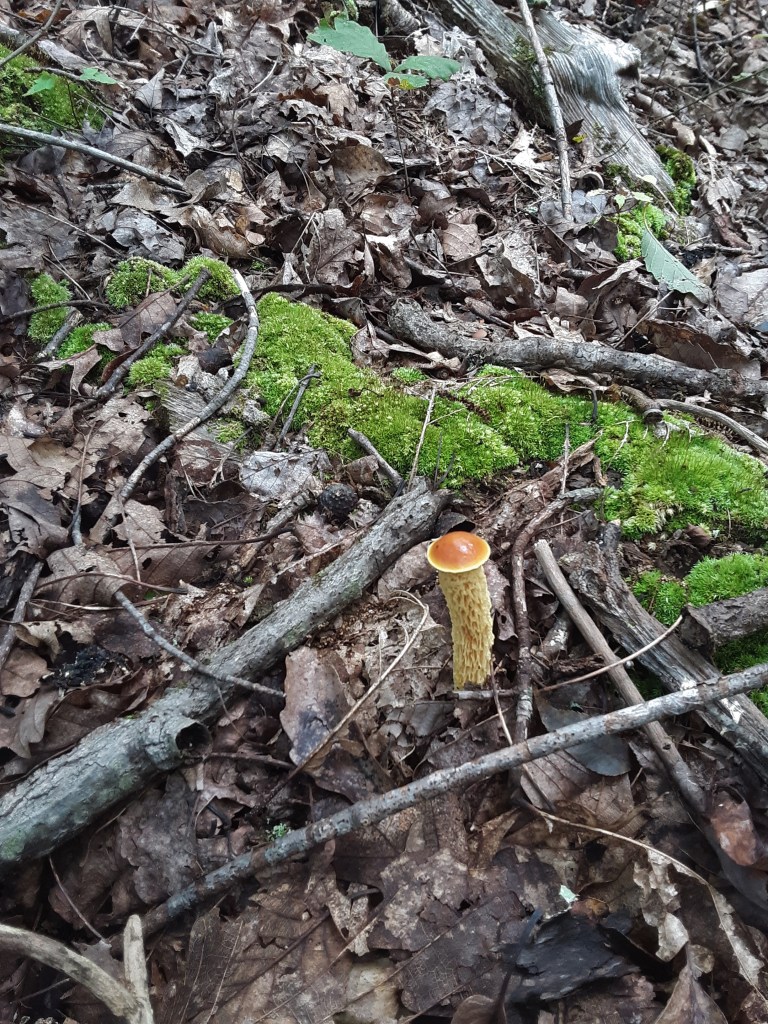
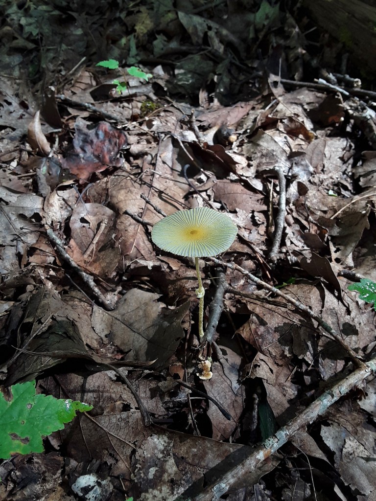
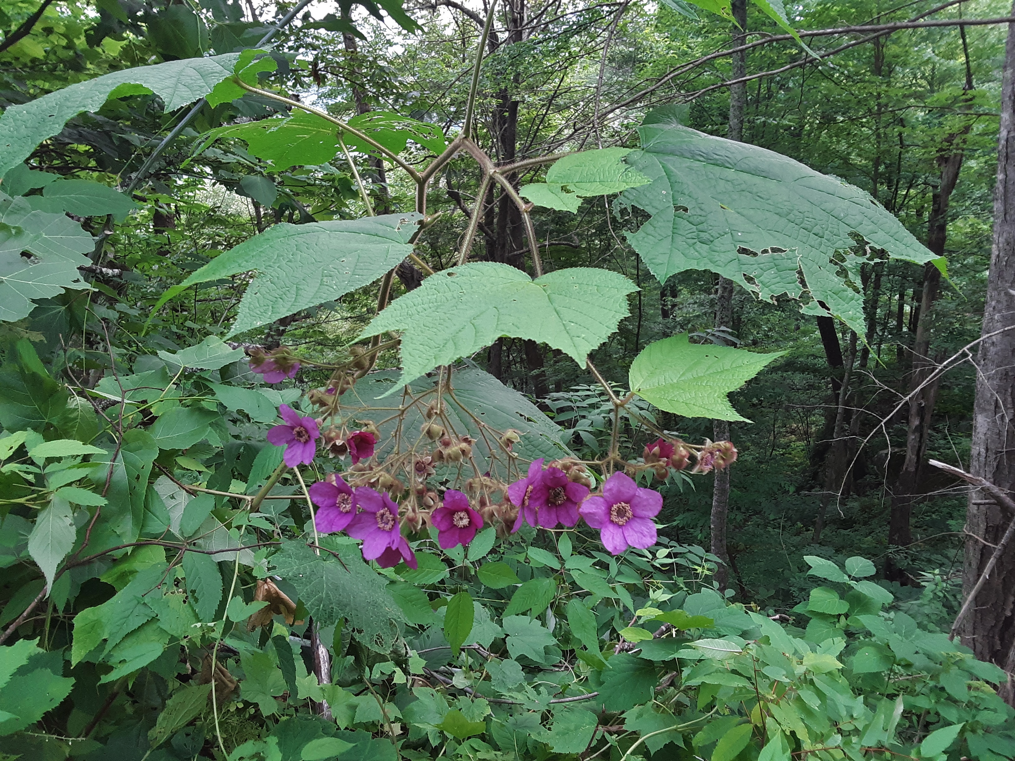
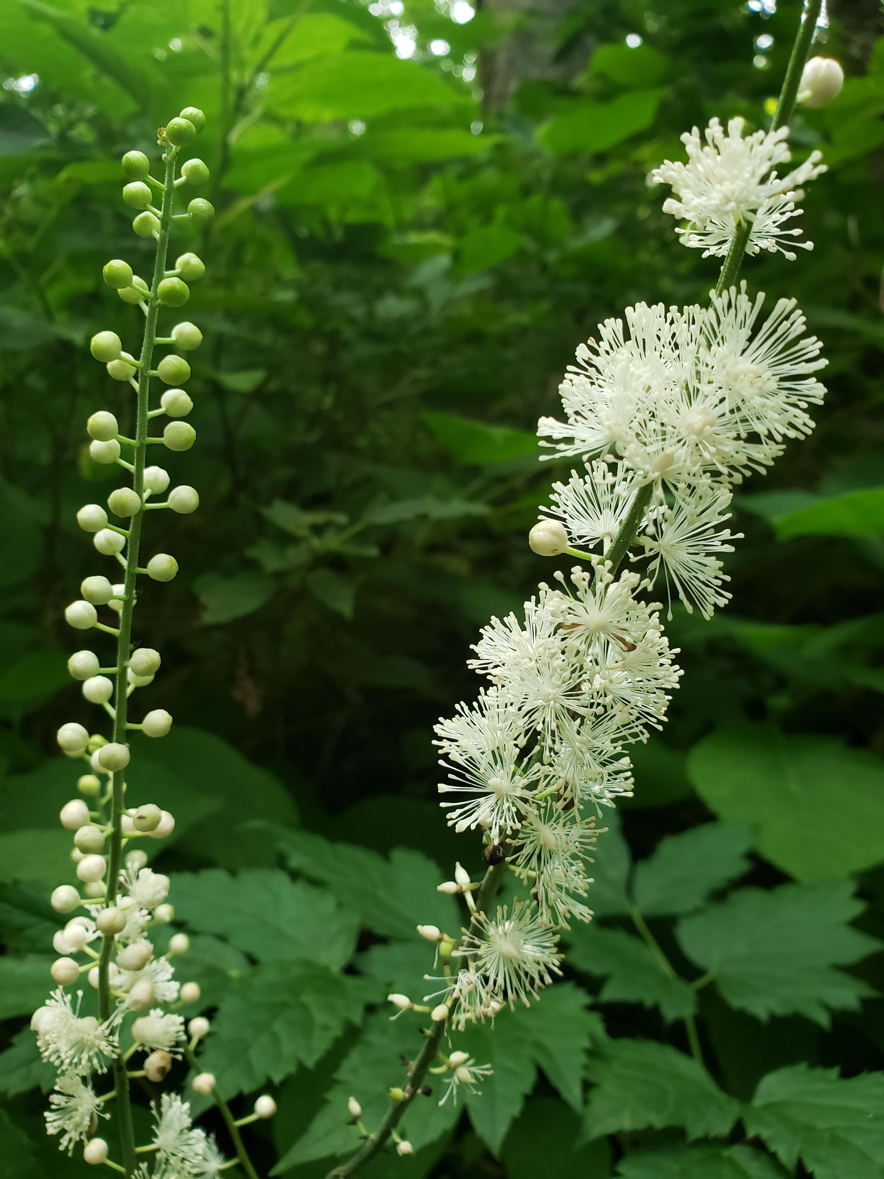
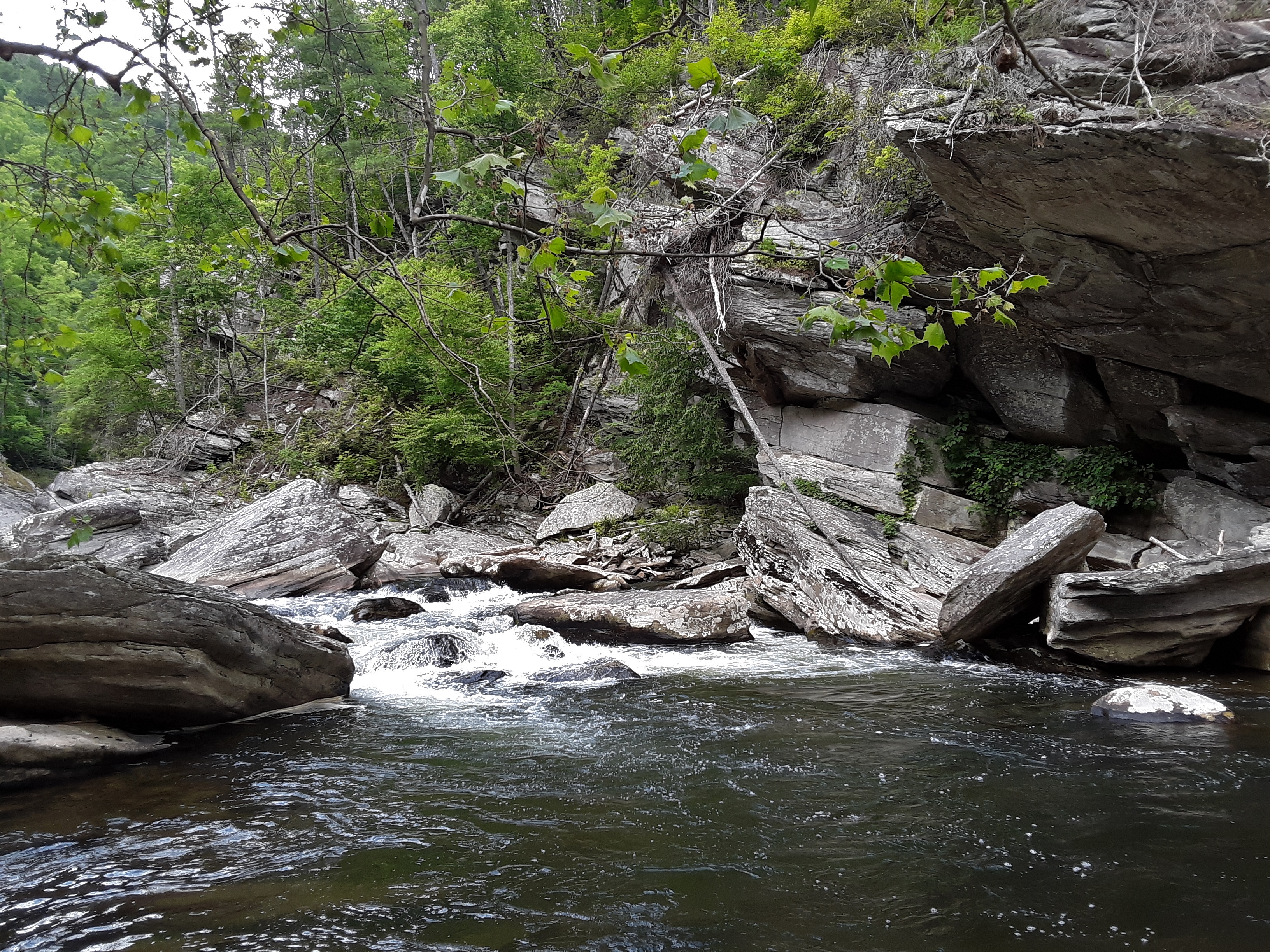
Two fires in the last dozen or so years have robbed the cliff base of its shade, but that in turn is generating a fast renewal. It seems early for Frazier Magnolia to be blooming, but there it was.
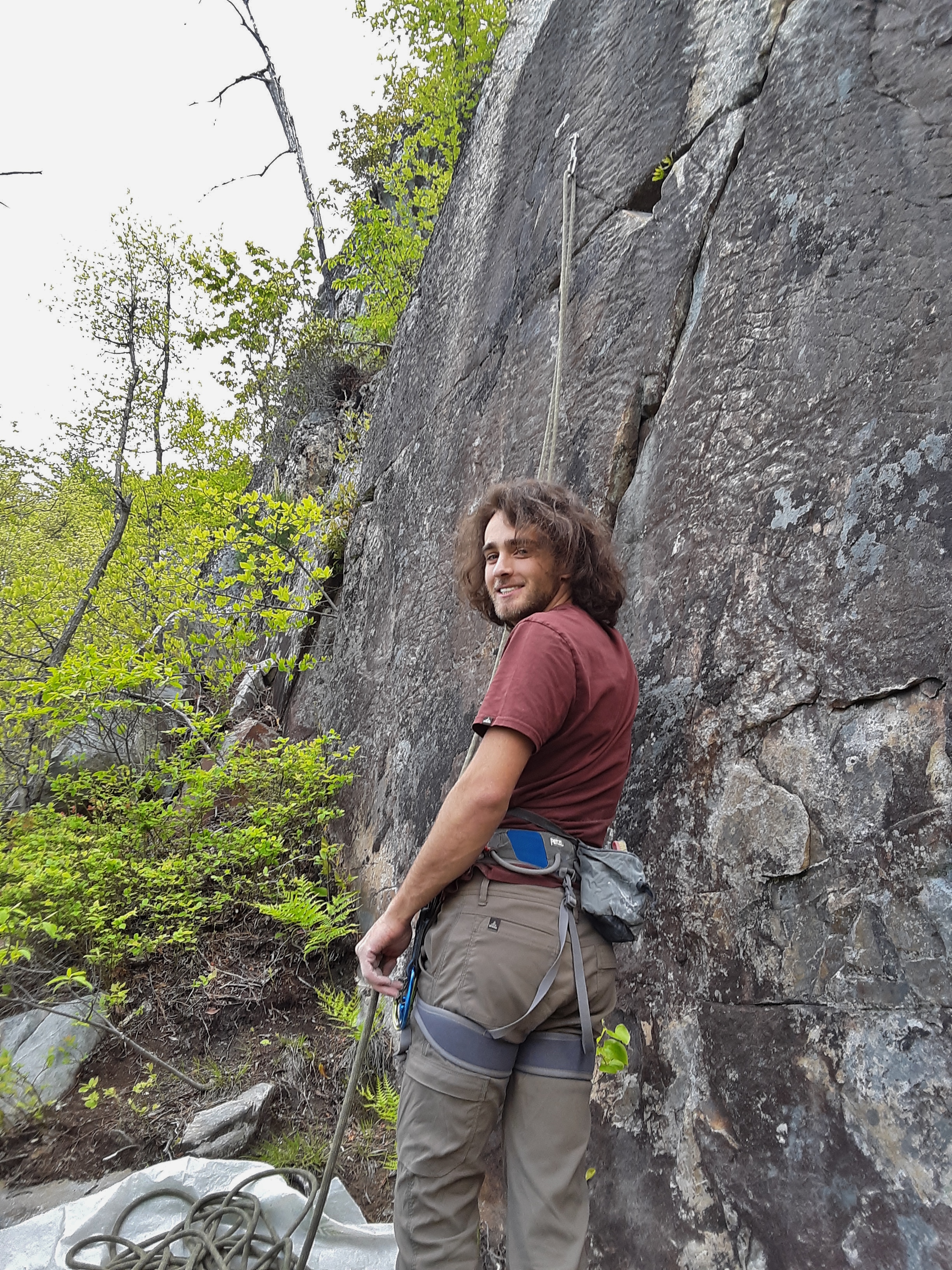
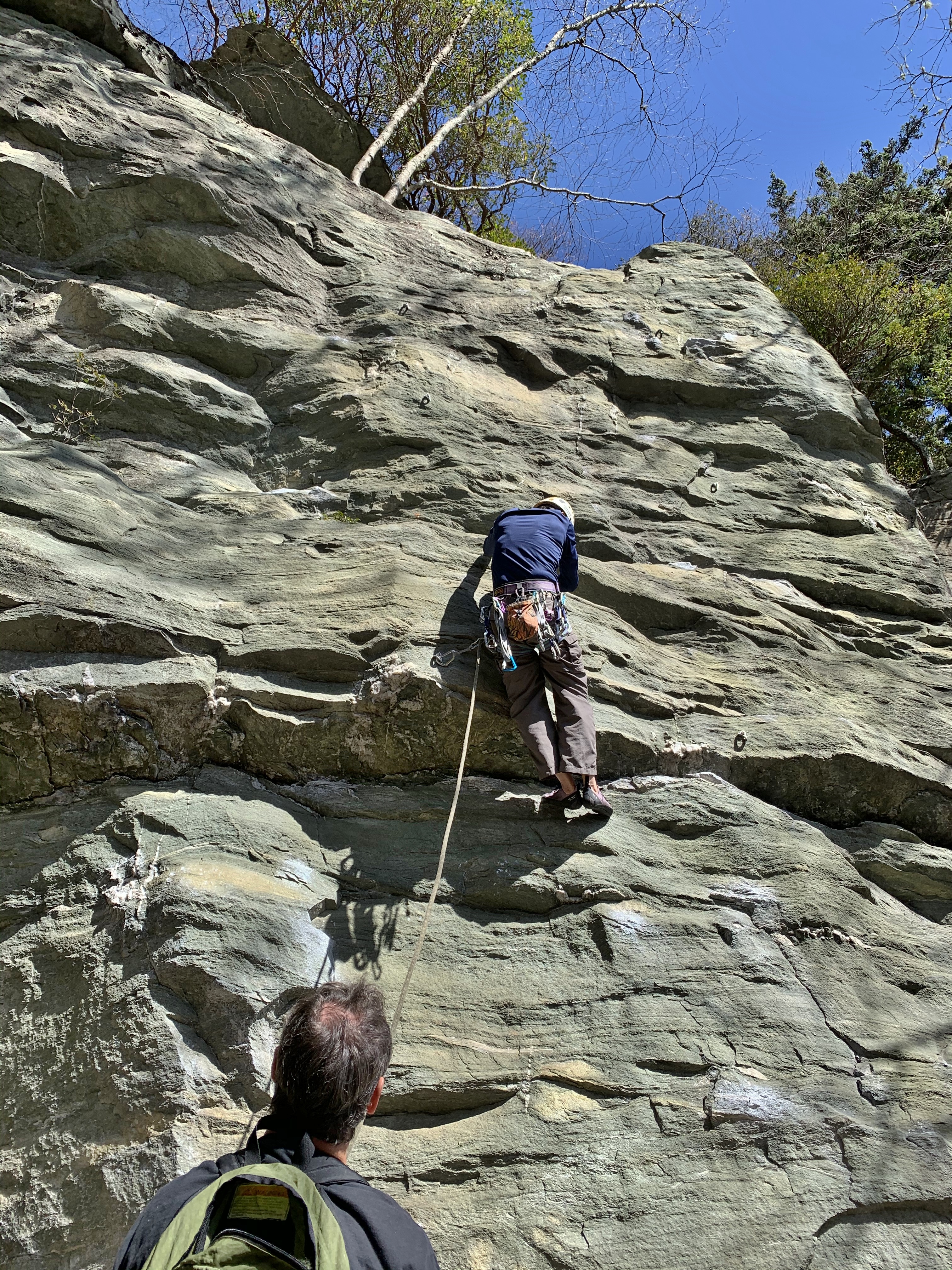
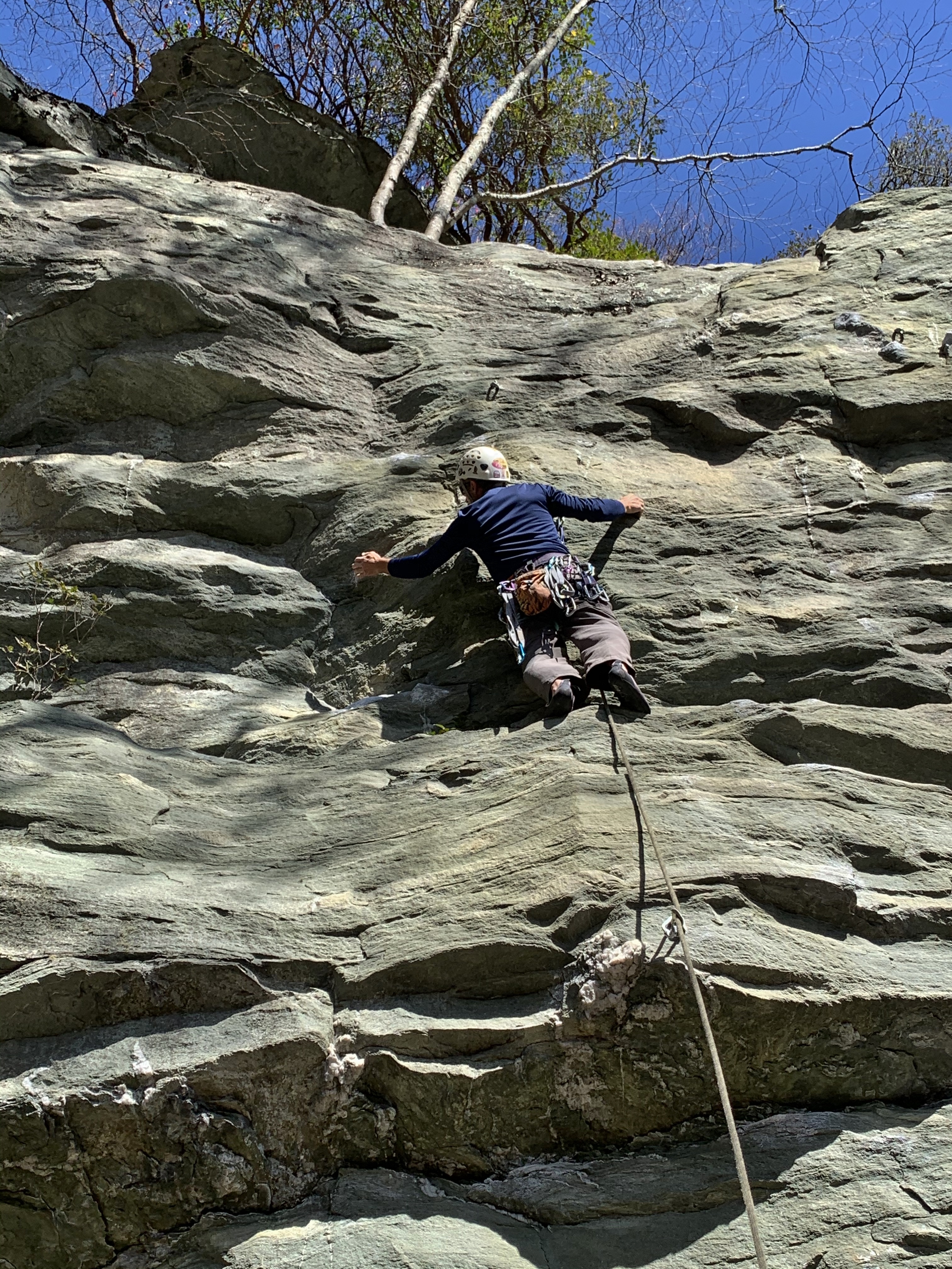
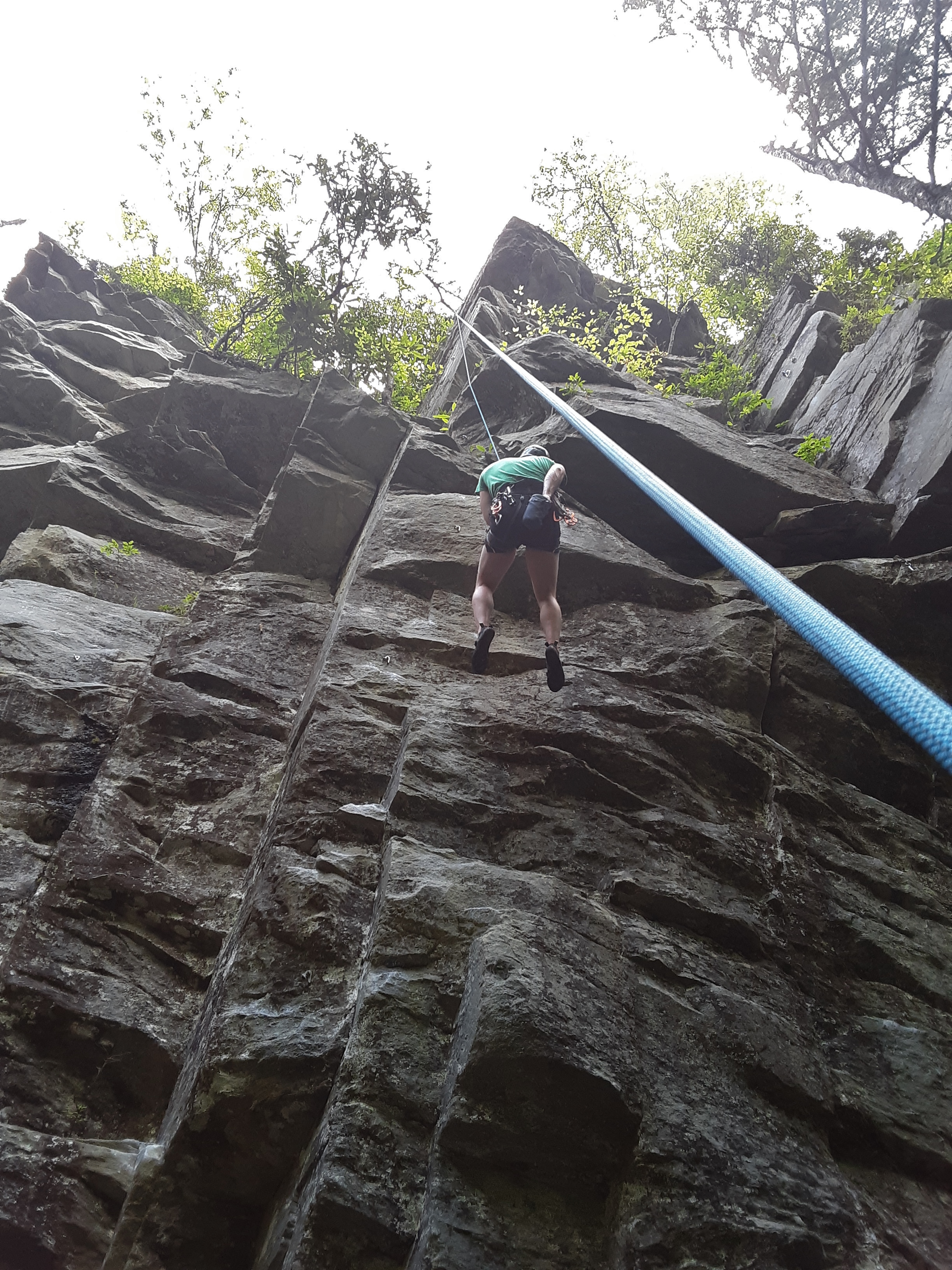
Psyched again and doing new pitches he’d never been on. Notice that the rope is already on the wall. How did that happen? It’s called stick clipping. In my case, I used an extendable painter’s pole with a device on the end that holds the quickdraw (shown on the bolt in the picture). This makes the climbing safe from ground up.
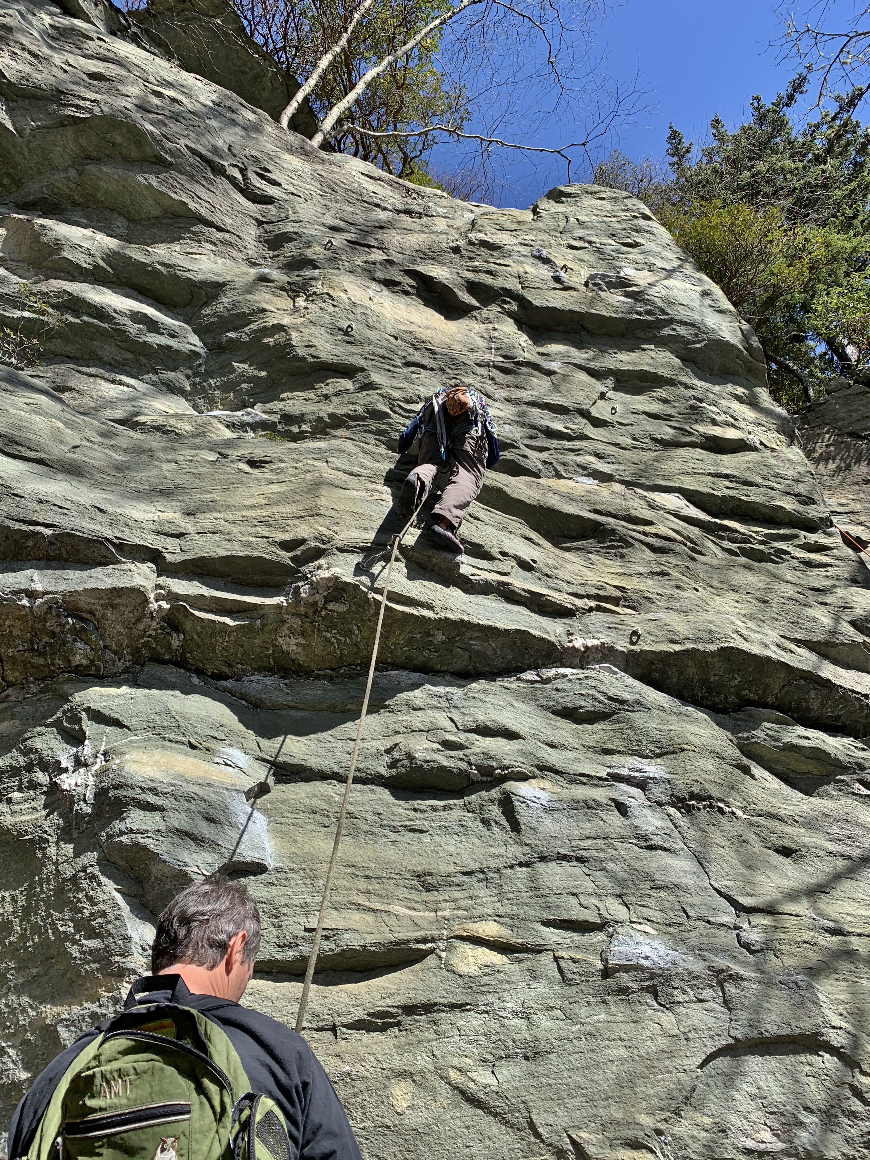
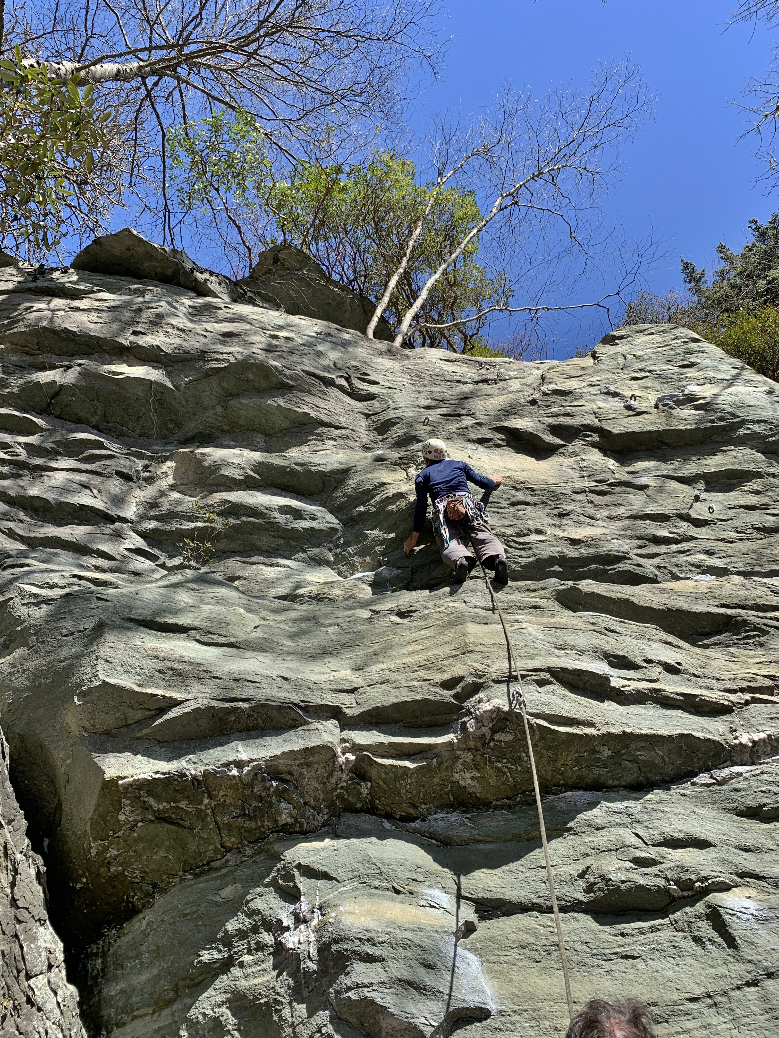
We refer to such climbs as next pictured as “one move wonders” because most of the climb is very easy except for the one move he is trying to make over what looks like a “warped wall” from Ninja Warriors.
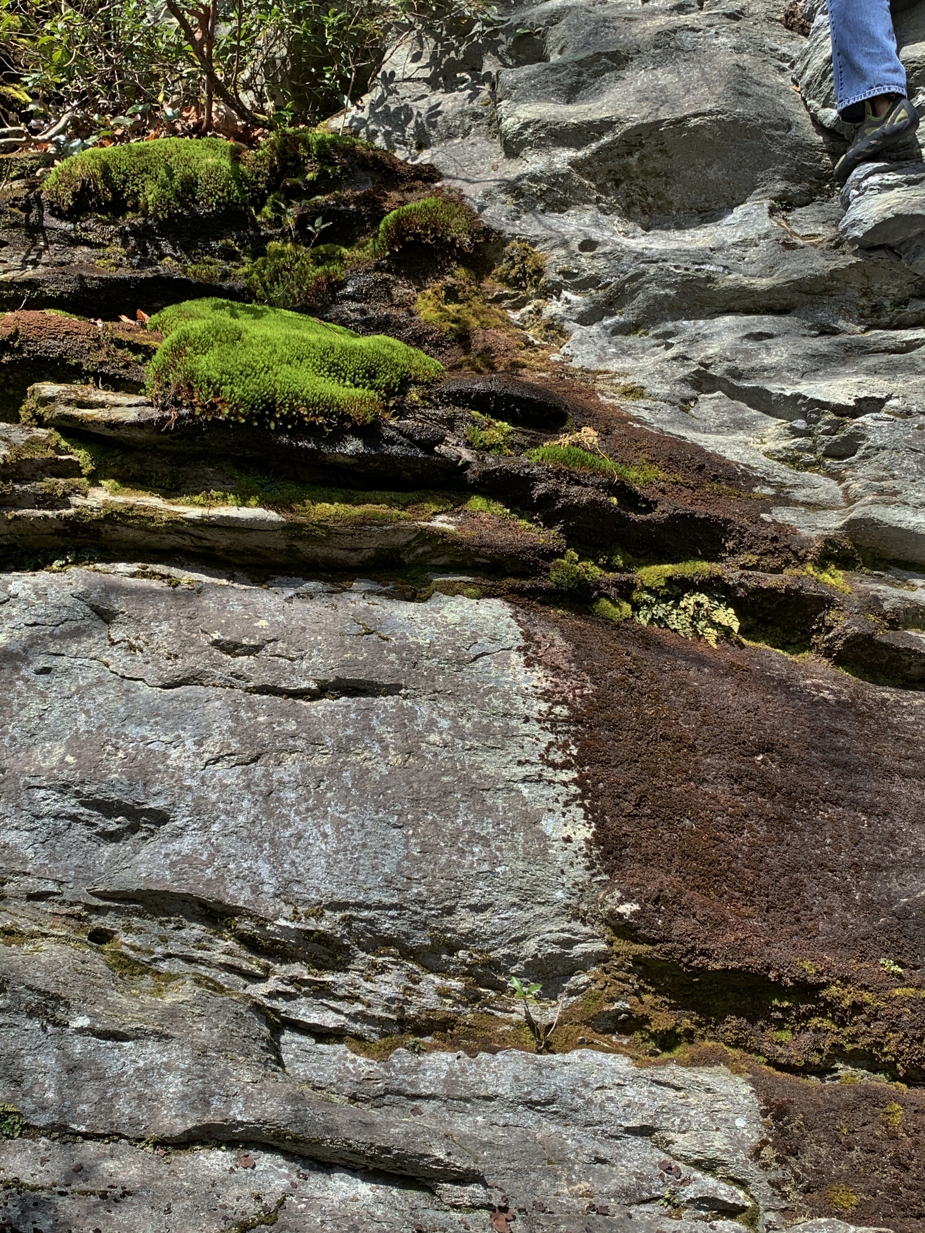
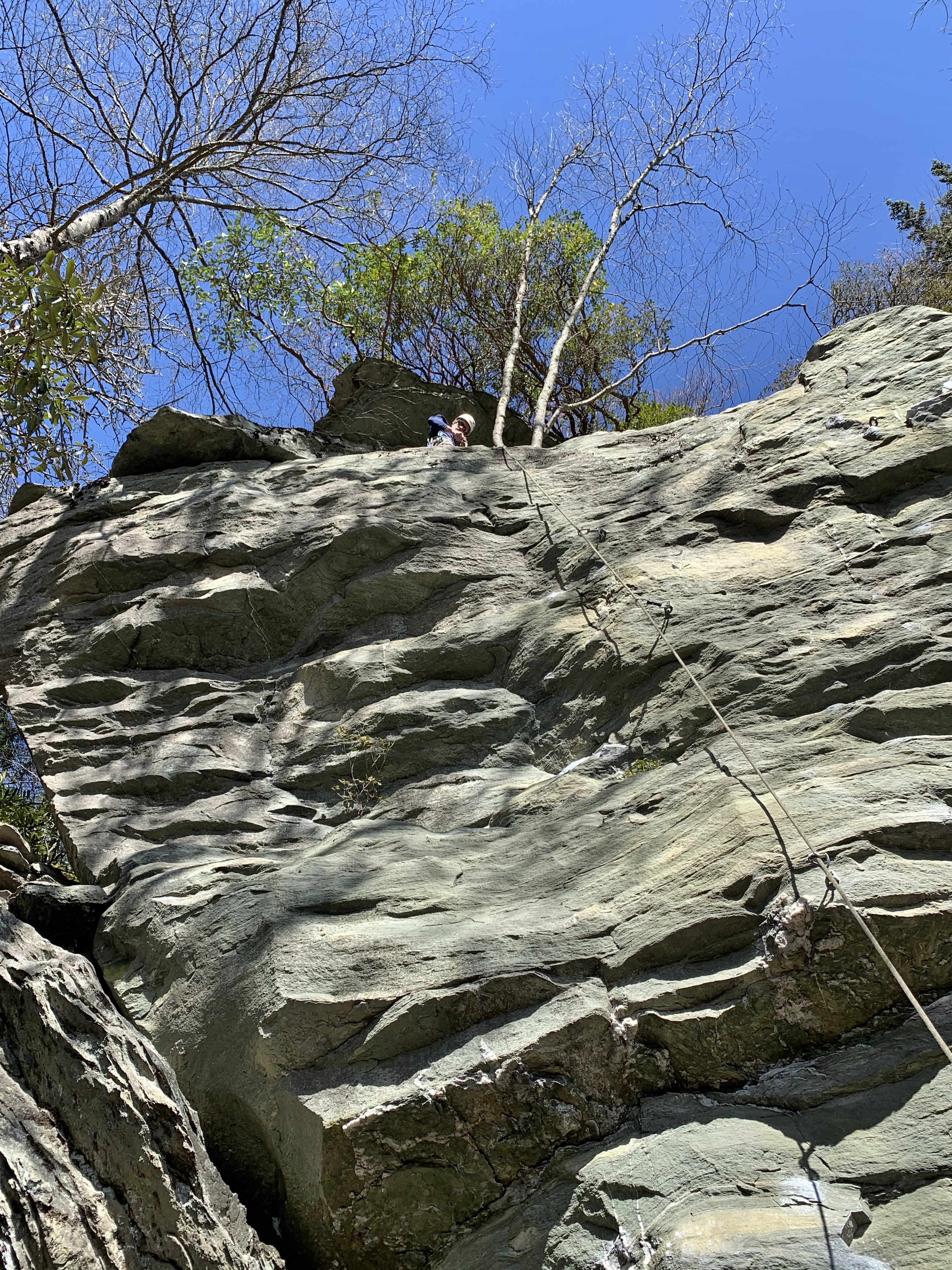
The stainless steel rings at the top of a sport climb are secure, giving a comfortable stance for looking around. The black lichen looks like pits in the rock, but aren’t. I cannot figure out the dead pine tree. Am I seeing another tree behind it cause the bizarre shape appearance of the trunk, or is it really that odd looking?
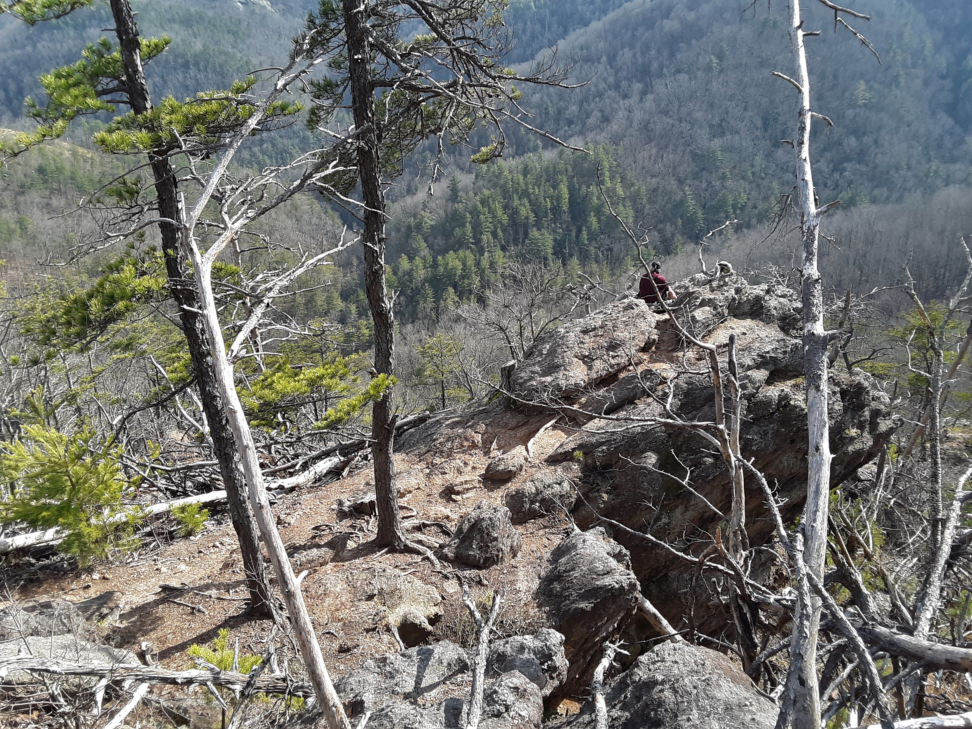
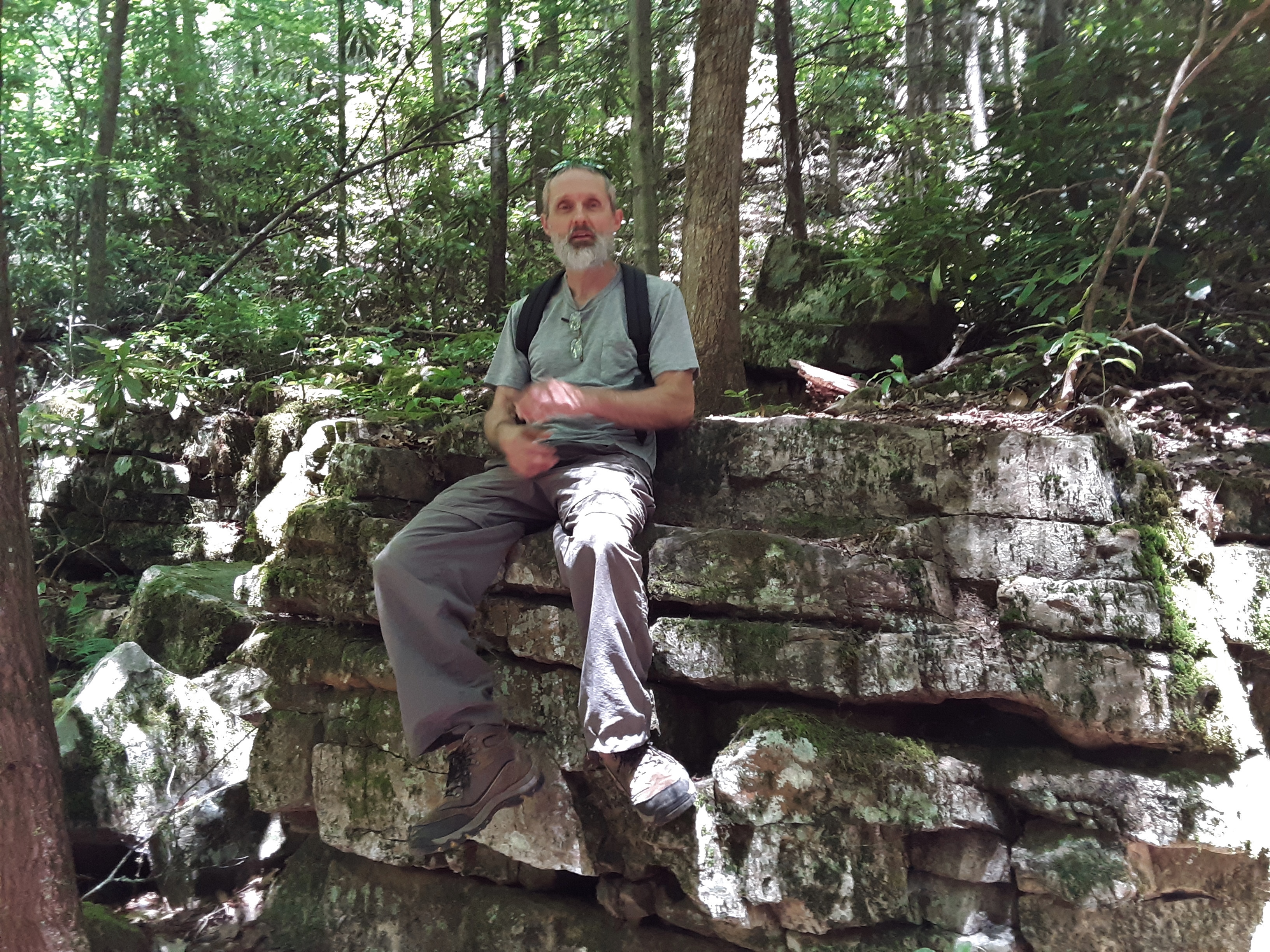
Contemplating.
Lunch snack and belayer rest. Maybe that’s what he was contemplating. When is he going to get up? The Komodo’s (a defunct brand similar to Crocks) keep my climbing shoes clean between climbs.
This rock formation looks like a spire or tower, but on the back side it really only sticks up about 10 feet above its attachment to the wall.
It looks cool even if it is an easy climb.
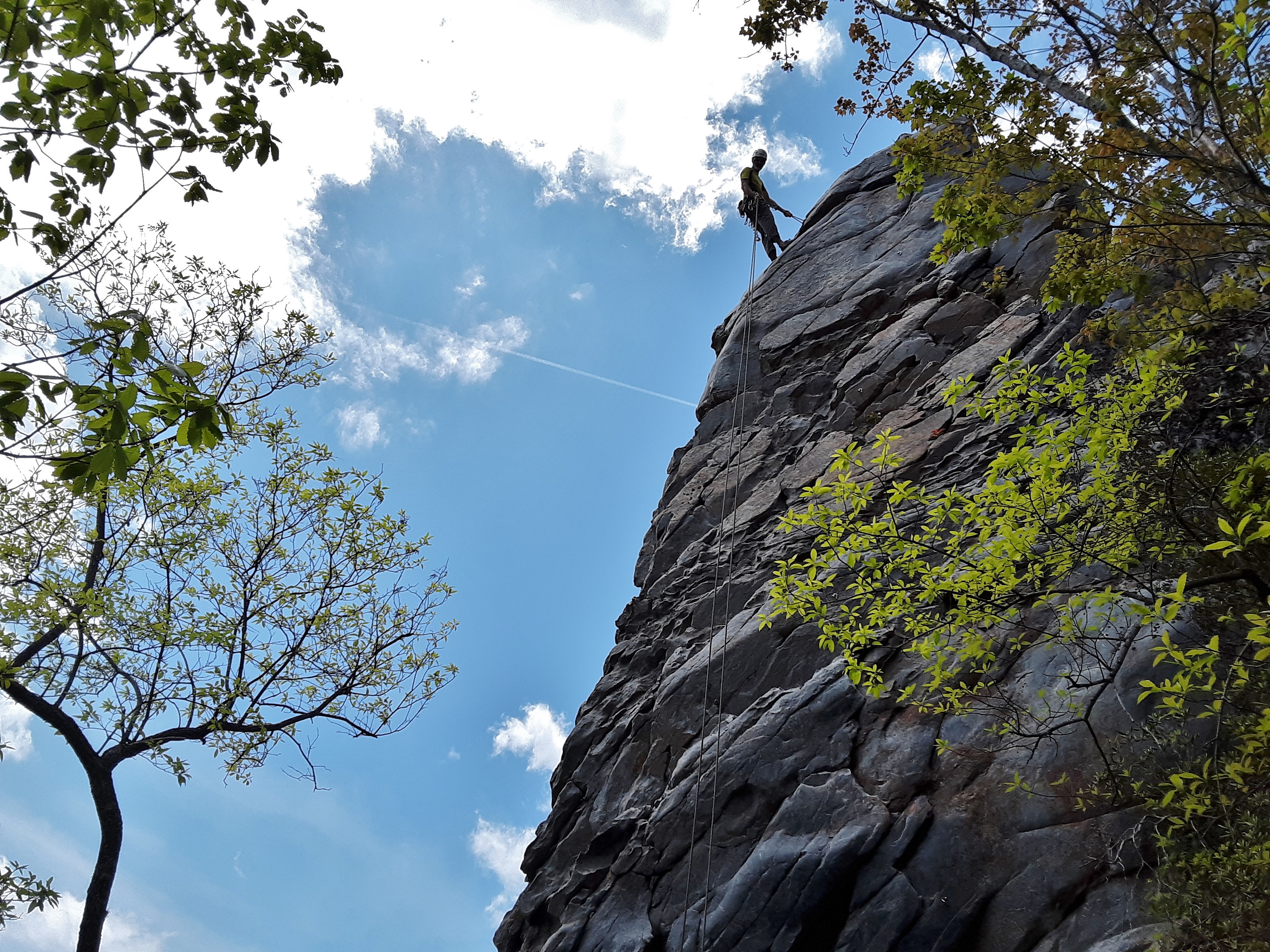
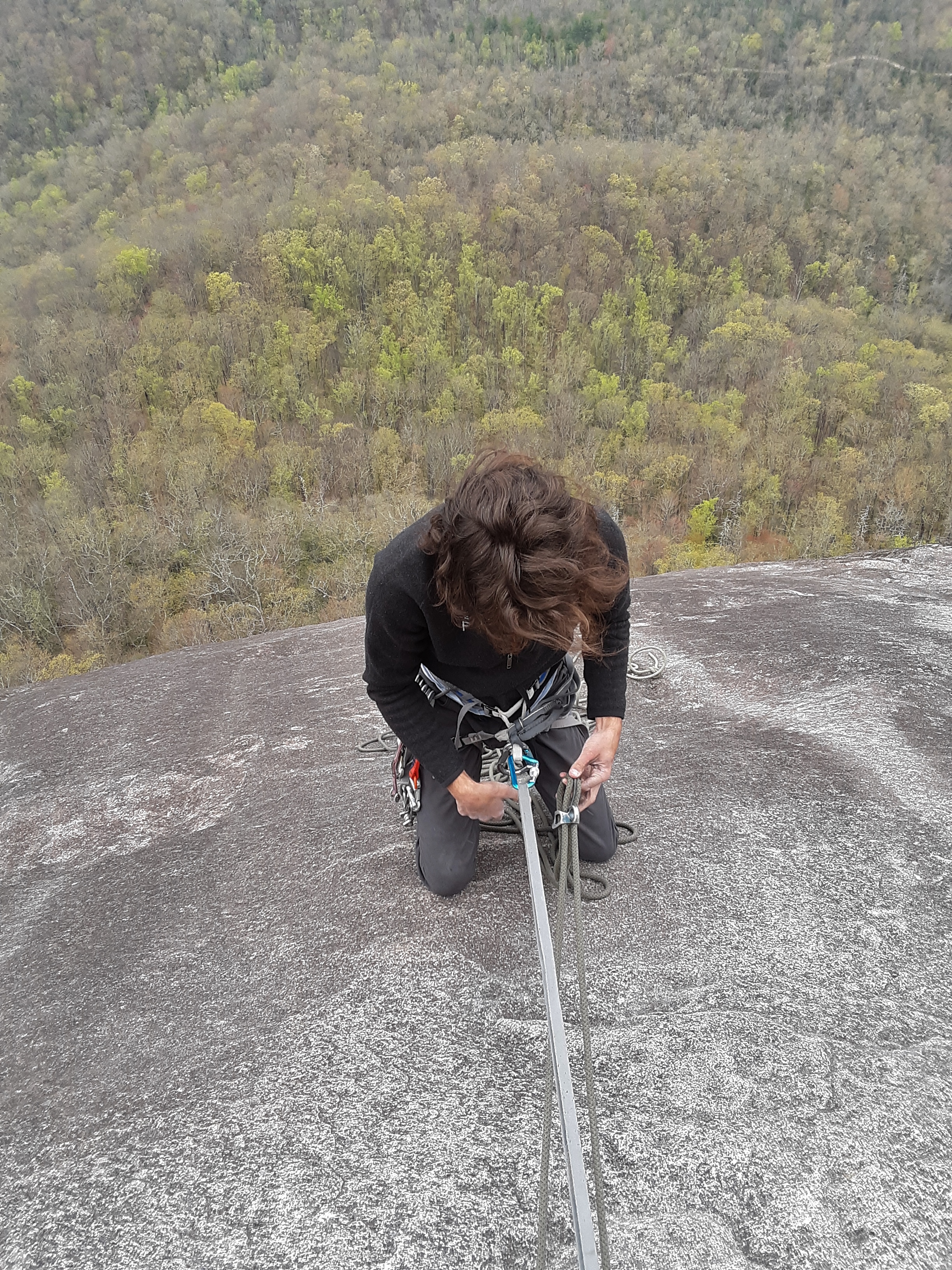
Notice in the next two shots my right hand, brake hand, position, as I rappel. Brake.
Feed rappel.
Broadhead Skink (Eumeces [Plestiodon] laticeps) (1): Such creatures make our attempts and pride about climbing seem rather pointless.
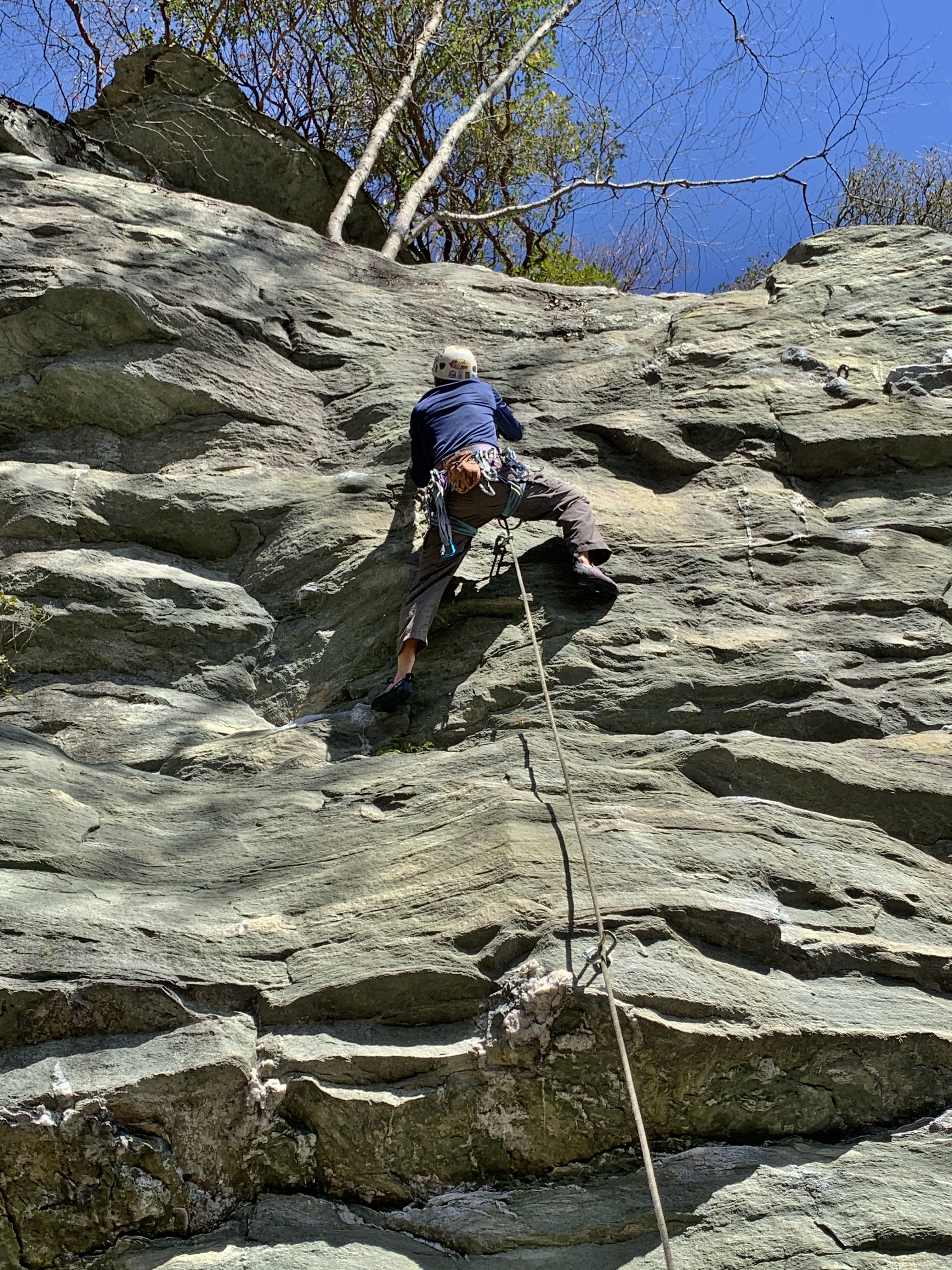
This is the second, and I might say, successful attempt. I couldn’t touch the move over the vertical section just after the second bolt. I saw him do it and still didn’t know what to do.
Another day out in the woods and fresh air, on the rock, thankful for the “One Who made, saved, and sustains” this world, and more specifically, me. May you see His care for you and choose to follow Him, too.
On my bucket list of climbs I’ve wanted to do was The Nose at Looking Glass Rock. Today I led all four pitches. This brave fellow was psyched to do it with me.
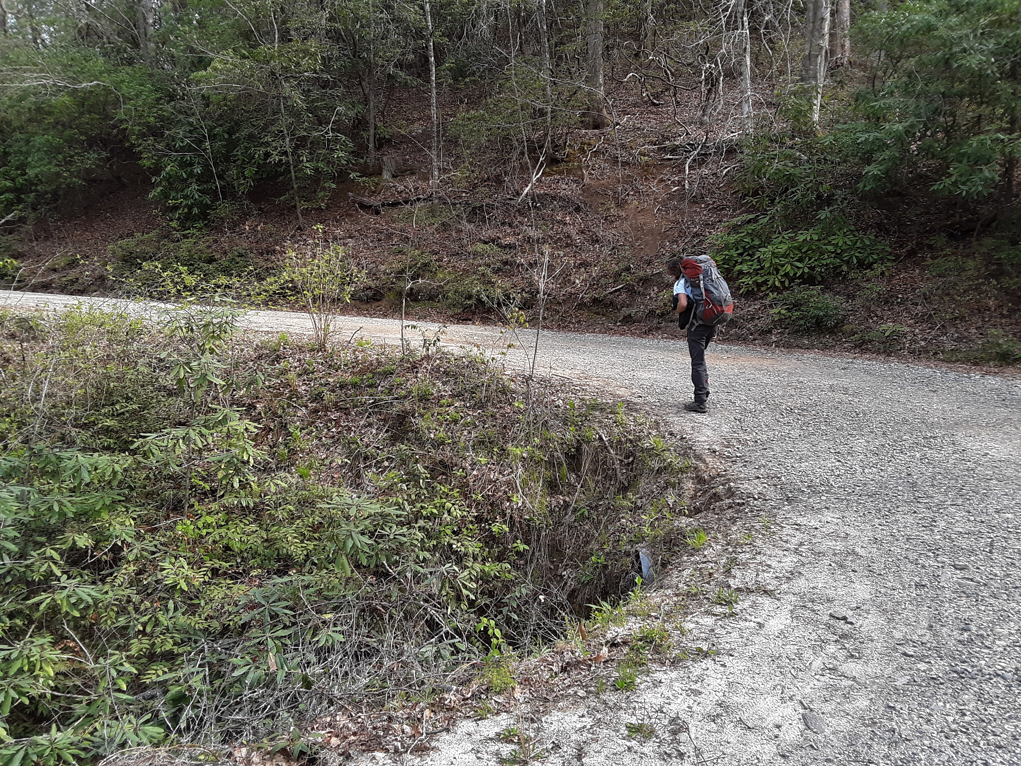
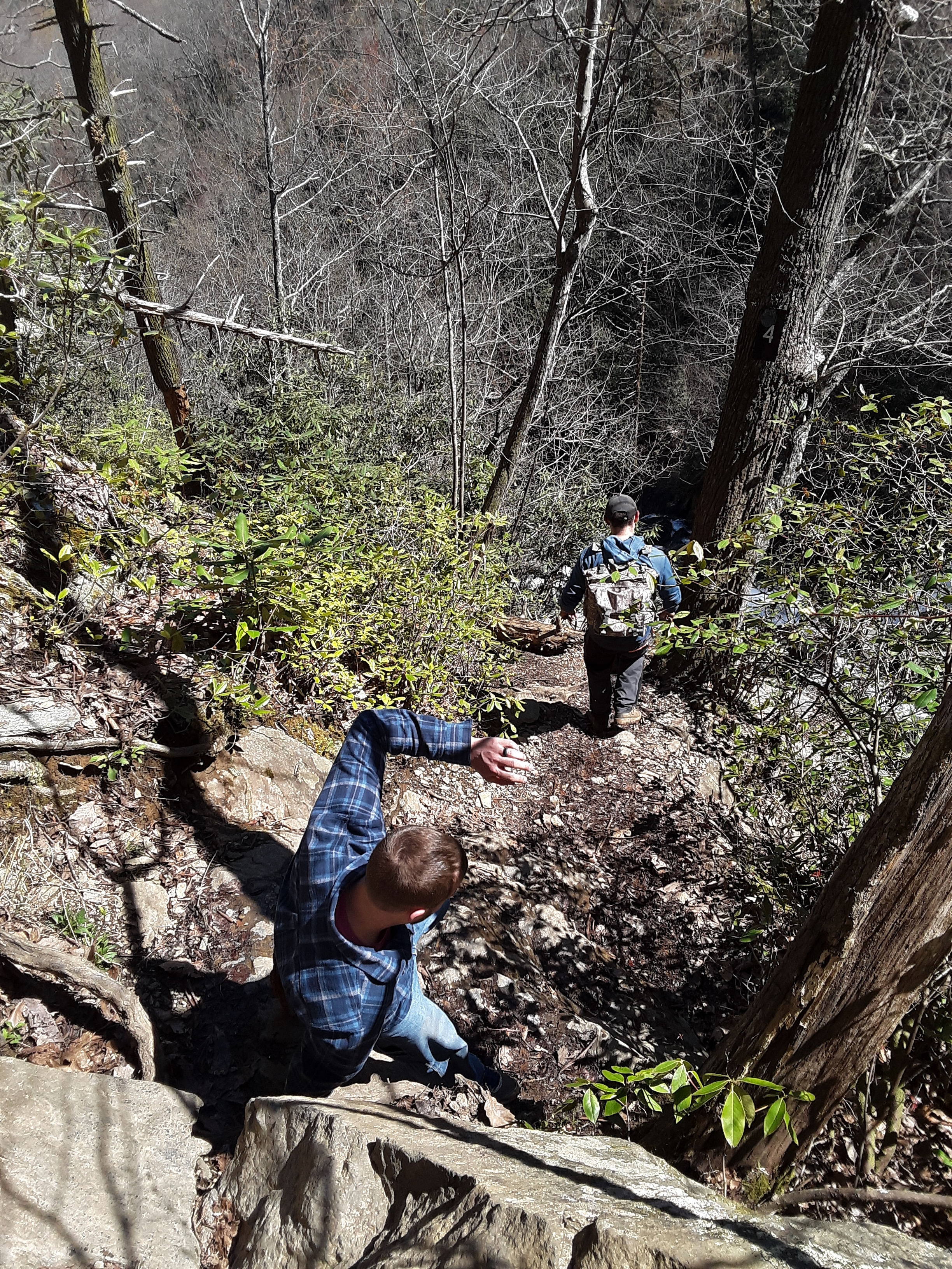
The gravel road approach was gated and we didn’t know that there was another way closer, so we walked in three miles from the Education Center.
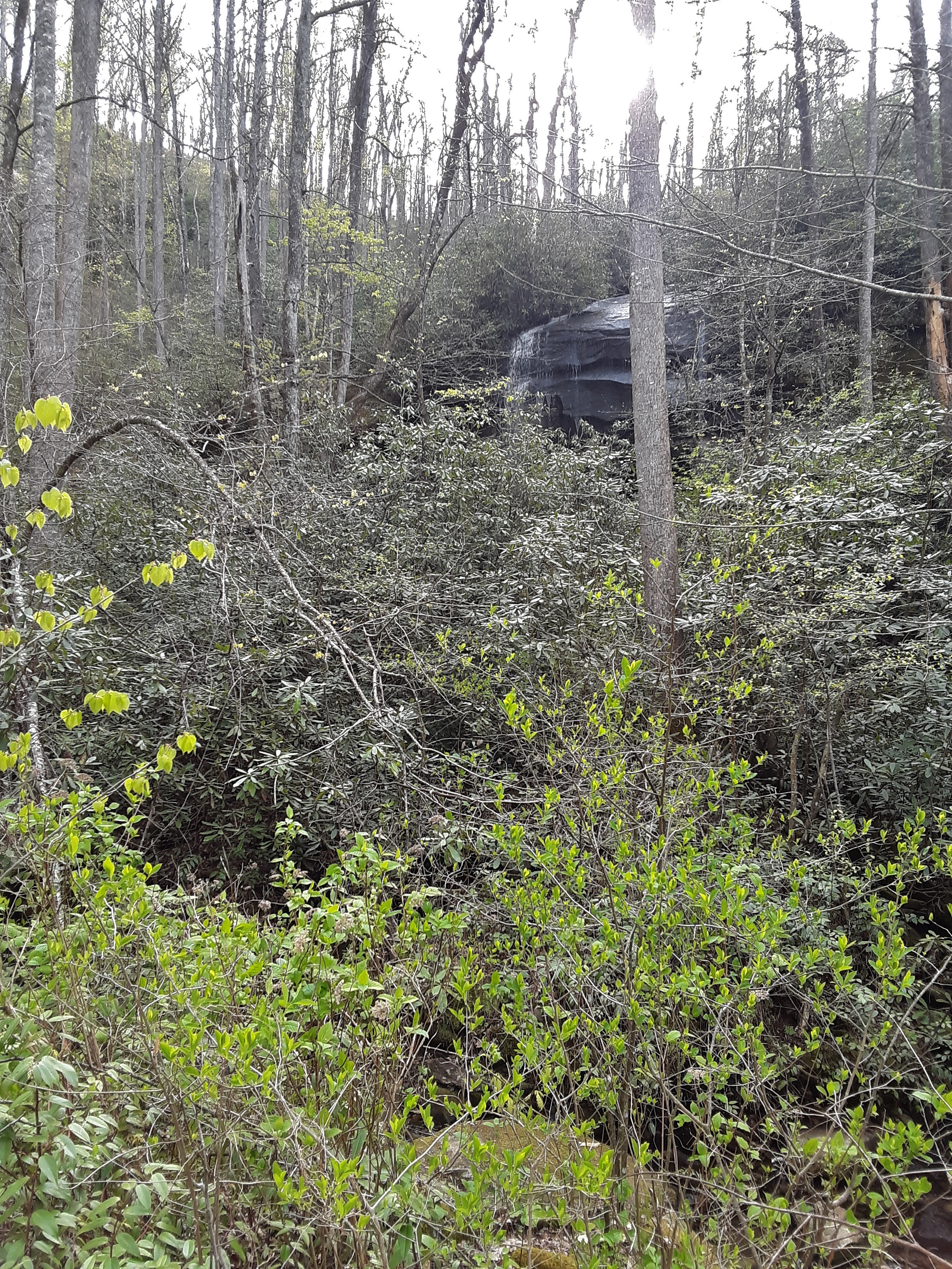
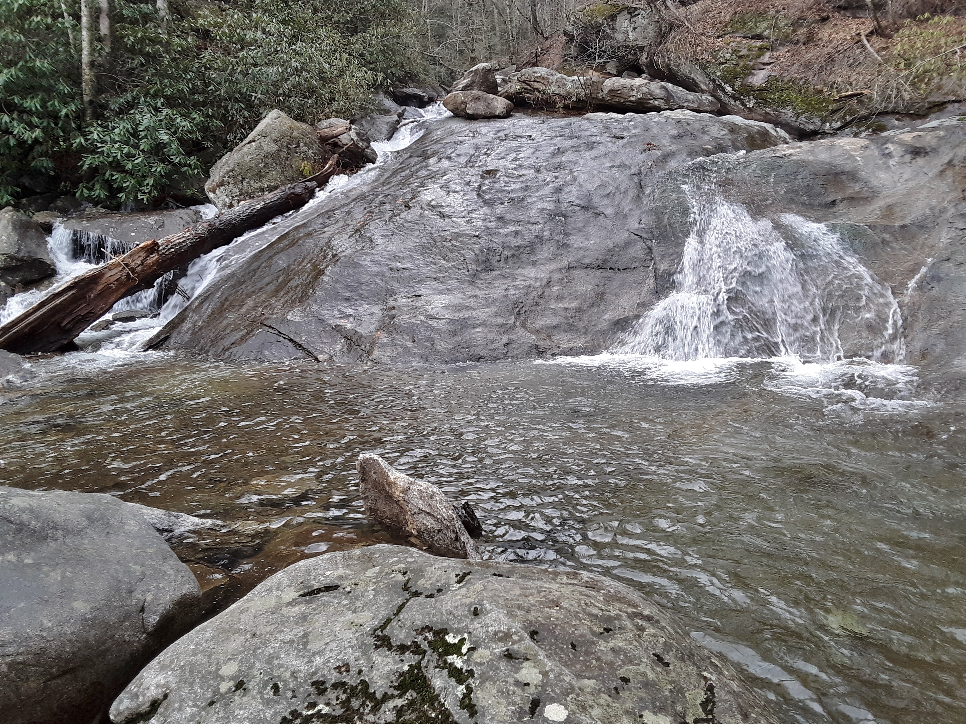
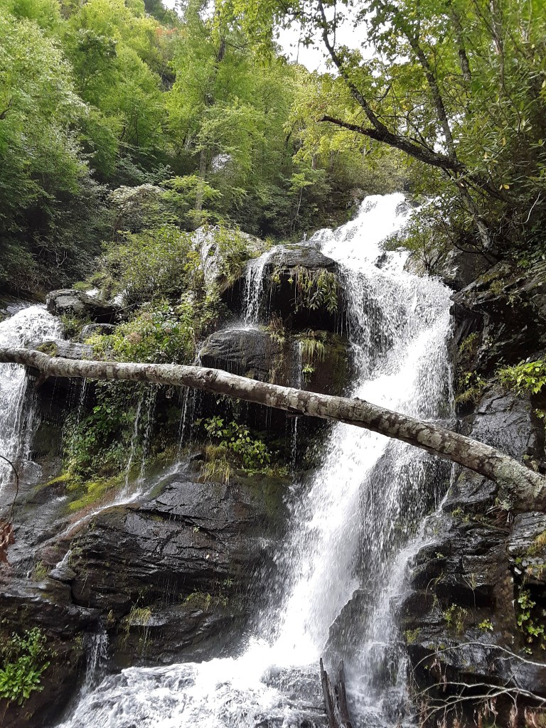
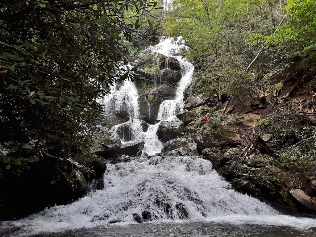
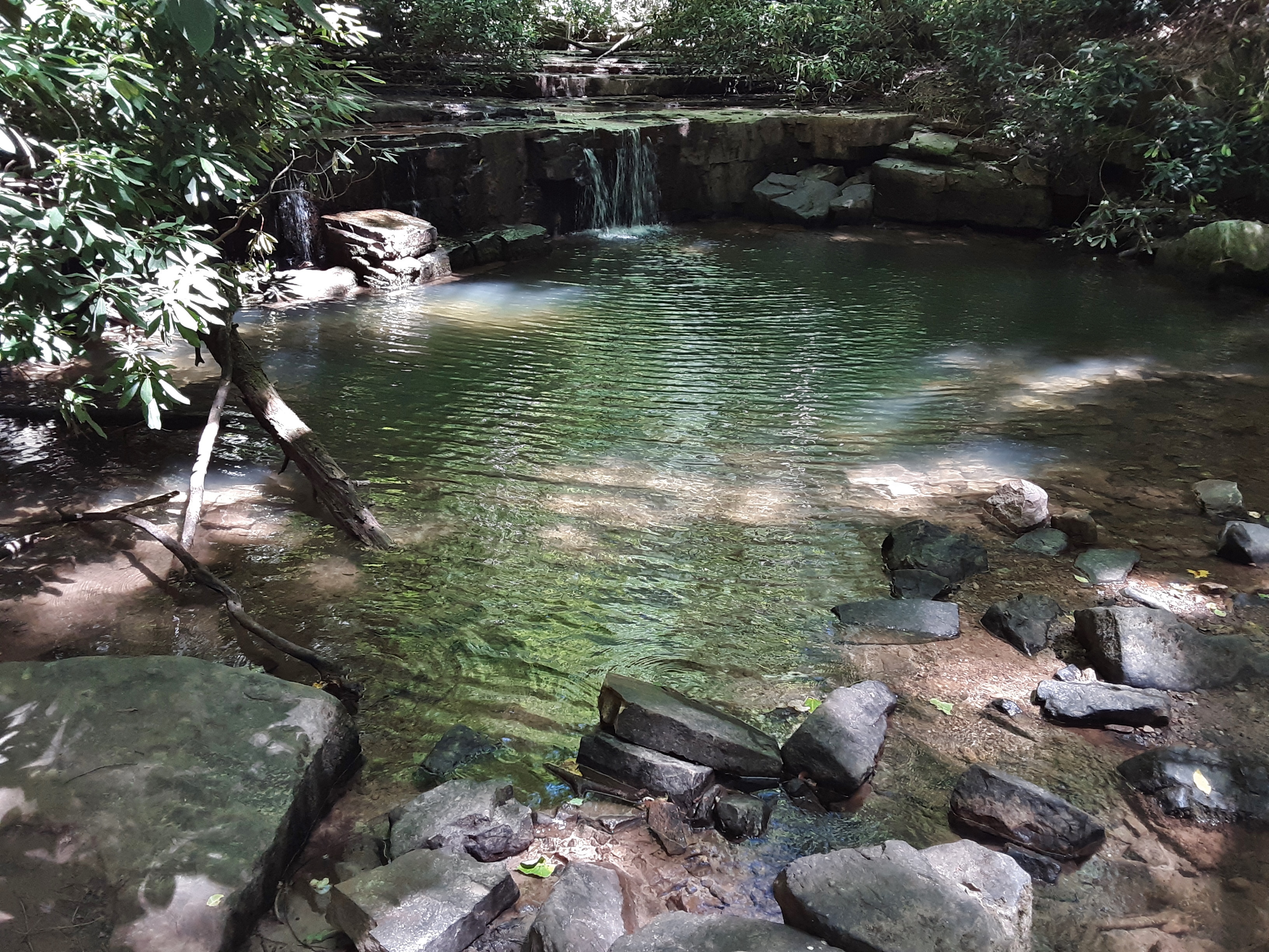
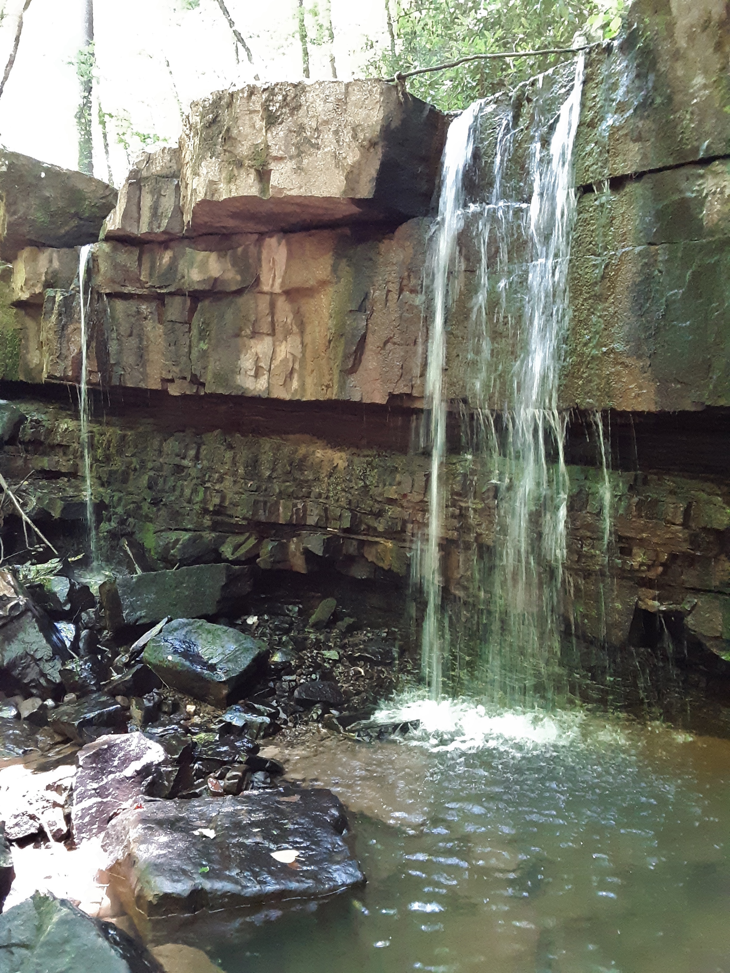
Along the way was a nice waterfall, but checking it out would have to wait until later.
The parking at the approach trail is about 0.3 mile from the base of the rock, though quite steeply up, especially with a pack of climbing gear.
To my eye this rock face is odd both in overall shape and features called “eyebrows” throughout the rock.
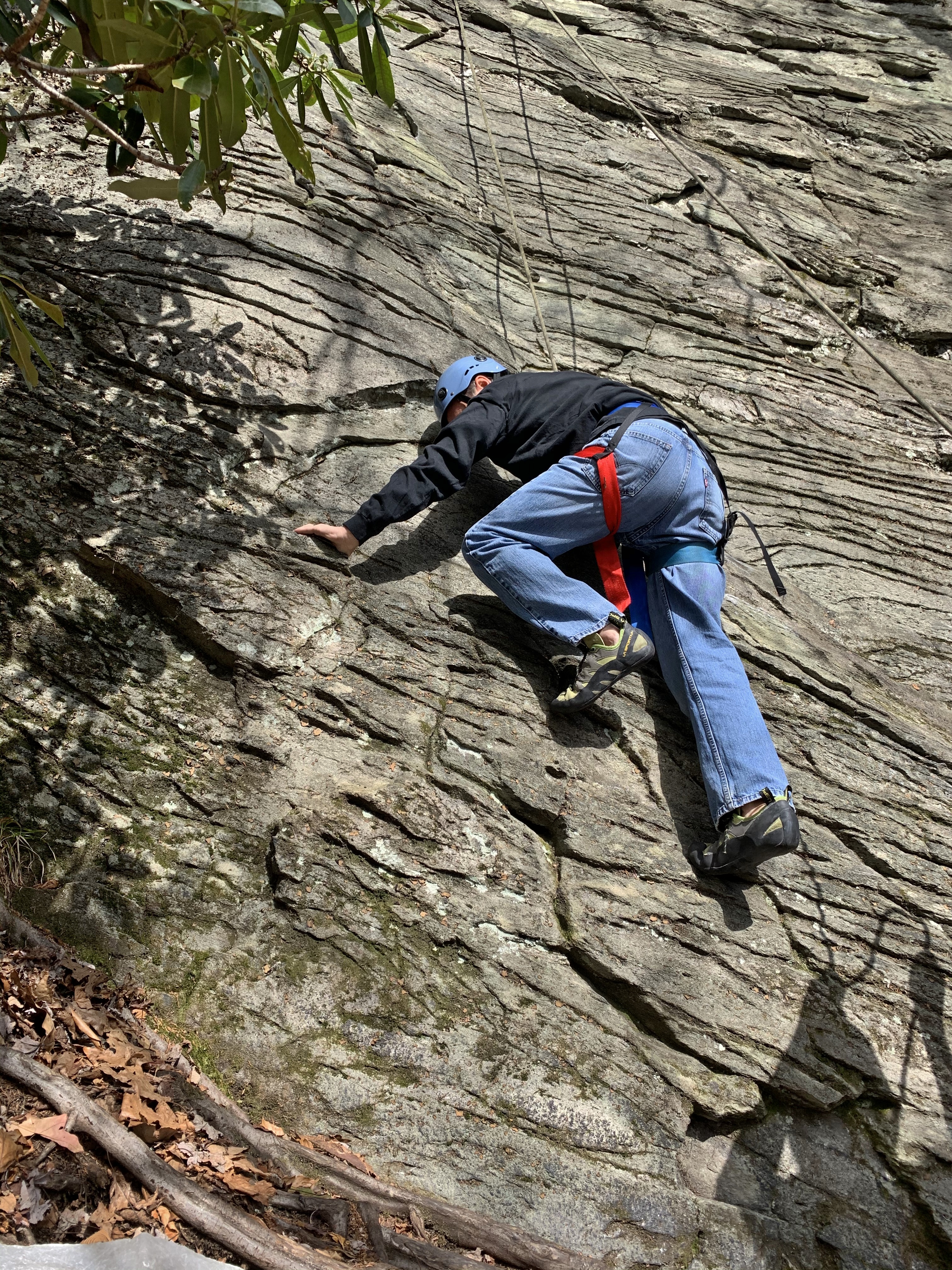
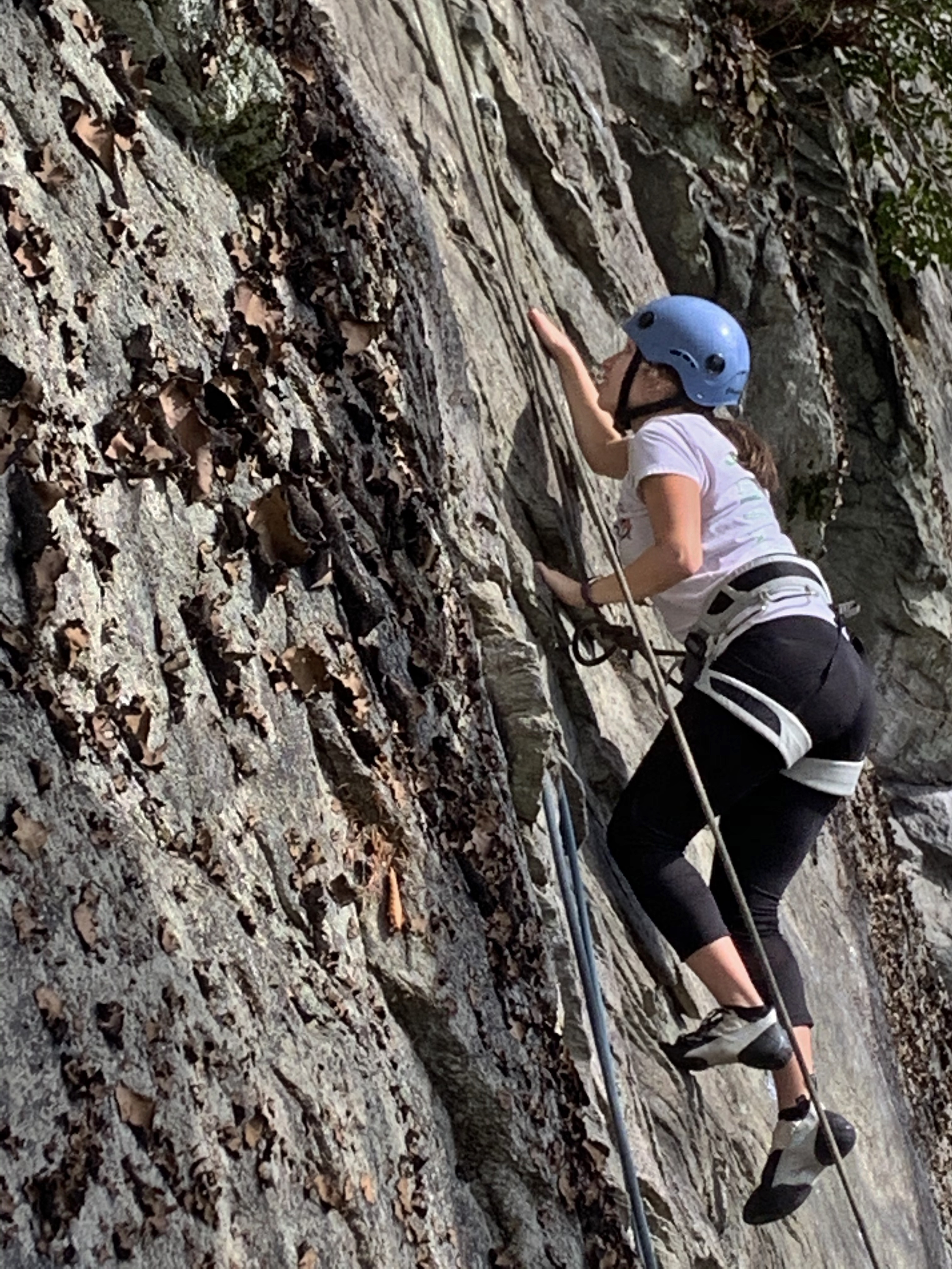
I wanted to lead the climb, which is a 5.8 and well within my wheelhouse. It is a different style of climbing, however, because one must use the ‘eyebrows’ as underclings (1). The weather was pleasant for hiking and climbing, but unexpectedly cloudy, cool, and breezy at times.
It is always good to see that your belayer is alert and paying attention. You can clearly see that this climb is the most popular by the impact of foot traffic at its base. Certain climbs are called “classic”, which I have never quite understood. Does that mean people like it, it has been around a long time, that it is interesting or otherwise aesthetically pleasing, or some vague combination of all of these? After some difficult climbs we could not complete later, mostly because of lack of good protection (2), I commented that perhaps the reason you only ever hear about half a dozen climbs out of several hundred is that most are crazy hard or too run-out (3) for most people to want to climb them.
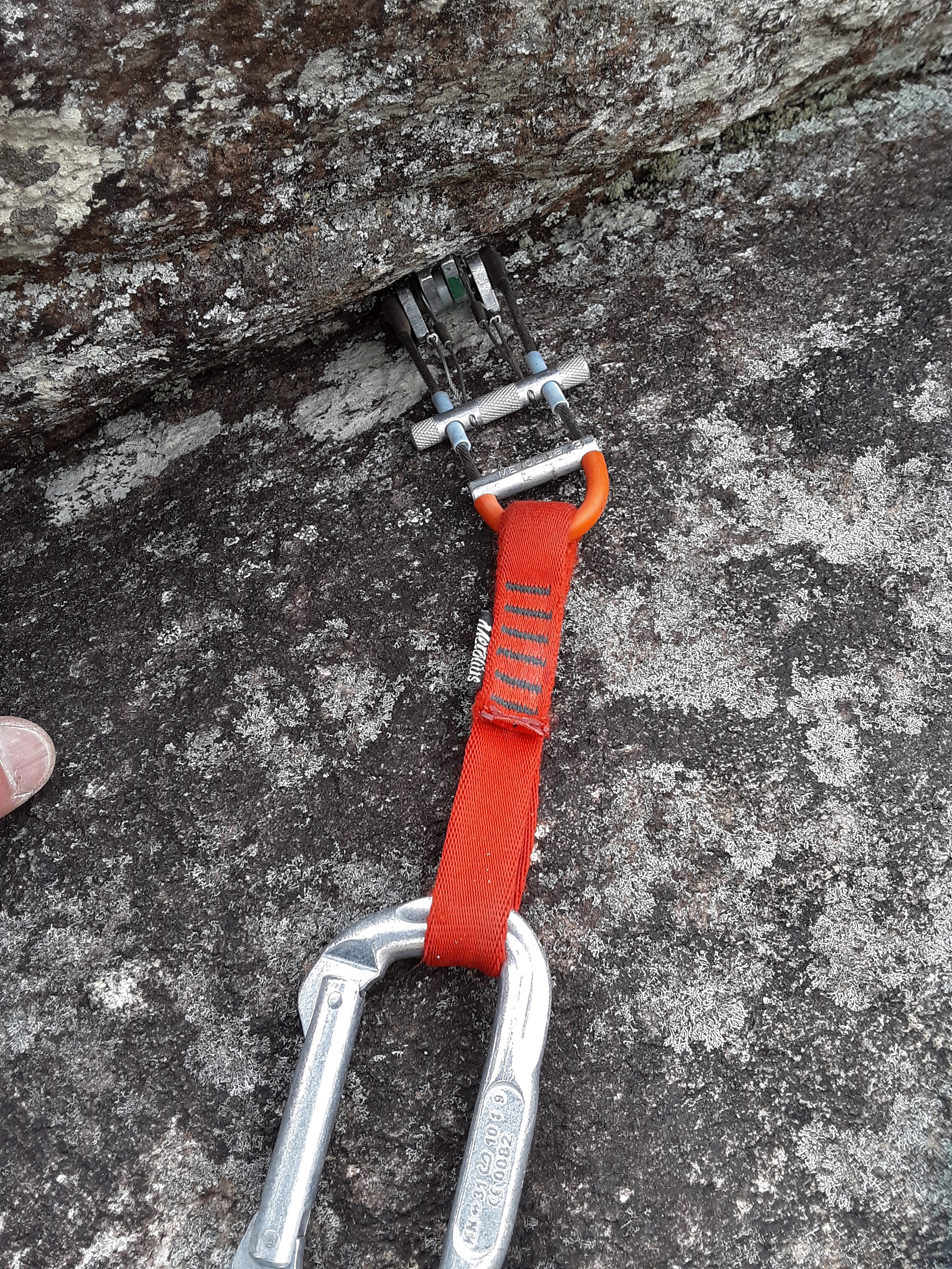
When you trad (4) climb you place protection devices like stoppers, hexs, tri-cams, slings, or cams like the one pictured here. Then you clip your rope into a carabiner attached to the end that catches your fall. This was a solid or ‘bomber’ placement. There are sections on this wall and this climb where there are handholds but no placement for protection. This results in a run-out situation. By the way, do you see how I mark my equipment?
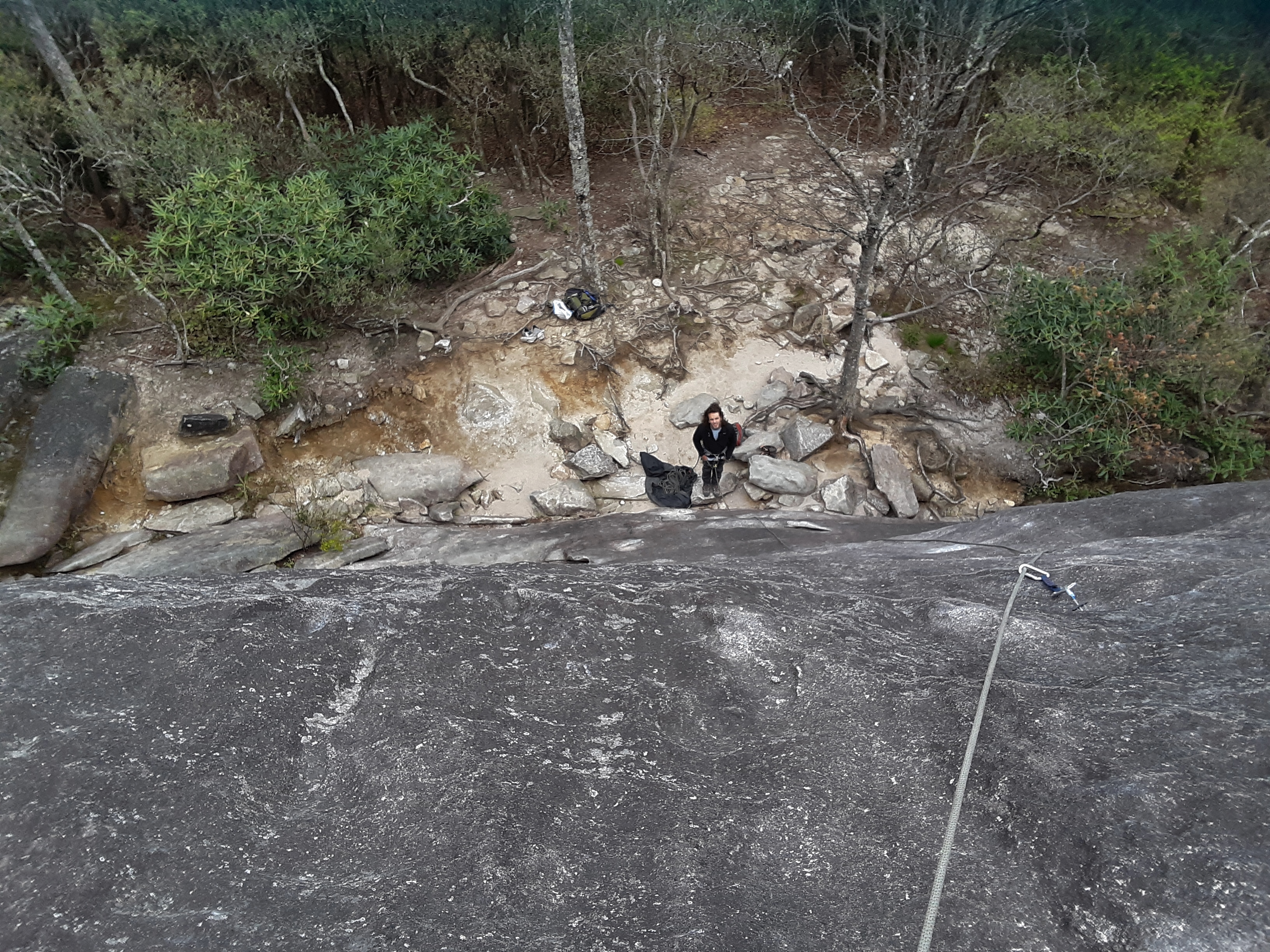
Following is the view at the first set of belay anchors about 90′ up. Spring has just begun at this level but not much higher. My partner commented on how he likes the contrast of fresh green and gray limbs, because the gray accentuates the bright green of new leaves.
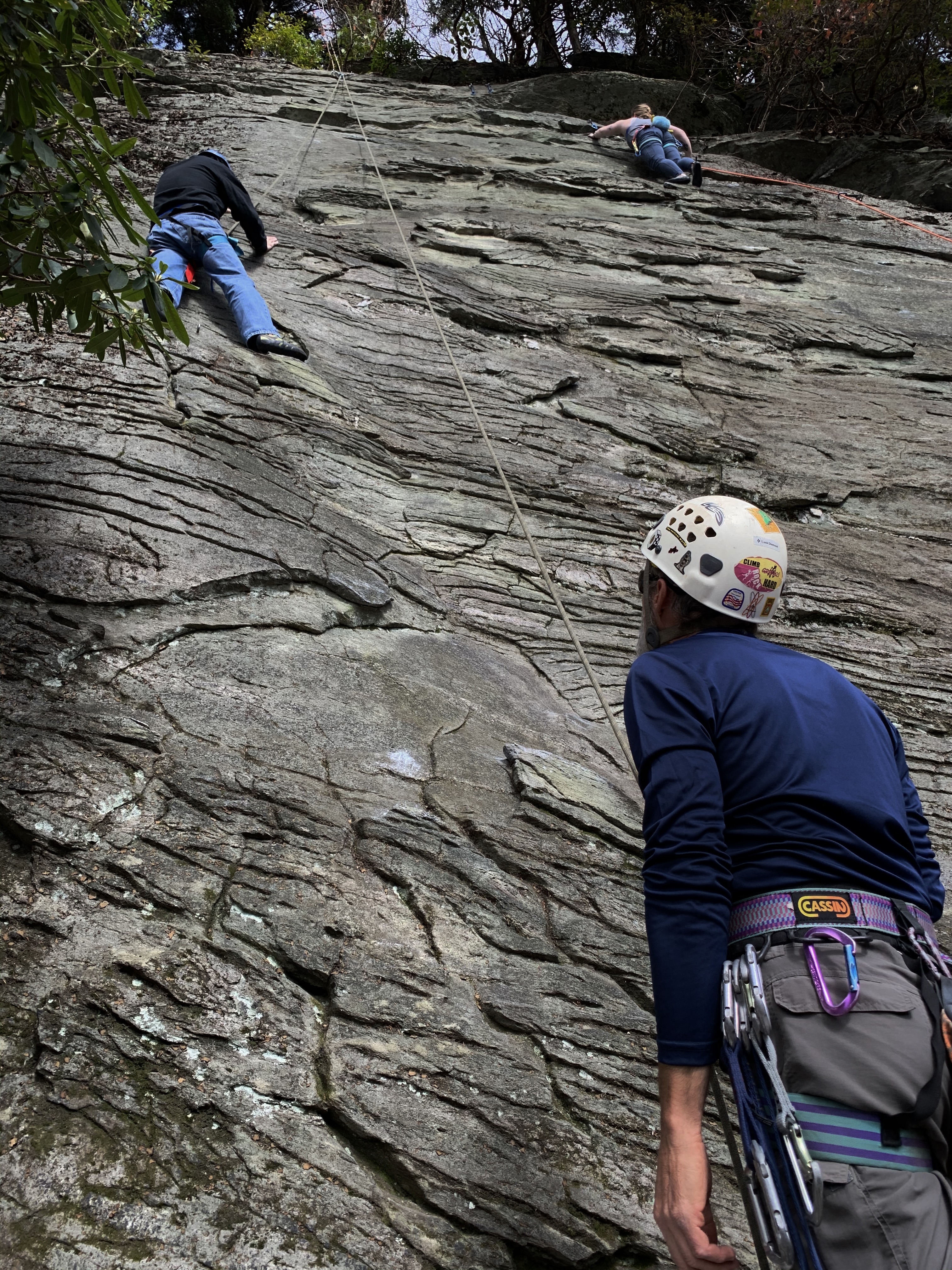
I was the lead climber on this climb. My partner was the follower. He is seen here cleaning the route, that is, collecting the protection that I had set. Notice in some of these pictures the visual illusion that the surface is not very steep, as in the foreground here. None of this climb is truly vertical, but except for a few ledges, it is a 60 to 85 degree wall.
And here we are on one of the ledges transitioning for me to begin leading the next pitch (4).
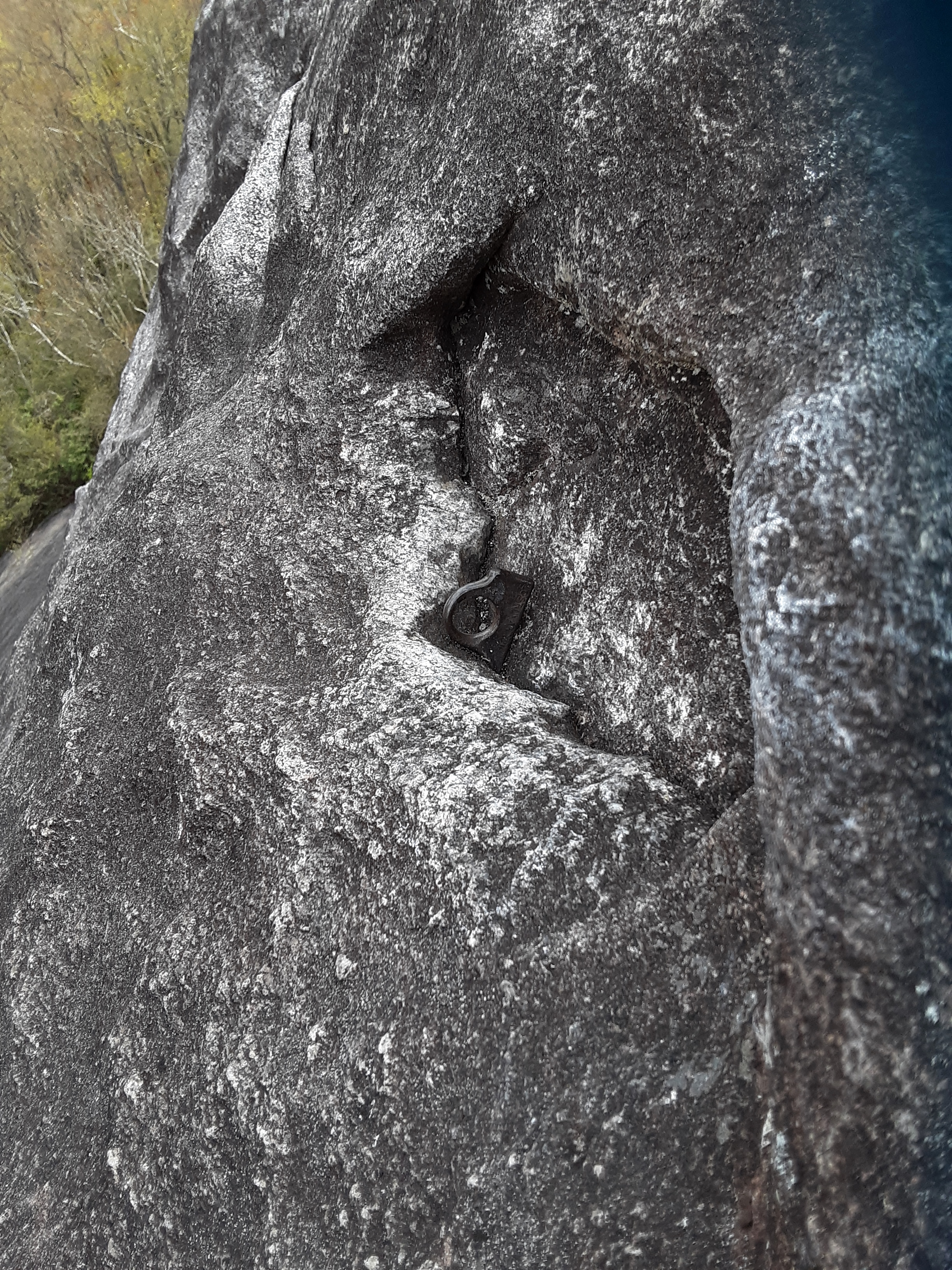
Being such a popular and old climb, I saw several old and broken pieces of pro along the route. The piton pictured is really old school.
The views were great. Note the occasional evergreen amongst the bare deciduous expanse.
It is always nice to have a comfortable place to sit when you are belaying, though it is not frequent. Notice the parked cars at the Looking Glass Mountain Overlook on the Blue Ridge Parkway. I had stopped there many times in the past, had a picnic with the family there once, and several times thought that I’d like to climb this rock. I wonder if any tourists with binoculars were spying our progress this day? I think that the peak behind the peak behind the overlook is Richland Balsam.
I gave my partner a hard time, saying this picture looked like he was a model for outdoor clothing. You can see some older, though quite sturdy, bolts he is tied into. This location is the lunch ledge which is still not level but reasonable to walk around on untethered away from the edge.
The following four images from the top combine to make a 180 degree panorama from south through west to north. We didn’t stay here long because it started sleeting. Yes, it was sleeting in late April. Well, it does happen rarely on the high peaks in mid-summer.
Time to rappel back down. Once again it looks nearly flat in the foreground but isn’t. The blue device through which there are two bites of rope in his left hand is called an ATC (5).
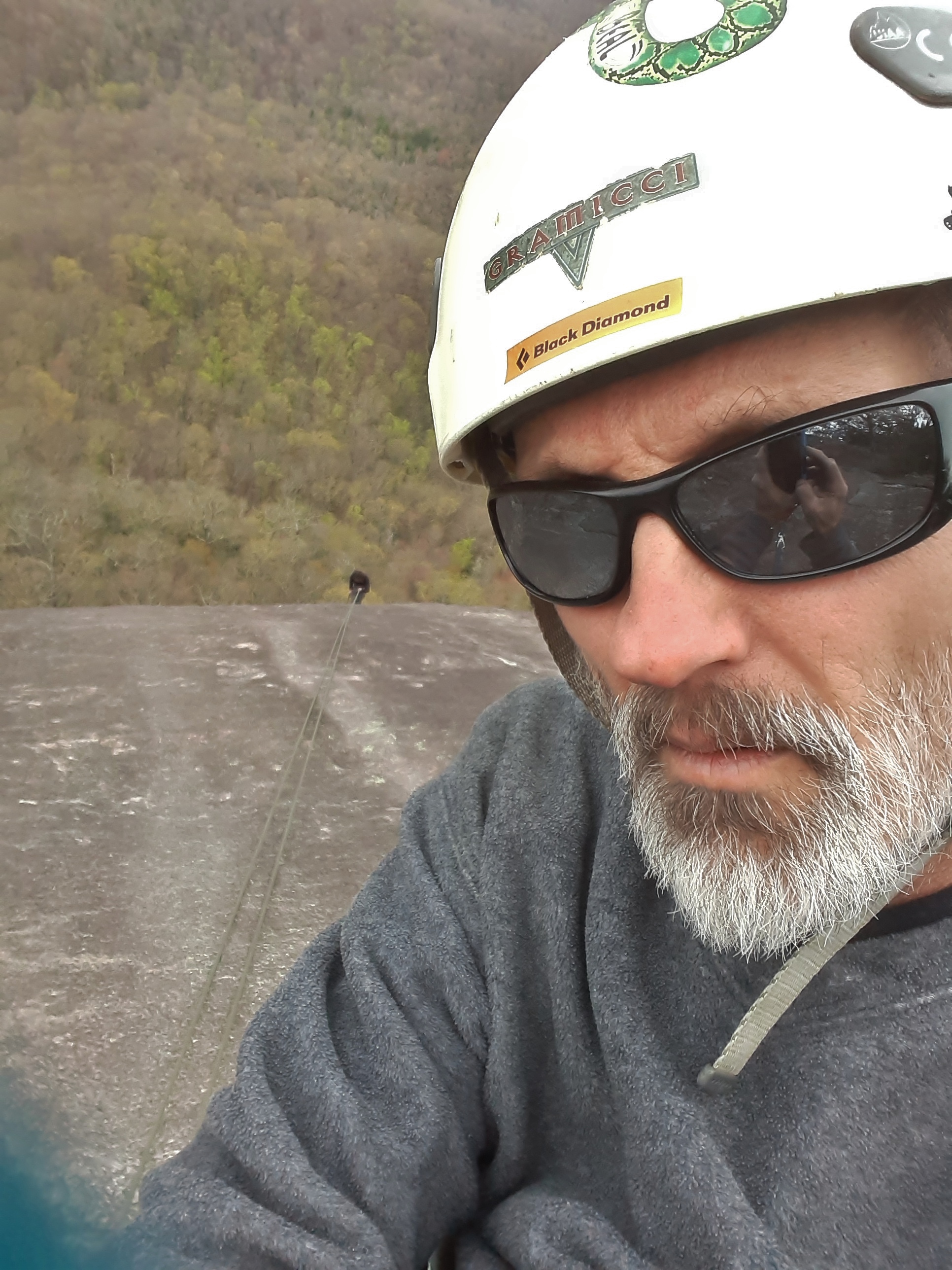
In the following selfie you can see the reflection of not only the phone with which I am taking the picture but also one of the bolts to which I am attach and my partner is rappelling and the tree line at the top of the peak.
On the hike out we saw some wildflowers like this blue flag and May Apple.
I got closer to the waterfall, which had a 20′ overhang to its right.
This day was the first time I have climbed at Looking Glass Rock and the first 4 pitch climb I have completed. It was a pleasant day with lively conversation. I see endless views of God’s beauty in the rocks and trees and sky and flowing water. It gives rest to my mind and challenge to my body to be out in His Creation and sharing it with someone. Perhaps that is part of the reason that I share it with you. I want to you to enjoy it with me, acknowledge the beauty of God’s work with me, and resolve to get out more and enjoy it yourself. Come along with me if you like.
undercling- fingers and palms facing up and pushing up to counteract downward foot pressure for stepping up.
good protection- strong enough to catch you and frequent enough to prevent long falls
run-out- excessive distance between climbing protection that may result in a long and dangerous fall.
pitch- the distance of climb between two belay stations equal to less than the length of the rope
ATC- Air Traffic Controller was named by Black Diamond and now colloquially referred to for all similar devices, sorta like Kleenex is for all facial tissue.
I was in need of going over the mountain a couple of days ago. I have done the trip so, so many times. I decided that I needed to stop on the way back to take a little hike and break up the trip. I appreciate scenes I have already seen and return to many frequently. I especially enjoy showing others little wonders of nature that I have seen. But I was alone and I longed to see something new, and it did not have to be big or impressive. I found what I suspect to be an underappreciated little jewel off the far end of the Linville Falls Access Parking Lot. Old growth forests are few in the Eastern United States. I content myself with enjoying the occasional lone larger tree. This Eastern White Pine is a healthy example.
The trail is very short. By the time you walk to the far end of the parking lot, you are half way there. The trail goes up over a little hump past several large trees and then down into a narrow notch where the park service has a bridge just right for viewing and walking up between the boulders.
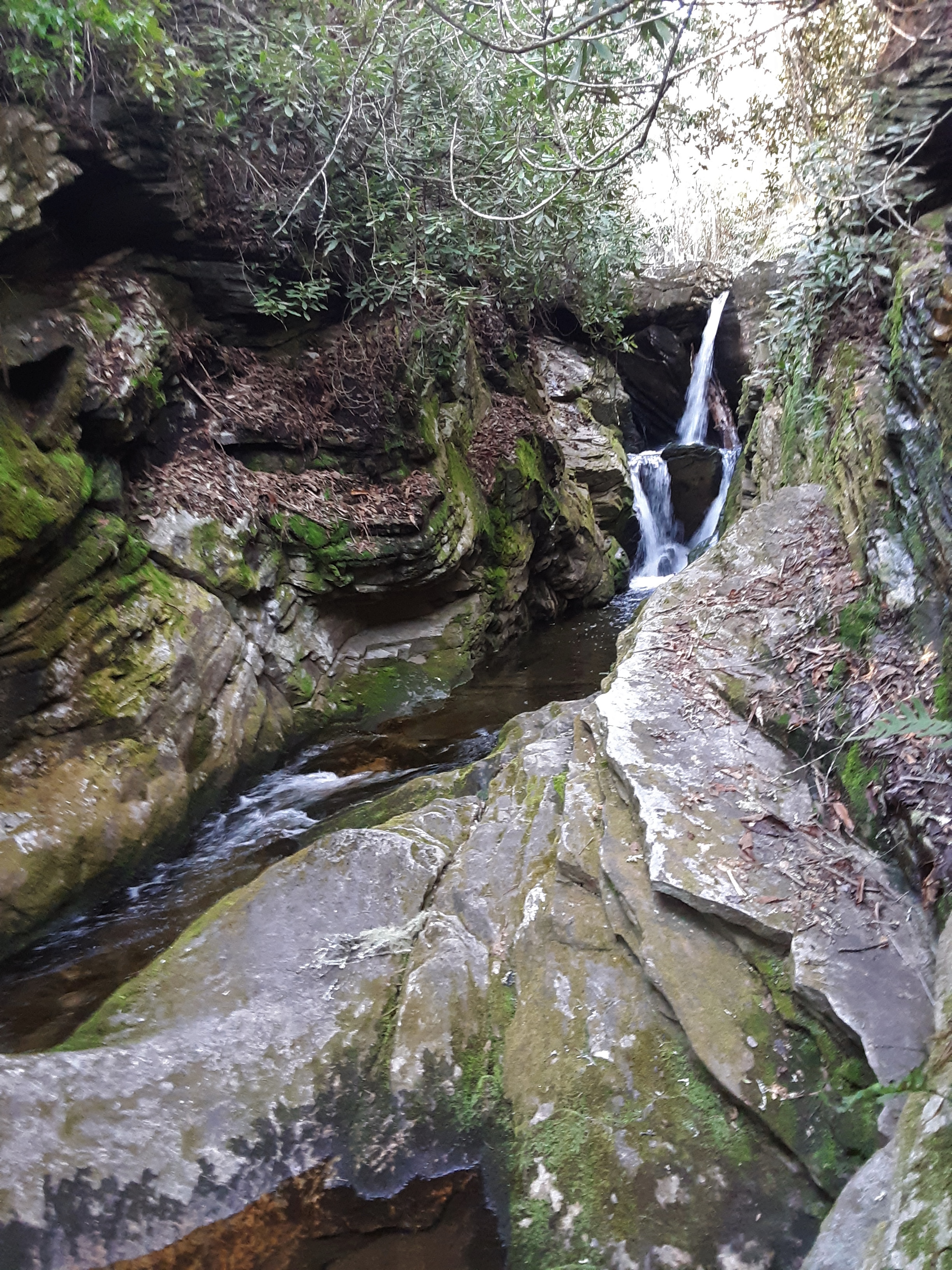
In the middle of the bridge, voila’, Dugger’s Creek Falls.
On the far side of the bridge the steps go up between the boulders in such an inviting way.
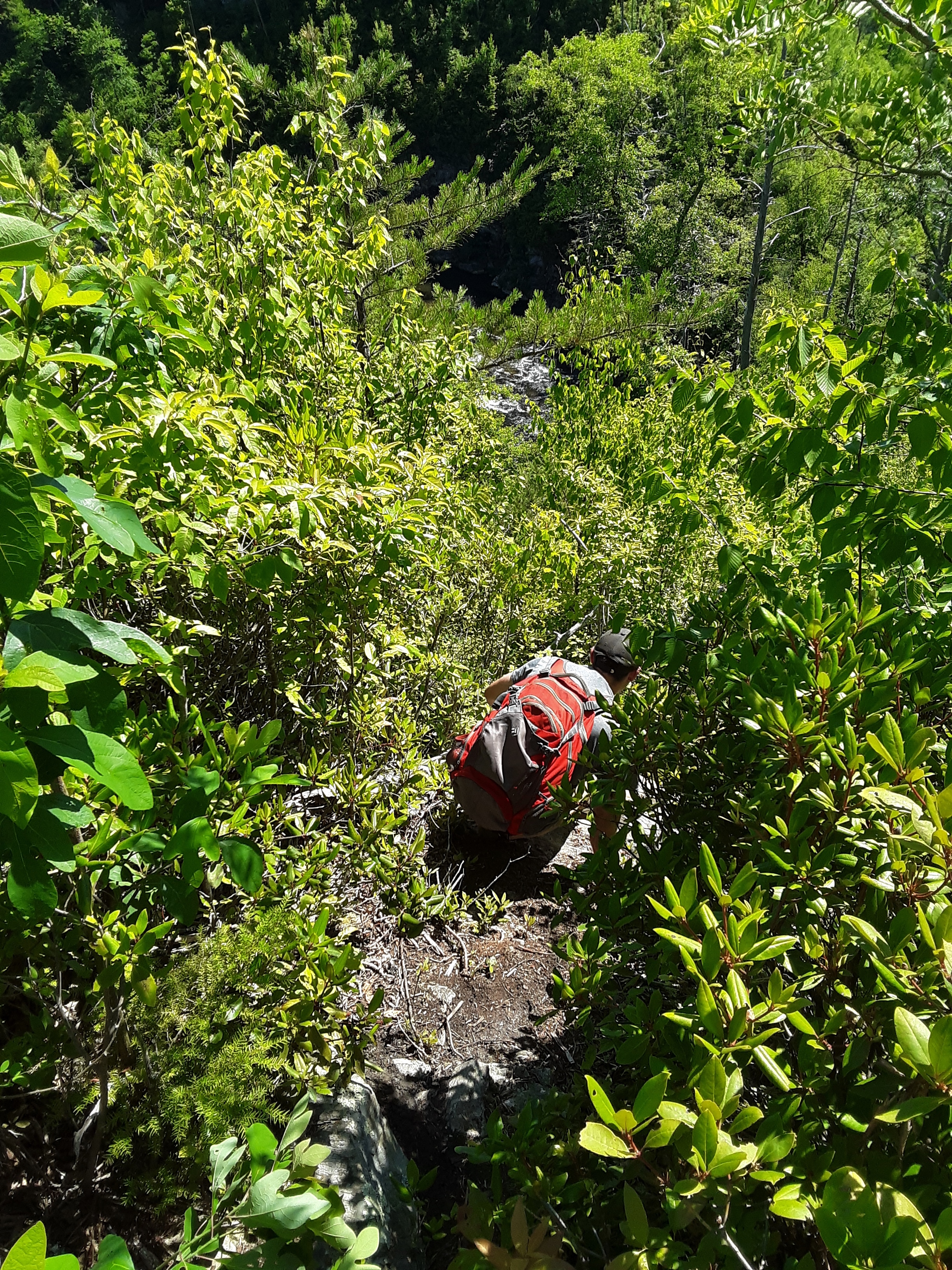
Always desirous of a little adventure and a better picture, I got off trail just at the base of these stairs. Inviting though they be, they were a bit too civilized for my present frame of mind. Instead, I battled a bit of rhododendron and some small drop offs. The falls, in the 12 to 15 feet wide notch and cloaked in rhodo’s was not having it.
So, I went to the top of the falls in order to check out how and where the water squirms between the cracks and voids of the notch. If you look closely, you can see the bridge. If it were summer, I would probably wade up the stream to the base of the falls, but I don’t have a waterproof camera, so that would not be recorded.
Above the falls the creek comes rushing down into the notch, still a steep pitch with more broken boulders along the sides.
The scene is green with Galax and fern and moss.
The rock form is definitely foliated metamorphic, the layers curiously formed in waves.
The trail exits the woods onto the road just out of sight of the bridge or falls, but just before it does you get one more good view.
Not quite satisfied until I have explored every little turn and divot, I crossed the creek and worked my way under the bridge and edged up along the small cliffs. It was no use. The likelihood of wet feet or more (e.g. wet cellphone) stopped me short of completing every inch. I was satisfied with one more picture and a rock scramble back up to the trail.
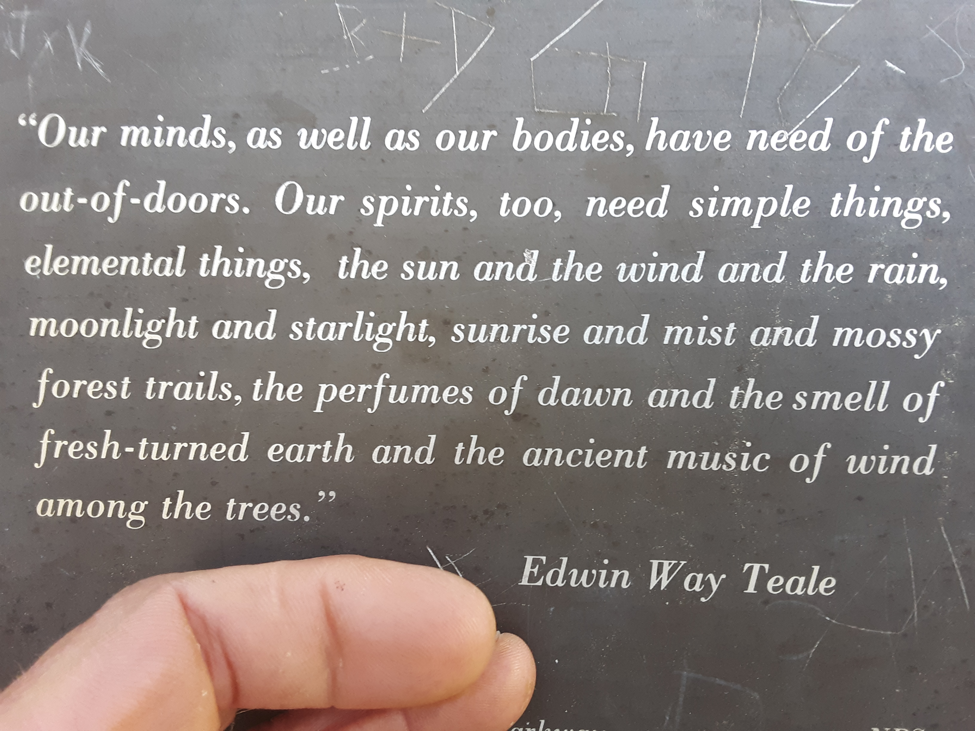
On the beyond the bridge side of the trail are several plagues with quotes. The following was apt to my present situation.
The author does not say why we are in need of these things, and it is certainly true that many never consider that they are. But when I muse upon why this quote is true, it seems to me to point to the beauty of God as the why we seek the beauty in nature. We cannot now see Him, though Jesus said, “Blessed are the pure in heart, for they shall see God.” (Matthew 5:8) We want to see His beauty and seek it in nature. But “How can a young man keep his way pure? By keeping it according to Your word.” (Psalm 119:9) But no one is able apart from the righteousness that Christ imparts, “for all have sinned and fall short of the glory of God. (Romans 3:230 As He told those questioning Him about the work of God, “This is the work of God, that you believe in Him whom He has sent.” (John 6:29) Therefore, I look forward, not based on my merit, but His in which I trust, to seeing His beautiful, awesome visage one day, just as I seeks its tarnished and veiled reflection in His Creation I so enjoy experiencing.
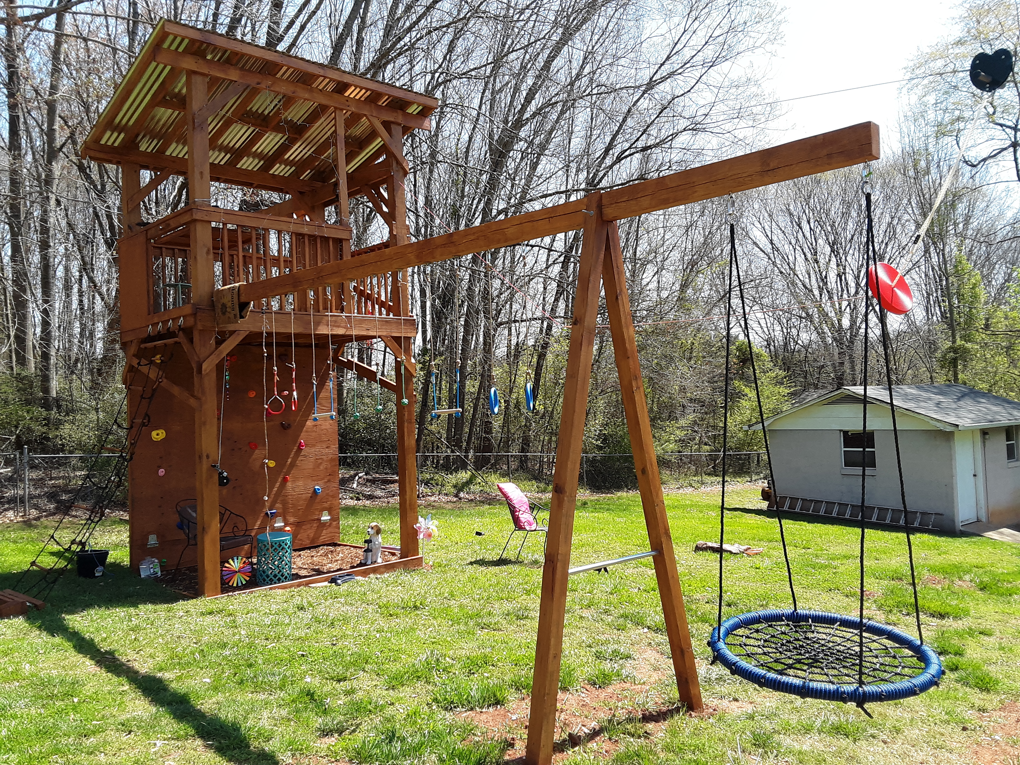
The owner installed the chain to hang the net swing temporarily, then asked me to move the swing. An outdoor aerial silk is supposed to reside here one day.
Check out the plans. The basic concept is there, but the homeowner wanted the addition of a climbing net, a zipline, a beam for the aerial silk, and a good place to mount the net swing. For cost reasons that eliminated the slide and monkey bars. The fold down table became a doorway for the climbing net. The climbing wall got lowered from 9′ to 8′ and 7′ wide to 8′ wide. The zipline resulted in changing from 4 x 4 posts to 6 x 6 posts and adding all of those diagonals.
The zipline, due to height of the playhouse and surrounding topography is steeper than suggested. So we began to look for a way to slow the ending. I added a spring and a friend added a magnetic break. They work on the same principle as dropping a magnet down a copper pipe. Copper does not magnetize but it does conduct electric current well. Therefore, when the magnet is moving down the pipe a current is induced which has a magnet field which just happens to be counter to the magnet’s field. The magnet is slowed by this counter-EMF. So is the magnet surrounding the zipline cable. The black bungee brings the magnet back to the point for the next braking action. So, the zipline is fast but has a controlled stop.
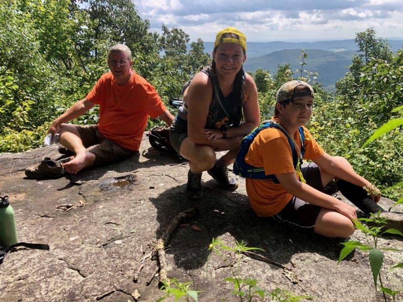
The opportunities to do things with my children have been spread out more as time has gone along. People get busy, new responsibilities and challenges come along, and time is stretched. So it was good to take two short hikes with my youngest two sons and a daughter-in-law. Coming from two hours away and a half hour away, they met at my house at just after 10 AM. We drove to Catawba Falls, seeing four waterfalls in a mile and a half stretch. Along the way there is an old powerhouse built in 1923 by Daniel Adams. (1,2) My son inspects the foundation and well where the generator once resided.
His wife awaits our return to the trail and bridge on this bright, crisp day.
Right next to the powerhouse is a recent pedestrian bridge from which my son is considering the course and flow of the creek. These new alloys of steel that corrode protectively are a boon for non-maintenance. The trees in this area have been left alone for probably 70-80 years and are beginning to grow decently large.
A tributary crosses the trail a little further up. Just below the trail is a large pile of boulders and little waterfall tumbling between the boulders.
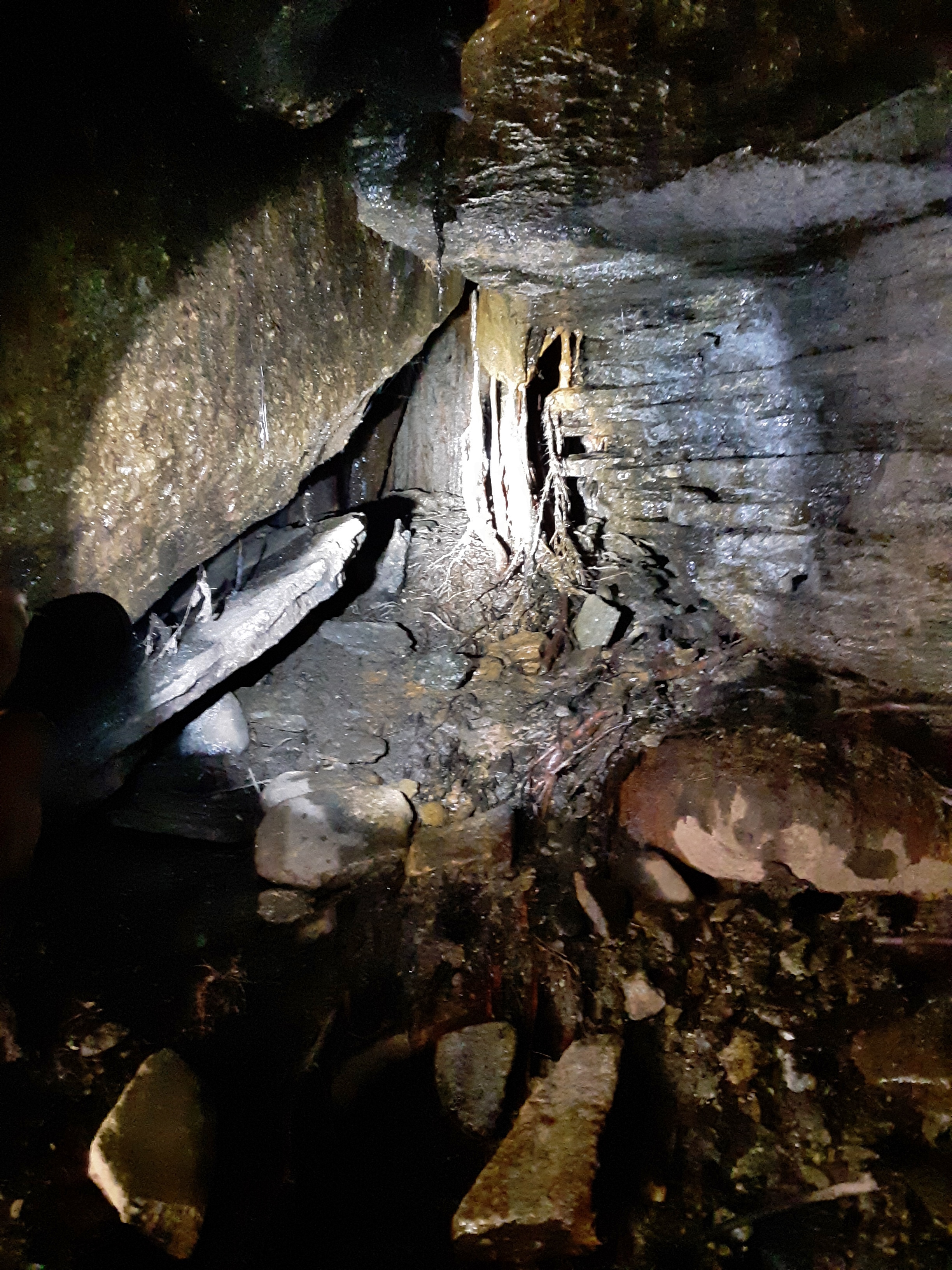
To the right of the falls and pool is a curious little cave that would be a good home for a water side creature. Tree roots provide a eerie entrance curtain.
She patiently awaits our silly exploring again. The boulders are fascinating with their significant overhangs.
The Lower Catawba Falls is a double falls, the upper part caused by the remains of the powerhouse dam. The dam is perhaps a 1/4 mile upstream from the powerhouse. I feel sure that this distance along the creek is to gain sufficient head (3), and therefore pressure, to run the generator. The water looks inviting, but icicles lined the edges of the falling water from the 20 degree morning.
The biggest show is the Middle Catawba Falls. It is said to be a 105 feet cascade. I don’t know where that is being marked from, but I’d say more. I have some better pictures of it when I went with my church group in September. (see “Cascade, Not Falls“) Today I was capturing our enjoyment of the scene.
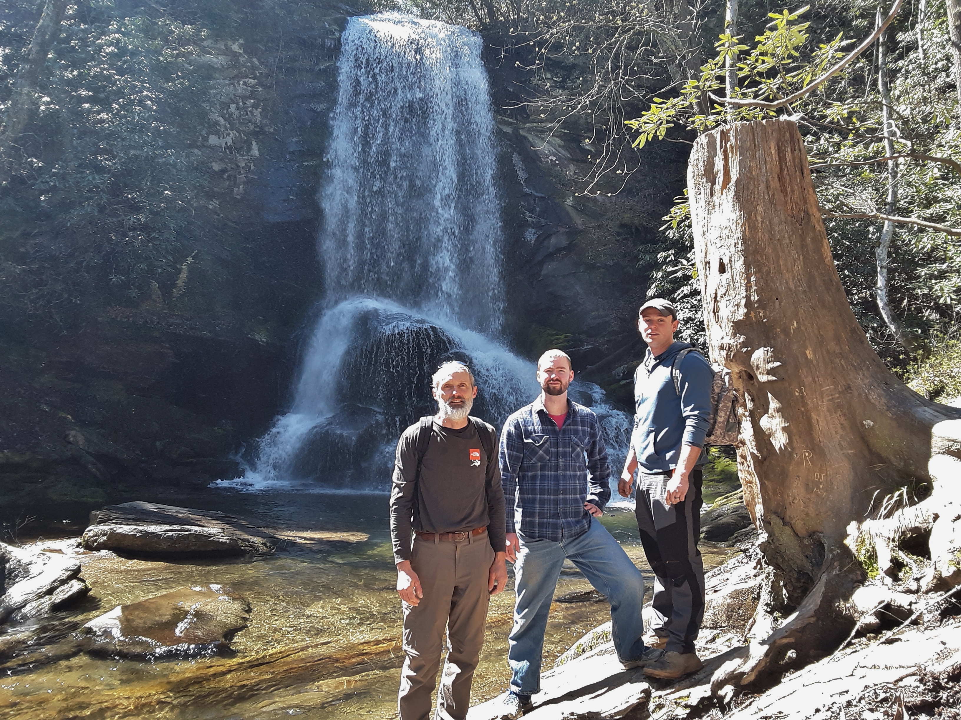
It’s good to see the guys together and happy and enjoying the outdoors.
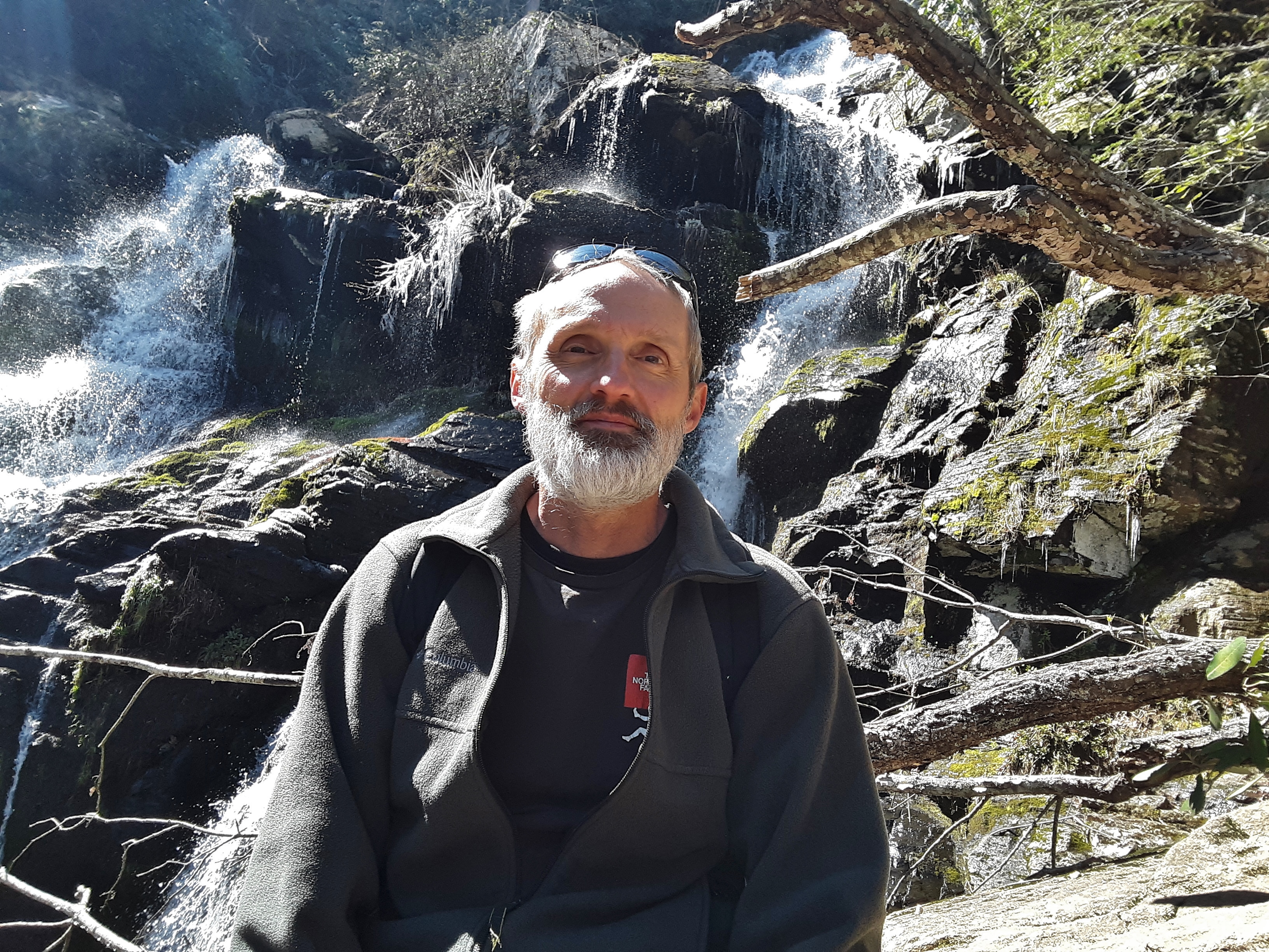
In this picture of me you can see icicles just up and left of my head. Pictures of falls in full sunlight are hard. In person the ever changing crystals of reflective light are enlivening to the eyes and mind, but my cellphone doesn’t know what to do with all of that light.
I wanted to see the Upper Catawba Falls. So my sons and I figured out a way to get safely above the middle falls. Recorded as 55 feet high, it is the most beautiful and symmetrical of the three.
I learned a little fun activity when I was at Machu Picchu, Peru. (“Peru 4“) I would go around and ask couples if I they would like for me to take picture of them with their camera. Being a cameraman, I know you can’t take the picture and be in the picture effectively (4). Several people offered to take my picture in return. Being by myself and wanting to record my presence there, it was a welcome offer. So this time I offered an exchange. I took their picture with their phone and they took our picture with my phone. Try it sometime. People are appreciative.
On the way back down there are good views and it is steep.
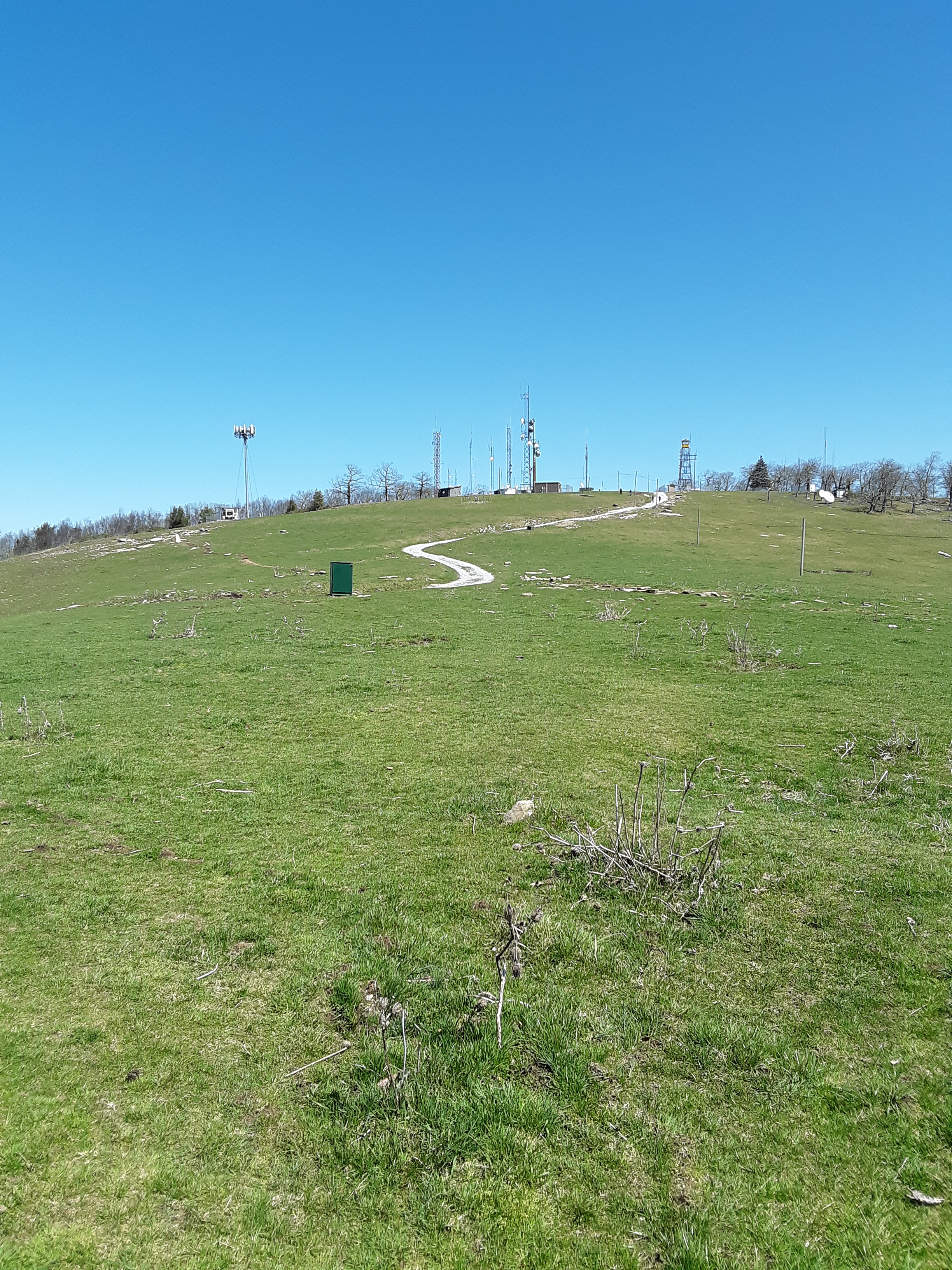
Next we took a 50 minute drive to the Bearwallow Mountain Trail. I should have taken a few pictures of the very open (no underbrush) woods on the way up (5). The large field at the top with the closely cropped grass and numerous variety of towers, both old and new, was a surprise to me. The short grass turns out to be the result of regular pasturing of cattle.
We lounged and ate in the grass and calm air. There had been a cold wind on the north and west slope on the hike up, but it was calm here.
My cellphone telephoto is not good but it does reveal mountains in the county where I reside some 45 miles away ‘as the crow flies’. The little pointy one is Table Rock and the asymmetrical one two peaks to the left is Hawk’s Bill.
The soil is very shallow at the top of this peak and the metamorphised granite pops out here and there.
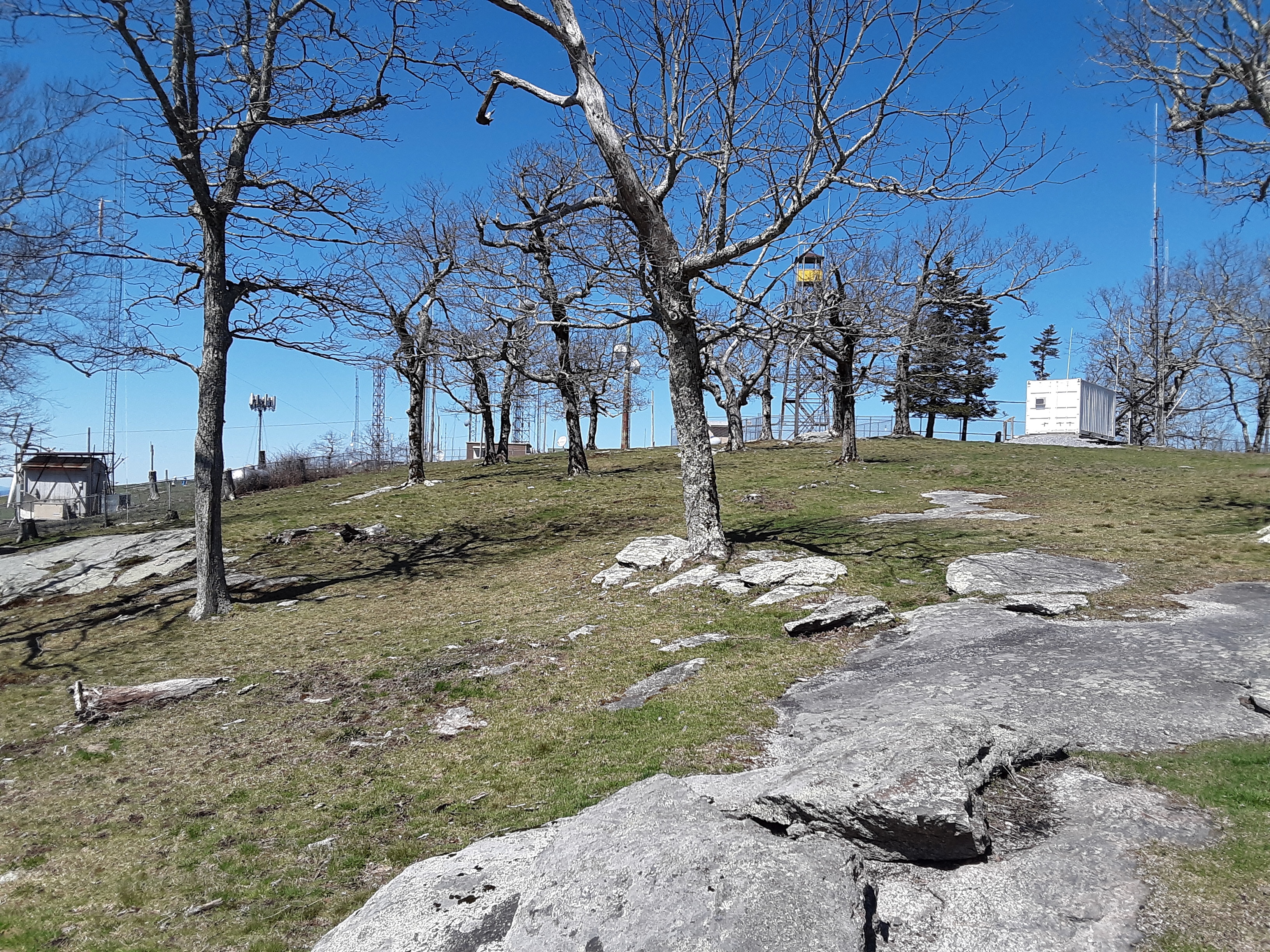
Sadly, the old firetower is fenced off. It must provide a truly unobstructed 360 degree view.
The largest domed shaped peak on the horizon is Mt. Pisgah. Even my old eyes could discern the huge tower that resides thereupon.
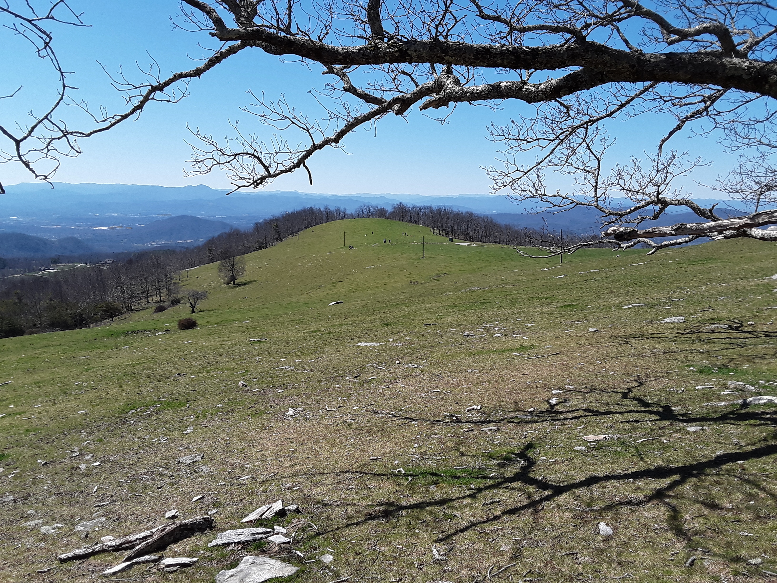
I present this similar picture for the purpose of showing how large the field is. My three hiking companions stand halfway between the two power poles awaiting my return from picture taking.
The wind was still cutting on the north aspect when we descended, but the conversation was warm and lively, like the greening grass and bright sunshine in the pre-Spring higher elevation we enjoyed this day. I am thankful to God for time outdoors with family and hope that more will come with more of my family many times in the future.
I don’t consider most selfies to be effective, that is, good picture taking, and certainly not to be compared to a good portrait.
I commented to my sons that the “woods is sure clear.” My youngest pointed out that it should be “woods are clear.” He was right, but it caused me to be amazed once again at the crazy language we speak. I think that the reason I didn’t have subject verb agreement was our use of the word woods. Based on reading, I am confident that past usage was “wood” rather than “woods”. Therefore, the “wood is”, referring to the forest.
Why haven’t I written a blog entry in awhile? Work has been intense. After a long week of work and an 11 hour Saturday repairing a deck, I took a Sunday rest. The week before an urgent situation caused me to have to pack and travel on Sunday. I was much in need of a break. I walked about 100 yards into the woods at the house where I was staying and leaned up against a tree. Lying down soon followed. I observed the surroundings for a short while and then took a solid nap. Only the first few lines of the poem came to me then. The remainder followed a few days later after two more 12 hour days to finish up the deck repair. I was away from home and appointments forced my hand to work such long hours.
My body is tired, spirit too Quiet rest, think things through The treetops sway, dry leaves rattle Pond frogs peep, crows far off prattle
Sunshine is warm, the breeze is cool Pushing so hard, oh, what a fool Working so hard, no time to play What’s the purpose, what is the way?
I sense just now the air is hush The leafy bed is soft and plush God helps His own in the their sleep Provides strength when the road is steep
Busy the ant upon my knee Still dormant branches above me What’s the balance of work and rest? Wait in trust or rise to the test?
Too tired to figure it all out And can’t know all God is about But on this quiet, pleasant day I will sleep right here where I lay
I made a few switches in word order after talking to a friend about our minds so often working from the concrete to the abstract. We see something and respond, “Oh, that reminds me of what I feel or need or how I relate to someone.” God has been good to me to provide health and work and skill to make money for the ever rising bills. I am trying to steward (manage) my blessings, not complain about them.
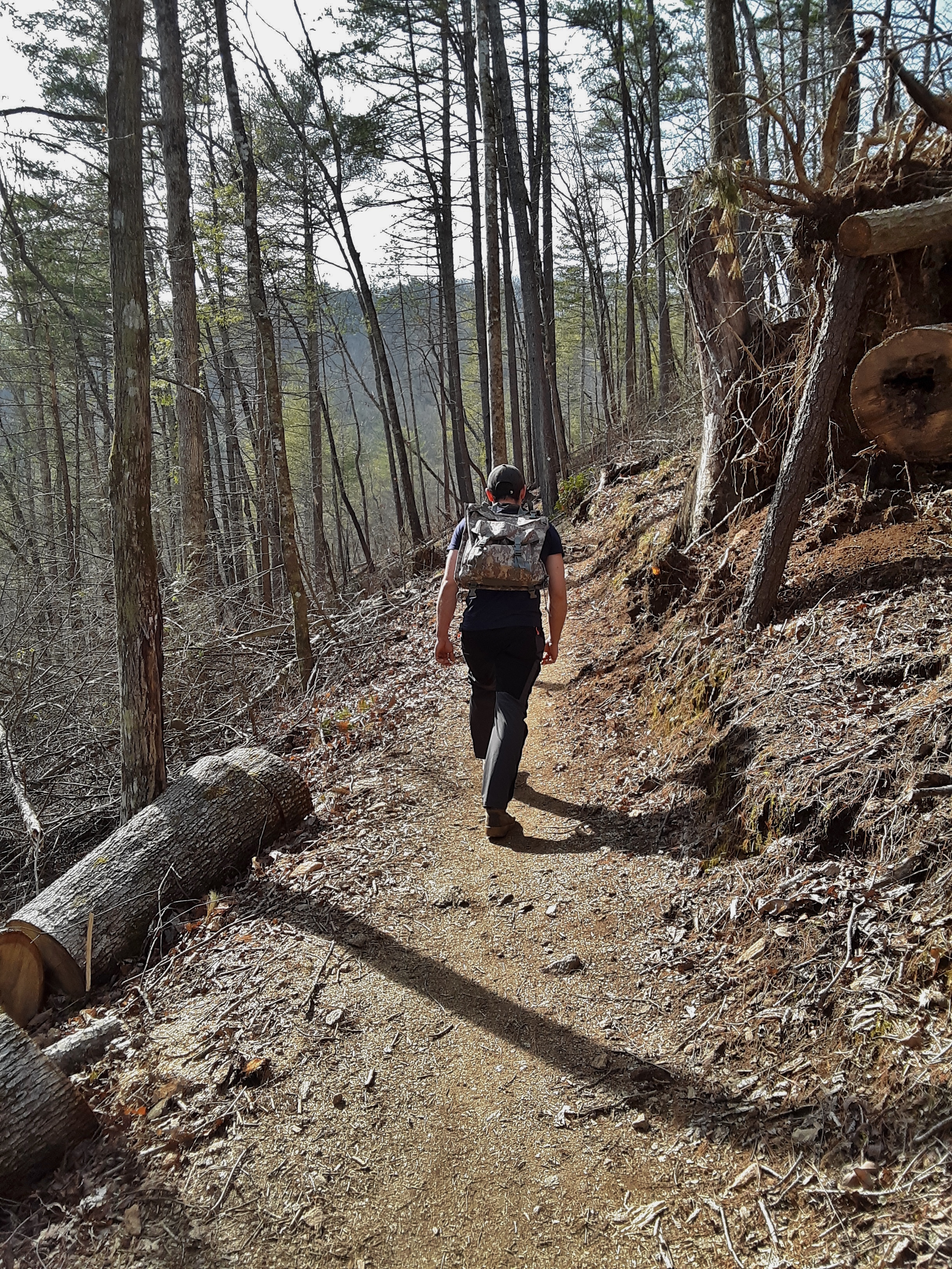
It has been a busy month since I last went for a hike with my youngest son. The conditions were totally different (See “Winter Hike” for comparison.). The temperatures eased into the lower 70’s with breezy patches of clouds passing over revealing and obscuring the sunshine. We started off on a crowded trail where most everyone strolls in the South Mountains.
Soon we started off up the ridge onto a trail I observed to my son that I had not been on for perhaps 20 years. He replied that was one way to reveal your age. I did not recognize the trail, however, because it had recently been reworked because of a forest fire that cleared some areas and thinned others.
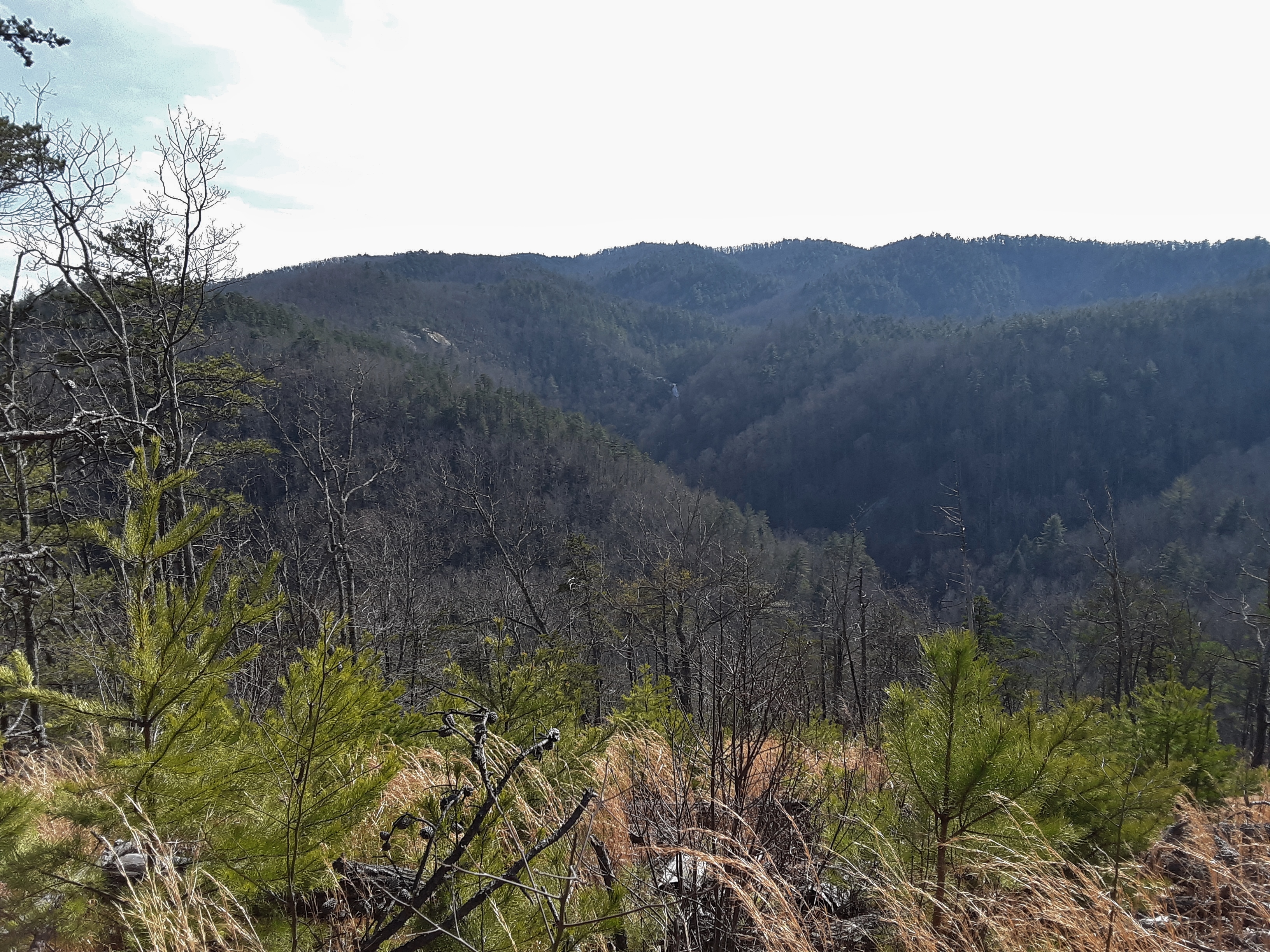
In one clearing where pine saplings were drinking in the full sunlight, we could see High Shoals Falls on the other side of the gorge. Can you pick it out?
A little snack was in order and more water than we would have expected to drink on the last day of February due to the temperature.
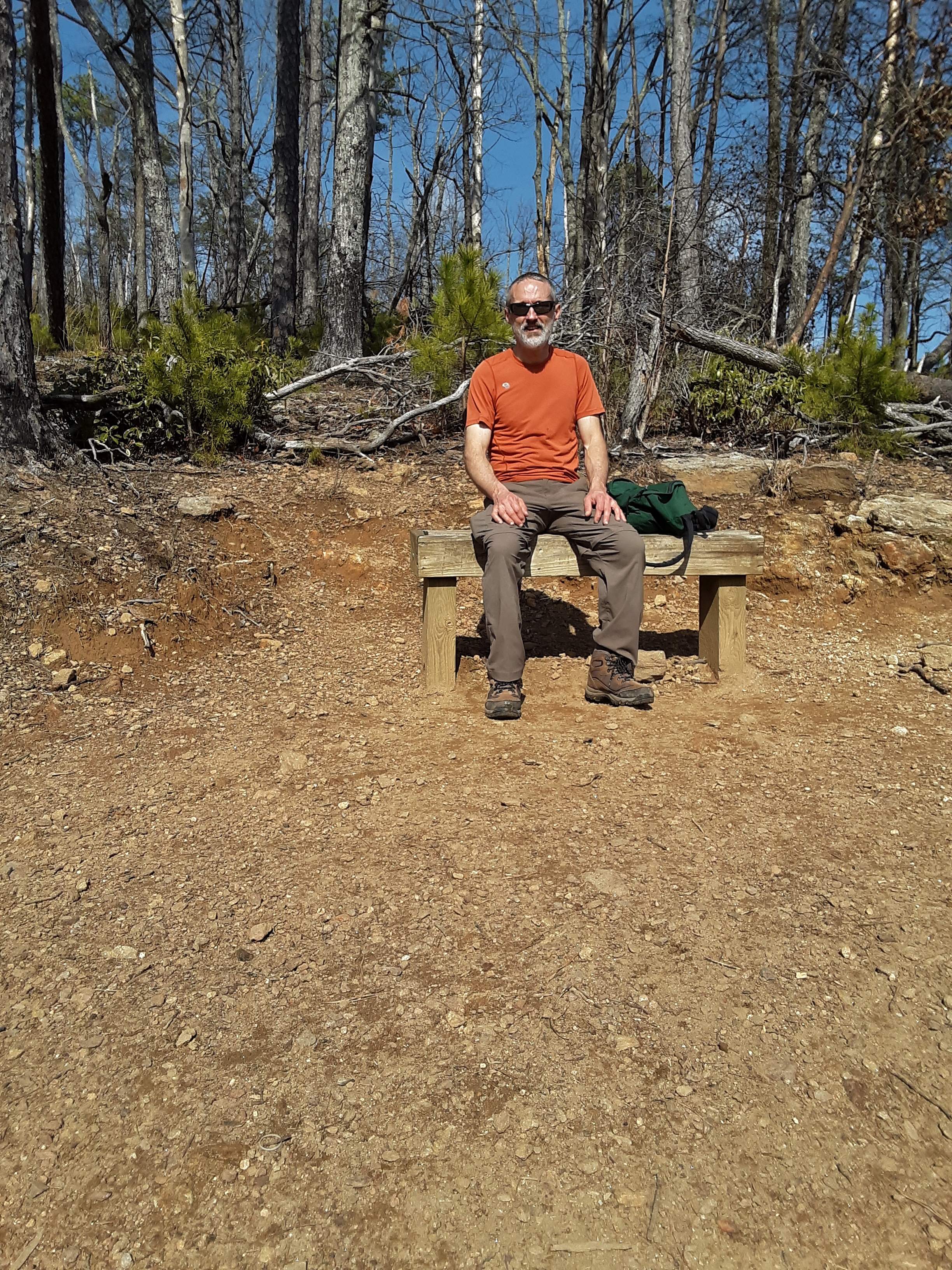
The old man enjoyed a little rest in the warm sunshine before continuing on. In reality, the major part of the climb was over at this point.
One hates to see so many large trees down, but there are advantages like better views, increased sunlight and the renewal it brings to the forest. On the other hand, fires also allow erosion of topsoil from rainfall, which has been heavy the past two years. Take note that every picture showing the ground has bare mineral soil. Notice also the beautiful blue skies when the camera was not facing south (glare).
When we reached the ridge, the breeze was a stiff but pleasantly cooling wind from the south. My son pointed out the peaks he had been on the day before with his father-in-law. We need to form a party of three for a hike sometime soon.
The marked overlook was down to the left of the ridge trail. It had an impressive rock outcropping, but not being near the top of the ridge, it had a limit angle of view. Also, the dude on the rock was listening to loud music and imbibing the combustion products of an aromatic herbaceous species familiar to the olfactory sensors.
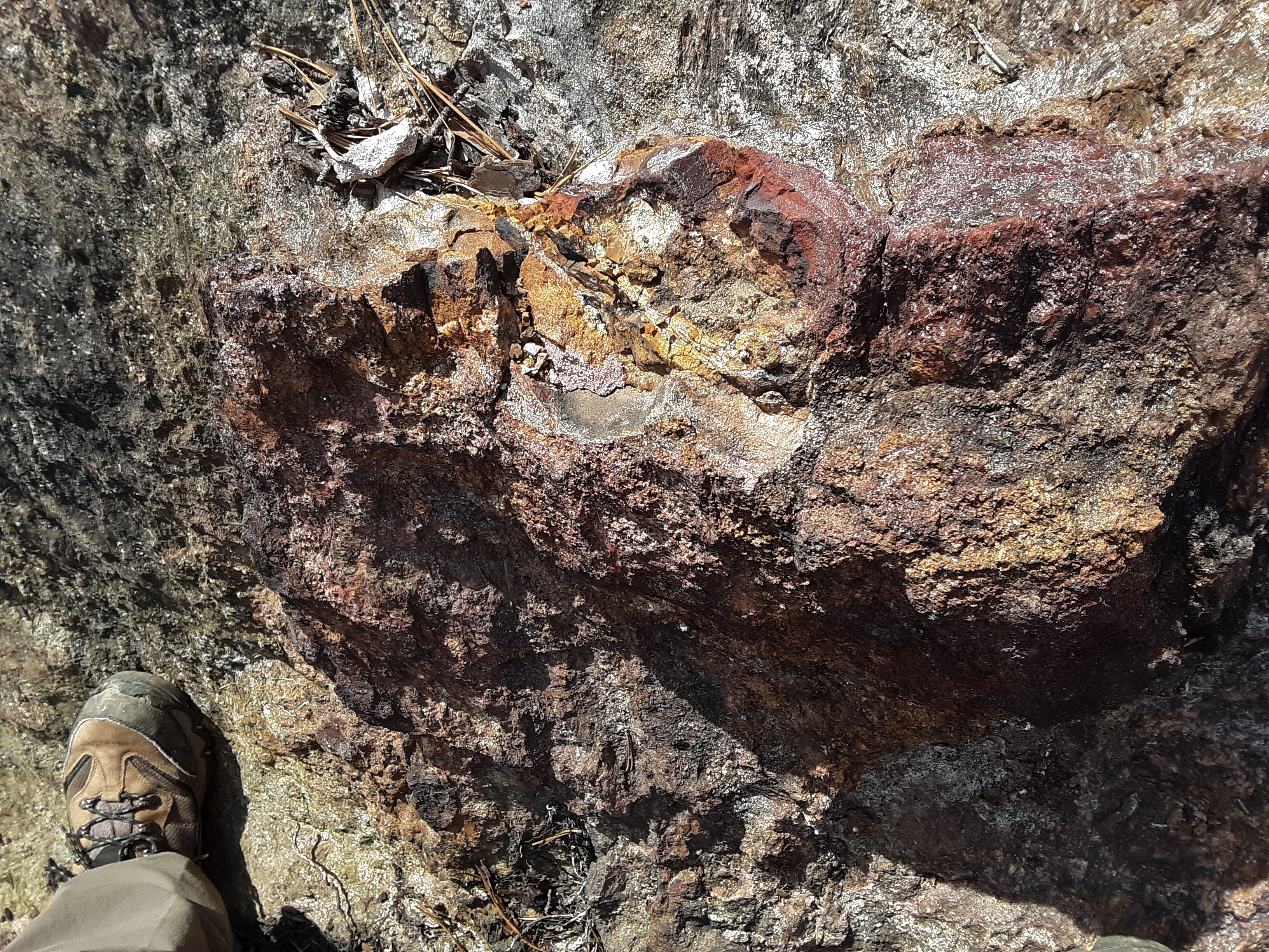
I quickly took a picture of some “overly cooked” metamorphic rock with iron deposits, which was quite brittle and sharp.
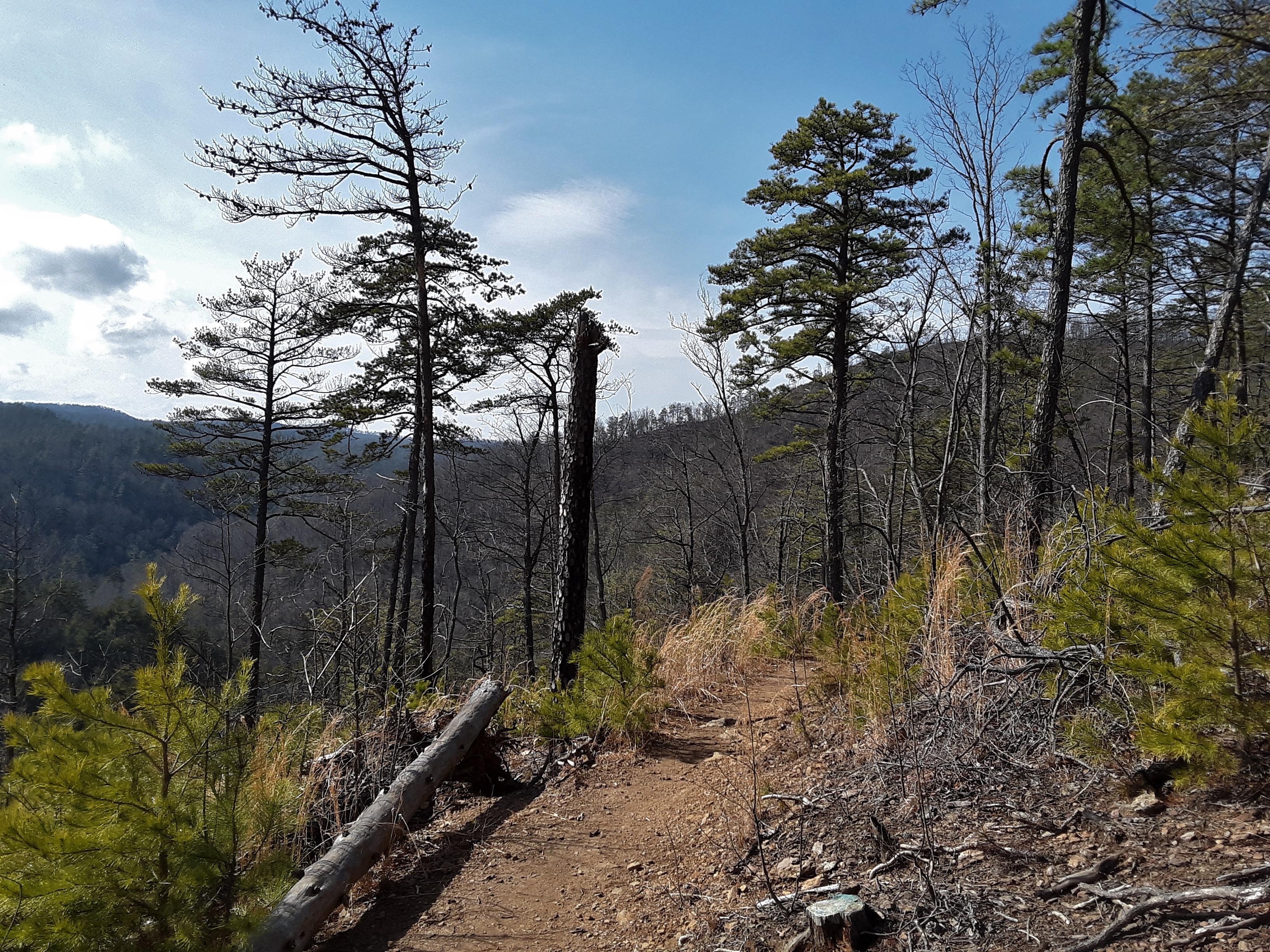
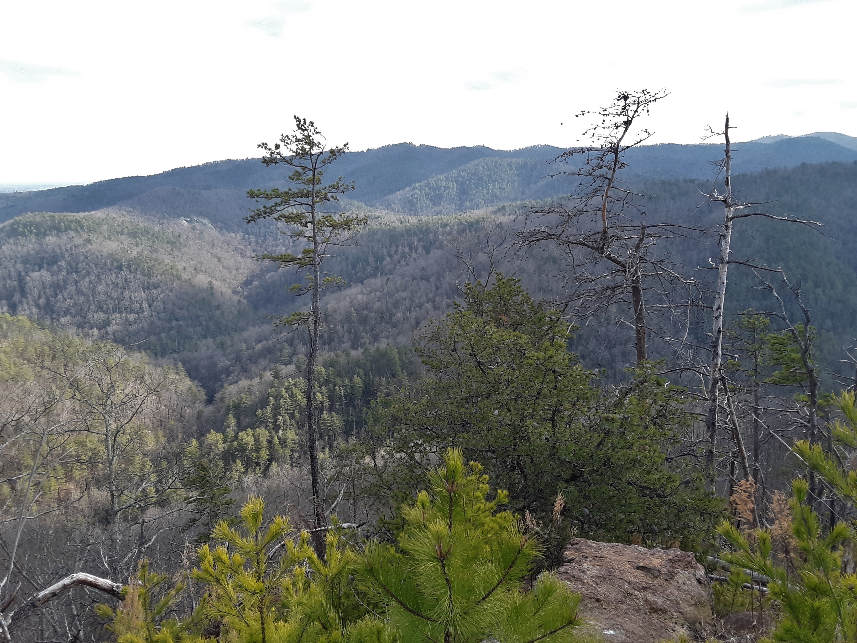
Then we promptly left for a location of more sensory satisfaction on top of the ridge. There we found a less impressive rock outcropping with far more impressive view. It was the site I had remembered from many years ago but with a 270+ degree panorama due to downed trees. We could see deeper into the mountain range, across to the other side of the gorge, and east toward the Piedmont (swinging around from south to east to north in the following pictures). See if you can spot the bright shirt on the lower lookout in the last picture of this sequence.
Snack and portrait time
Earlier and further down the slope I had hoped outloud that the fire would result in a quicker transition to hardwoods as it sometimes does. You have probably already discerned how wrong I was. In fact the top of the ridge, where it is quite dry, was spread with Table Mountain Pine saplings, whose seeds only germinate with assistance of fire.
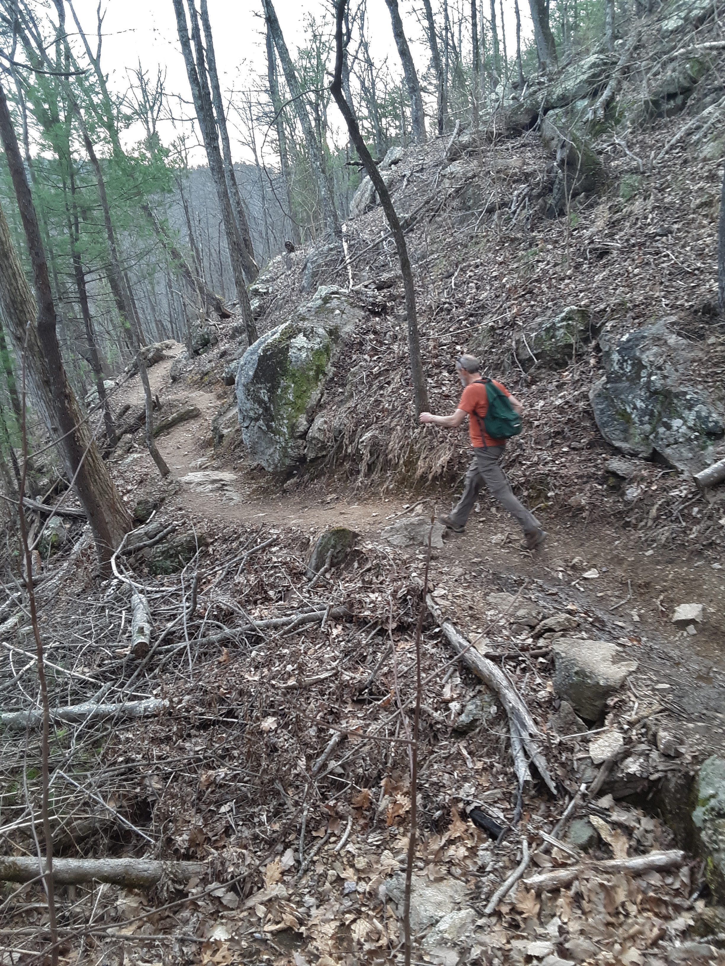
I don’t get many pictures of my son looking at the camera. A certain degree of camera shyness or camera apathy is involved, but also he may be getting back at me for those hikes years ago when I expected him and his brother to keep up. Now the old man mostly sees the his back side as he glides away. The next picture is the very top of Chestnut Knob. I am very skeptical that the top of the knob ever had a Chestnut tree on it. More likely it was named downslope where the abundant producers of food for forest ranging swine were fed.
I asked my son at one interesting turn in the trail on the way down to take my picture when I got to a rock below. That picture actually didn’t turn out so well but several before I got there did.
At the bottom of the gorge my son checked the temperature of the water. It is amazing how much a week of warm weather can warm up a creek after it had been filled with ice just two weeks ago.
The company, conversation, temperature, wind, trail, and views were pleasant. It is always good to get out into God’s Creation for a few hours to reset and recharge.
The temperatures have been very variable this winter, frequently ranging from high sixties to low twenties in less than forty-eight hours. We haven’t seen much snow in the valley, but the mountains and west slope have gotten consistent, though not deep accumulations. My youngest son wanted to go for a hike and I wanted to go see a waterfall that I had never seen. We started down the wrong trail, which I pretty much knew as soon as we started, but we saw a waterfall anyway. It was good to get out into the woods in some crisp air. The first picture is of the Hump Mtn heights from Mortimer Road.
Frozen gravel is an odd sight. The air spaces created by the expanding ice make it quite crunchy to step on.
If you have not seen it before, the lacy frost heave of bare soil with excess moisture is even odder to see.
I am a little out of practice, but you can tell the temperature from the position and shape of the rhododendron leaves. They droop more and more as the temperature drops and curl up in the mid-teens degrees F. The following picture shows low twenties. When we first entered the woods in a shady spot, the leaves were hanging straight down, indicating below twenty. I didn’t see any curled on this trip.
Which trail are we on? The color of the blaze tells you. The sunbeam across this Mockernut Hickory bark gives the blaze an extra apparent significance. It makes me sad to see when someone slashes at a tree. the damage to the bark can introduce disease or allow entrance by insects.
Microcosms or micro-environments have long fascinated me from the perspectives of the interactions and completeness of their little ecosystems and the photographic possibilities. If one takes the time to look, there is so much going on in the following picture. And in warmer seasons, insects, spiders, and other arthropods would be combing the surface and subsurface for detrital delicacies and with carnivorous cravings. My son mentioned that spiders can be incredibly small. Having studied spiders, I told him that the Family Microphanidae (1) required a hand lens to even see and more magnification to discern parts. I had identified a few back in the day.
Stone wall, rock outcropping, or tree bark? This one is not so hard to figure out but pictures with a narrow field of view are frequently used for puzzles. The interesting features include moss “leaves” (2) and miniature lichen scales, remnants of snow, insect bore holes, and the platy form of pine bark.
I like the open hardwood forest which has such a stark, leafless beauty in winter.
The quietness of the woods soothes, quiets, and focuses the mind. Work and societal stress are well coped with by the occasional few hours in the woods. Rhododendron thicket ahead! It means increased ground moisture and change in aspect. (3)
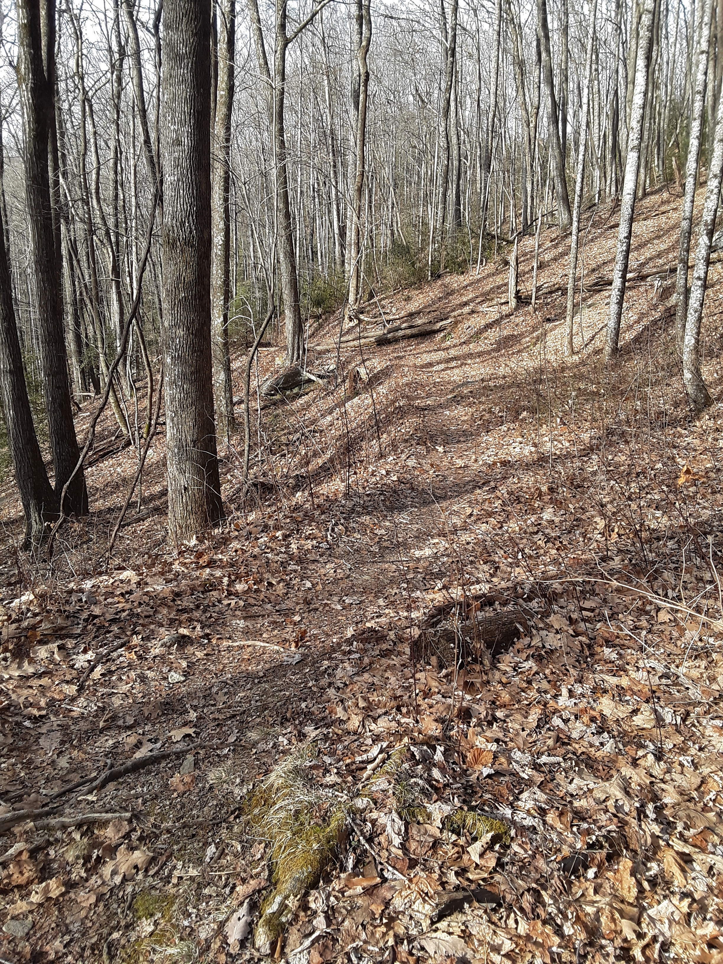
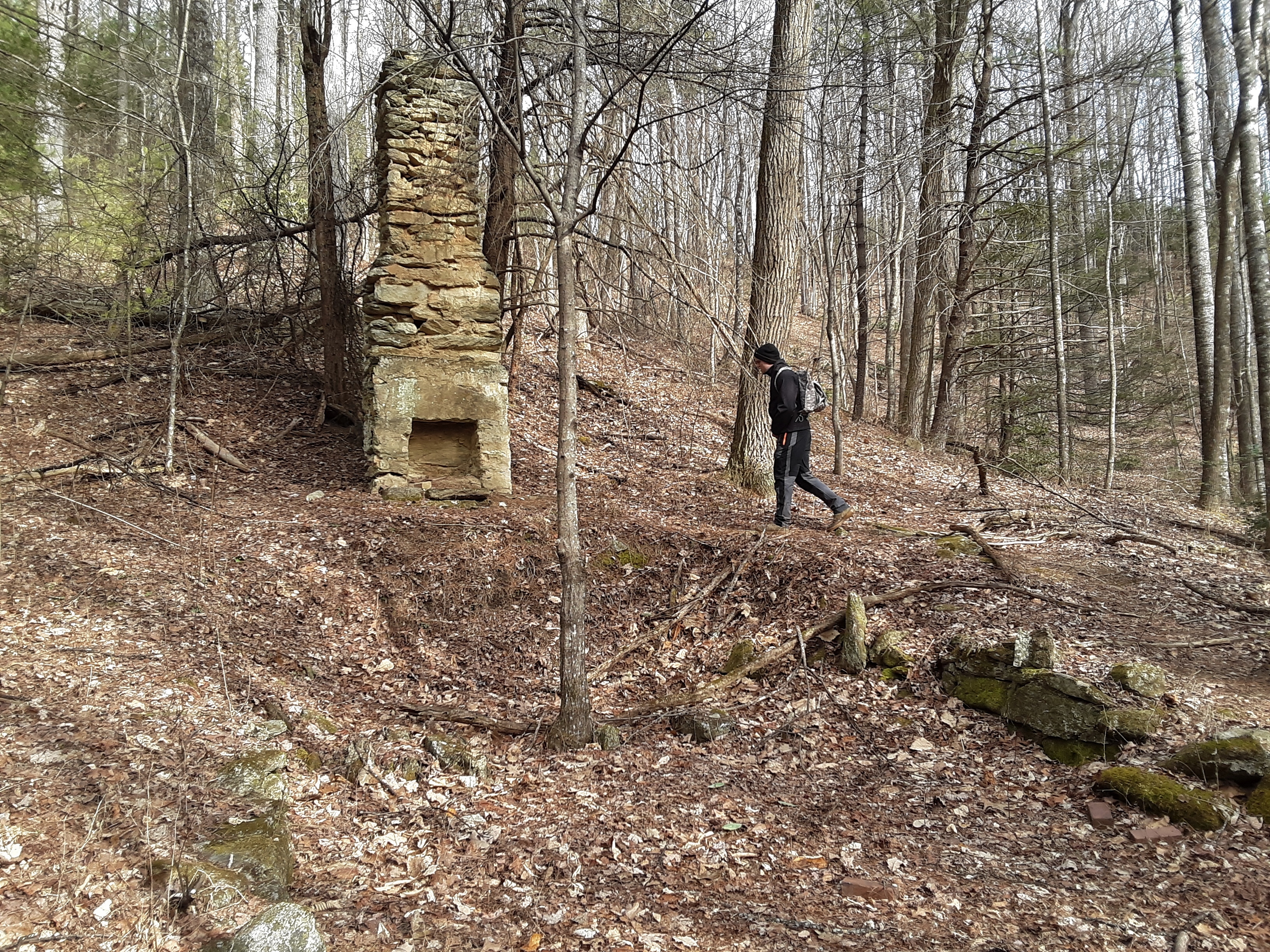
Chimneys in the woods are not uncommon, but this one is in particularly good condition. My son thought it might be an old store next to the logging road.
The old cookstove has seen better days. I had hopes that the nameplate was on the door, but someone had removed it long ago. It would have been cast-iron and not so deteriorated as the plate-steel guts of the stove.
My son wanted to see how thick the ice was. Given the fluctuations in temperatures lately, it surprising that it was about 2 1/2 inches. Composed of three distinct layers, it had vertical striations of air bubbles ending at clearly seen interfaces between the layers.
A full week of consistently cold temperatures would render this cascade flowing under the ice. The edges were icing.
Only a video can show this next curiosity of bubbles: Click on https://youtu.be/HAeuLXcRzyg to see the short video.
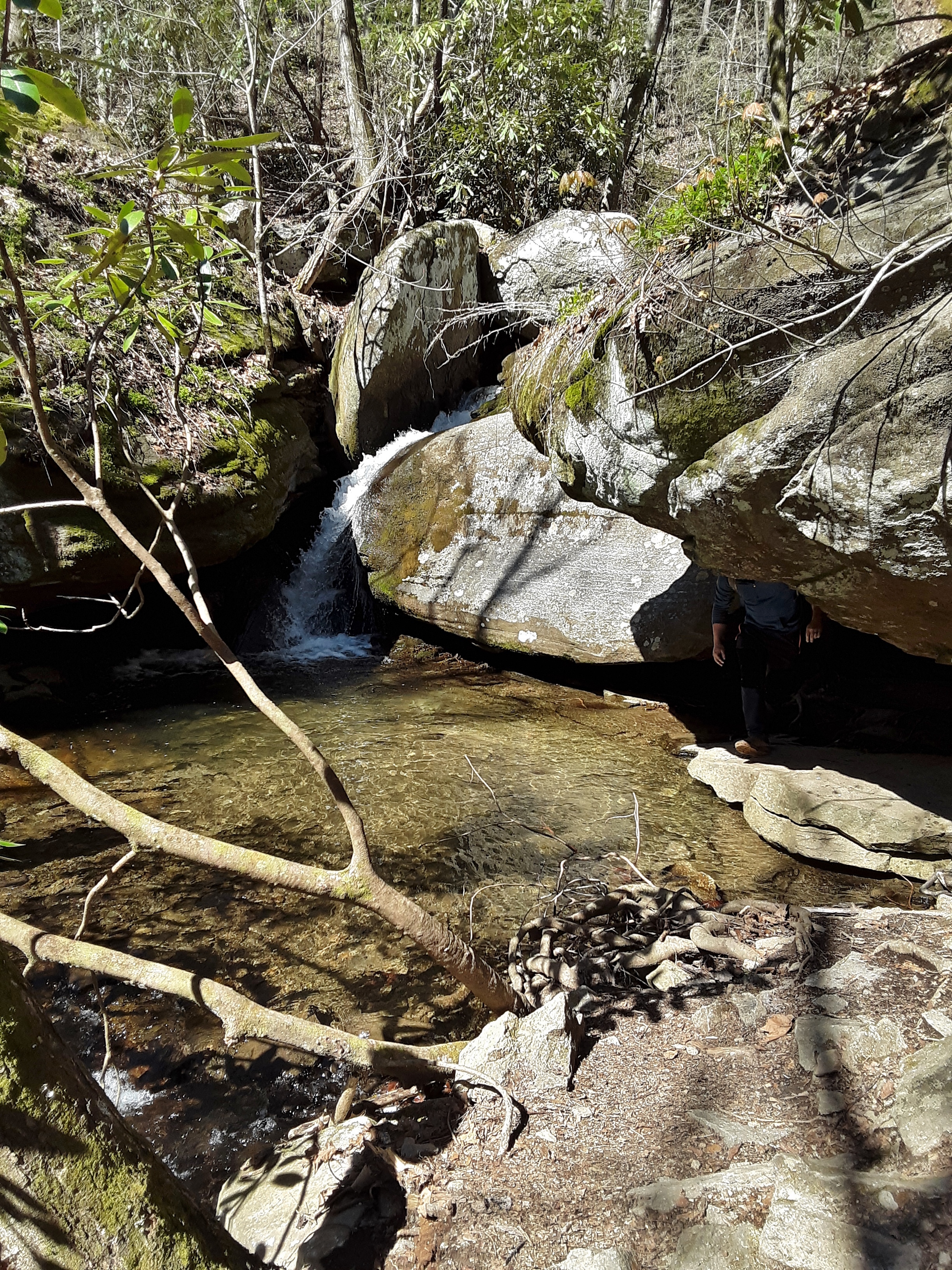
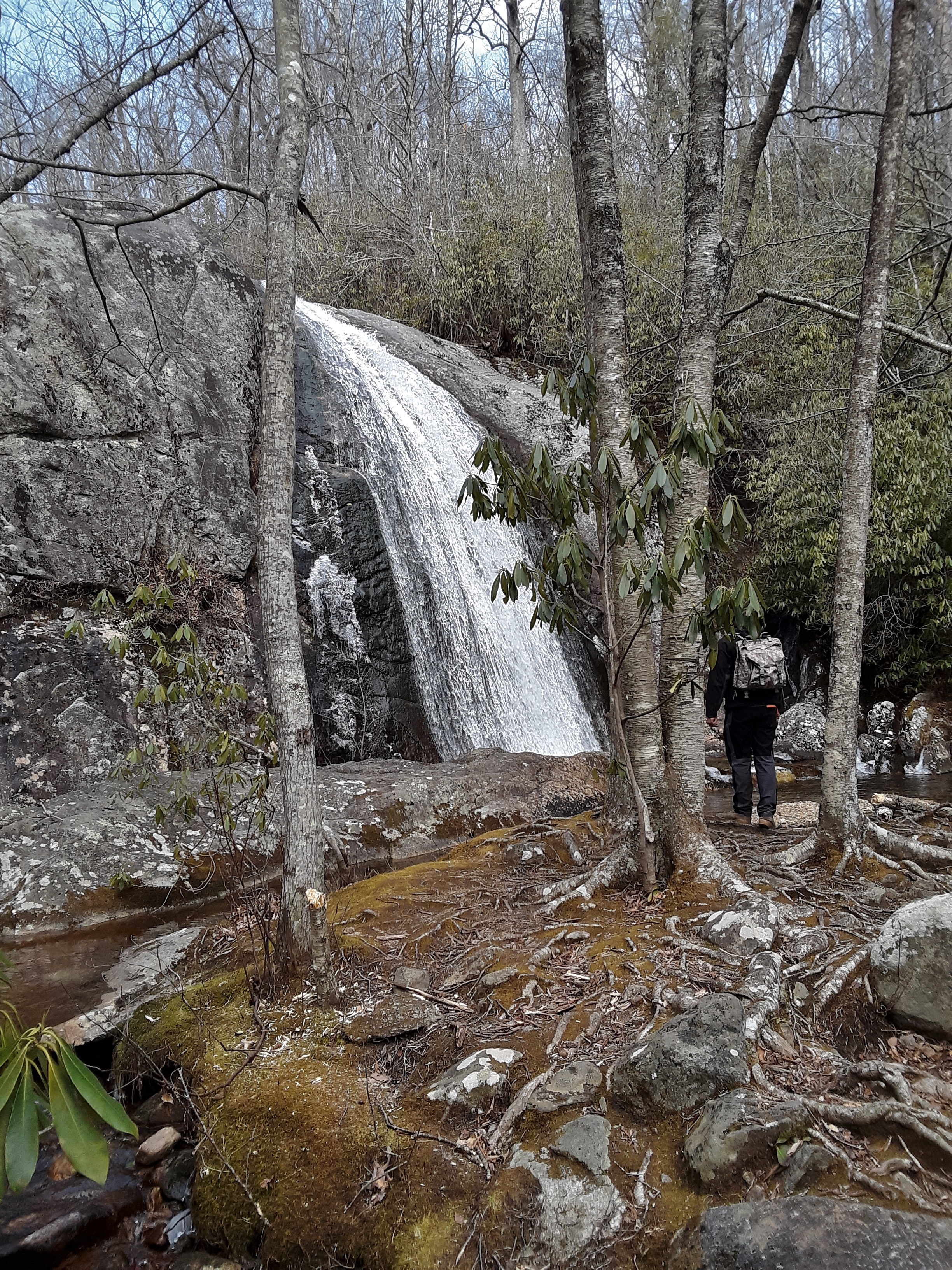
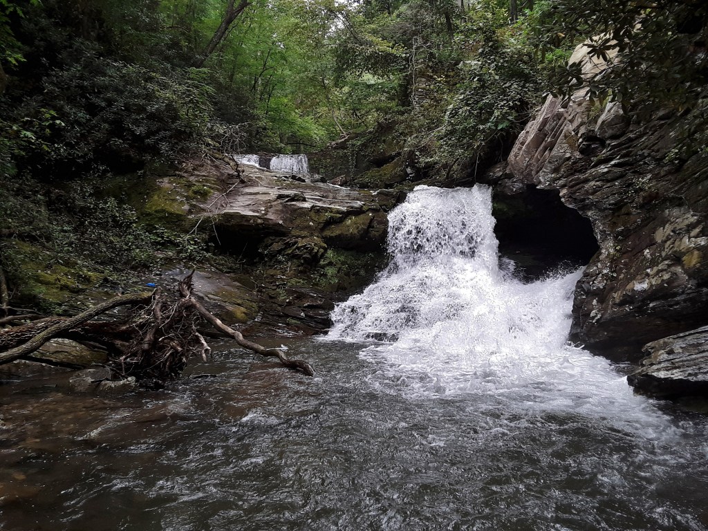
North Harper Creek Falls runs down perhaps 150 yards of 30 degree sloped rock outcropping to then fall over a 25′ cliff at the bottom. It occurred to me that the water slips into the pool and makes far less noise than most falls. The picture shows moderate flow for this falls.
You can tell it is cold when I bring out my Australian surplus army wool paints, Canadian down skiing vest, and purple heavy weight fleece pullover. As I get older it takes less cold to pull out the serious gear. We actually saw two trail runners, one of whom was wearing shorts. I guess they didn’t stand still too long.
This spot has memories. I once did a homeschool ecology lesson from this spot. As you can see from the view, this spot feels totally out in the middle of nowhere. It is about as close as you can get to it in my neck of the woods.
Right at the beginning of the trail it crosses private property. The confirming indicator is the corner marker. The government clearly marks their corners.
In fact, they are hard to miss.
I wonder if it is advisable to report an unwilling or accidental destruction, defacing, change, or removal?
Early in the hike as I was making a creek crossing, my left foot slipped on ice and plunged into the creek over the top of the boot. It could have been worse. No injury and nothing else got wet. I poured out the water and walked without a sock on my left foot for perhaps a mile. My heel began to tell me a blister was in my future, so I told my son that I would take him up on his offer to dry out my sock. We found a wide spot on the trail where there was totally bare, mineral soil. My son gathered small dead umbels (4) of flowers that he said are always dry even when it is raining. We both gathered leaves and twigs up to about thumb diameter. He got quite the hot little fire going and fed it while I rotated my sock near the base causing steam to rise from it. I have one regret concerning this blog entry. I was so intent on drying my sock that I never thought to take a picture of the fire. My son did do a thorough job of spreading the embers and stamping it out before we left. I crossed the creek at a different place on the way back.
I was thankful to be able to get out and enjoy the quiet and talk with my son and see beauty. Before we left, with the assistance of the runners’ map, we found the trailhead where we should have begun. We are determined to return soon. I thank God for the beauty of His Creation and His kindness toward me to allow me to hike for so many years and still yet.
I would not be at all surprised if you cannot find any reference to that spider family name. Classification Scientists love to change things around, especially since they believe, falsely as I believe, they have found the key to classification in DNA comparison phylogenetic trees.
Mosses do not have true leaves because they are non-vascular plants and lack the complexity of leaves.
Aspect is the compass direction of slope, which determines amount of sunlight, drying, and temperatures.
Umbels are arrangements of flowers in an umbrella shape.
I worked on a deck project for about half of the day before my son and his wife came for lunch. I thought we would be sitting around and talking, but he declared that he, his wife, and his brother had planned a hike for the afternoon. I asked to come along for what was a surprise outing on my birthday.
My youngest son decided that he wanted to enter the woods downstream of the main parking lot. The lower lot was full so we had to walk down the road a bit to get to where we wanted to begin on the trail.
I guess they didn’t want their picture taken.
For a change of pace we did the usual trail to the falls backwards, hiking up the long, steep, old logging road to a point above the falls. On the way up there is one small view of the waterfall, which was further obscured by fog this day. The backlighting of the fog caused outlines around twigs in the following picture- odd.
High Shoals Falls through twig and mist
Fog precludes panoramic views but it quietens and narrows the woods down to a more introspective view.
I think that my earth tones blend well with the trunks and leaves.
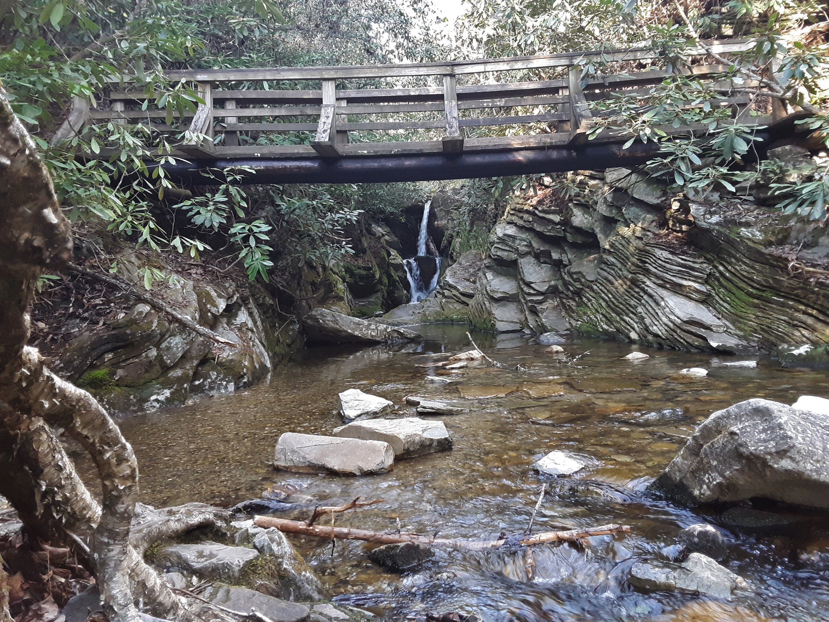
Sometimes bridges are provided which helps when the water is up and cold. This has been another year of excessive rain, so clogged and sand lined creeks are common.
There is always something foreboding about the top of a waterfall.
Most rock can hold its own weight up, so what level of forces are needed to crack boulders in this way and what supplied it?
The following picture has a number of curious elements. Check out the lower trunk on the small tree a the right. What happened to cause that? The moss testifies to the fact that this area is always wet, not just during a damp fog. The couple are frame perfectly, observing nature, and yet seem out of place somehow. There has been much slippage for these boulders to lie just so. The noise and action of a waterfall never ceases to grab our attention, but there is so much more going on if we look closer.
The splash zone of this waterfall and rapids below is quite large so there are plenty of Hornworts, Liverworts, Mosses, and Ferns. Check out the Doghobble at the right.
We came across some friends, all girls: a mother, 4 daughters, and 2 cousins.
Watching over the brood
There is plenty of Doghobble and Rhododendron, too.
We took a new side trail to a small waterfall as well.
Above the waterfall
River rocks are so good at revealing the geology above their resting place. Though colorful in variety, they speak loudly of the regional metamorphism that shaped these mountains.
My young friend took the following pictures. She is improving regularly in her framing and composition of her photographs. I wear the sunglasses on my head out of habit even when there is little hope of the fog clearing.
I did not expect a hike on my birthday. I mused later that God is good in the little details as well as the big. I enjoyed the day with a few of my children.
The tradition in my family for about 30 years has been to gather at my oldest brother’s house for Thanksgiving. Numerous traditions grew up around this basic idea. One of the most enduring is the day after hike (see “Cascades and Escapades” and “Ebb and Flow of a Tradition” as two recent examples).
Of course, you can guess that this year was different. We didn’t meet at the elder brother’s house. His immediate family did. They also went on their hike. A good portion of my immediate family met at my house on Friday for thanksgiving reflections and a meal. There was plenty of good food prepared by numerous hands. We read psalms of thanksgiving and sang hymns and shared things we are thankful for.
On Saturday, prompted by two of my sons, we took a hike. My youngest and a young friend were beginning a one night backpacking trip, and the rest of us were along for the views and conversation. The slope had been burnt over twice about 15 years earlier and eliminated much of the topsoil. Regrowth has been slow, but the views are good.
The backlighting turned out OK, but since we did not know that at the time we shifted 180 degrees and posed again for the friendly hiker that I asked to record the images.
My son admitted that he was overly packed for a one nighter.
There are patches where it was not completely burned off and the younger trees come back faster here with the presence of more soil.
New growth is heartening.
The previous pictures show the relatively shallow slope the southeast face of the Shortoff Mountain. The next one shows where the trail comes along the edge of the vertical northwest facing precipice.
Table Mountain Pine predominates the stressed conditions of shallow soil, wind blown and otherwise drying conditions.
You wouldn’t be surprised to discover that this young friend is a tri-athlete. He stands upon metamorphized layers that are common to the Gorge.
Lake James actually dams three parallel streams, two of which are visible here. The South Mountains are visible in the background, being the last foothills before subsidence into the Piedmont region.
Wind is a creative and random sculptor of trees, imparting to this specimen a bonsai appearance.
There are many lone trees hanging onto the cliffs but the pine on this vertical section seems somehow “braver” or “more determined” as anthropomorphisms would have it.
Table Mountain Pine is also one of those species that require fire to open the cones and germinate the seeds. The cones appear to be fortresses against their time of opening.
Shortoff Mountain is amazingly flat on top as seen in this view along the Mountain to Sea Trail.
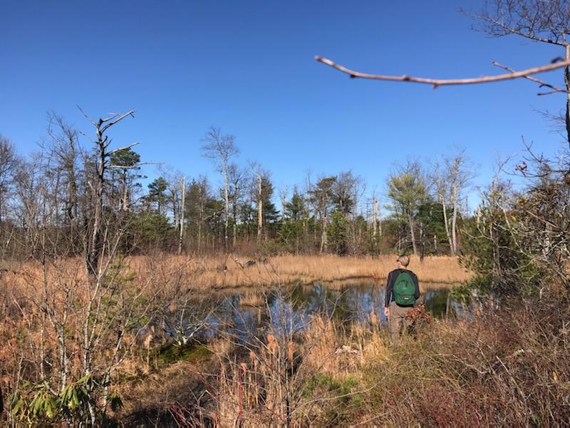
I know that fire is necessary and unavoidable, but I hate what it did to this little pond. First of all, it is amazing that a pond exists at the summit of a flat-topped mountain. It is not a mere wet weather pool. It used to have shade, open water, abundant frogs, small fish with only minimal vegetation in the water. Now the pond has eutrophied to such an extent as to hold no discernible animal life.
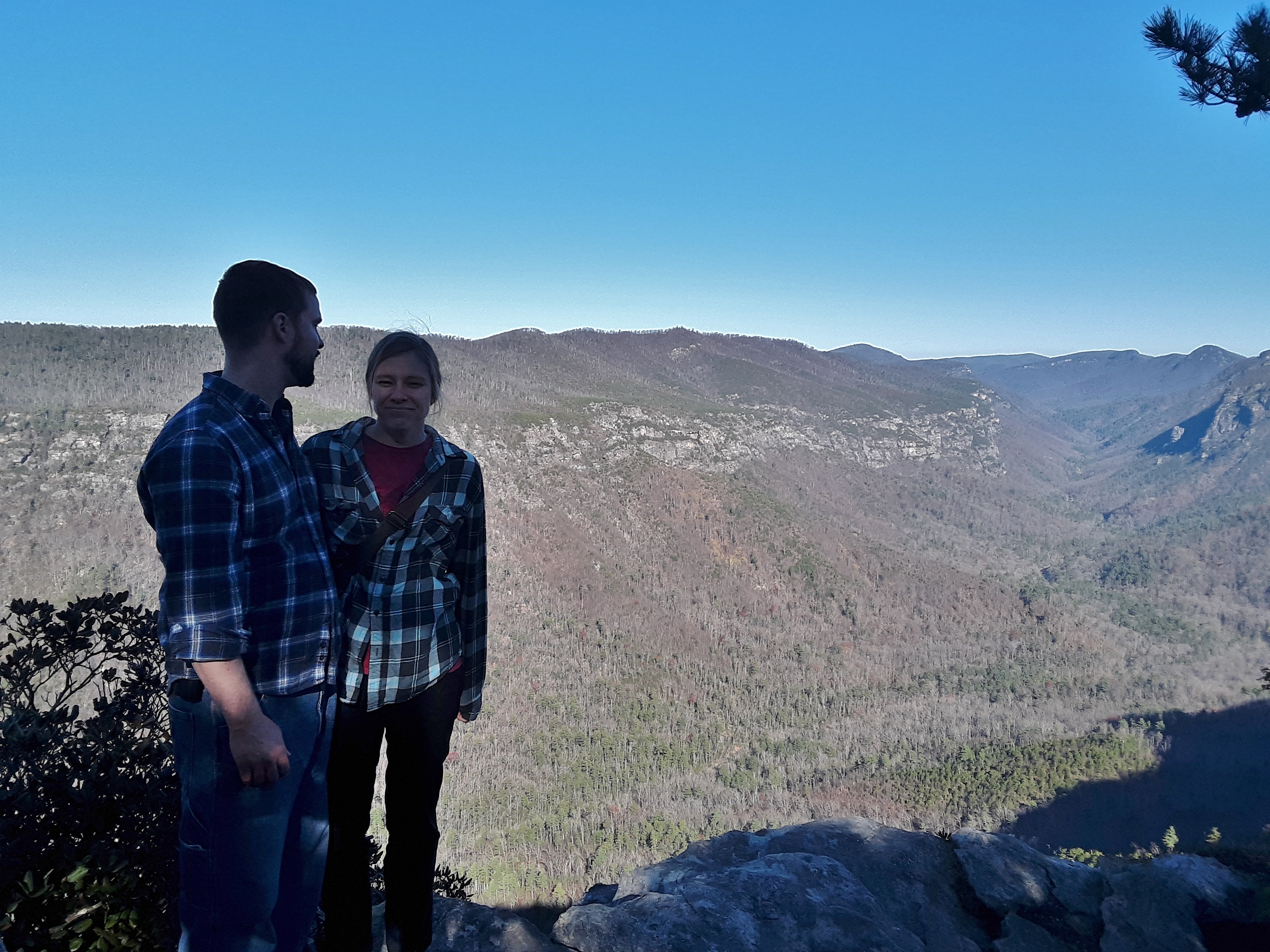
Not knowing that it was there, I had to point out to my young friends that we should stop and look at the best view of Linville Gorge available. Because the Gorge turns slightly at the mouth, you stand here on the rim looking straight up the majority of the length of the Gorge.
You can tell by the quality of the colors that this picture was not taken with my phone. I credit my daughter-in-law for this good picture.
And here she is with her husband.
Near the previous view is another one facing out of the mouth of the Gorge, revealing ridges more than 30 miles away.
I conclude with a picture of me contemplating the change and continuity of God’s nature. We can design our Biosphere 2 in an attempt to copy the real thing*, but our attempts cannot hold a candle to the ability of God’s designed Biosphere to absorb stress in the form of weather and natural disaster and human pollution and still recover and adapt. Man may have caused the fire that so affected this pond, but lightning could have just as well accomplished the same thing during drought. The pond may be changed for the duration of its existence or it may eventually recover its shaded, lively charm. Either way it is and will adapt well.
*If you don’t believe in design in nature, just consider the extent to which scientists go to design experiments like Biosphere 2 and they don’t even work that well.
I enjoy relating to serious, fun-loving young people. How can they simultaneously be both you may ask? A person can know what is serious, consider and muse on it and discuss it and act on it, and still have a good sense of humor and enjoy fun challenges and take reasonable, considered risks.
The climbing partner with whom I have been out the most in the last six months is just such a person. He is a former science student of mine who loves to climb, is getting married soon, just started his first nursing job right out of college, and most importantly shares the same faith as me. Life still challenges me with work and play and relationships and worship. As a result, there is plenty to talk about.
Because of where we now live, we meet approximately halfway in between at Rocky Face Mountain Recreation Park. The old quarry has numerous and wide ranging difficulty of sport climbs. I usually post pictures of one or both of us actively climbing, but the mood of the weather, the climbing, and the conversation had me pointing my camera elsewhere.
Reorganizing equipment at the top of the first pitch.*Happy, but on edge on the first pitchShutdown, resting, and figuring out where to go.
On the point of climbing, I suggested that we climb two pitches to the top of the second tier since I had never been there. I bit off more than I could chew on the upper tier and had to traverse left to an easier climb and then far back right further up. You can see this in the following picture.
Check out the rope at far left and stretching across the middle to the right, and me sitting on top under the tree.Hanging out on topNo easier approach to a climbing area can be had.**
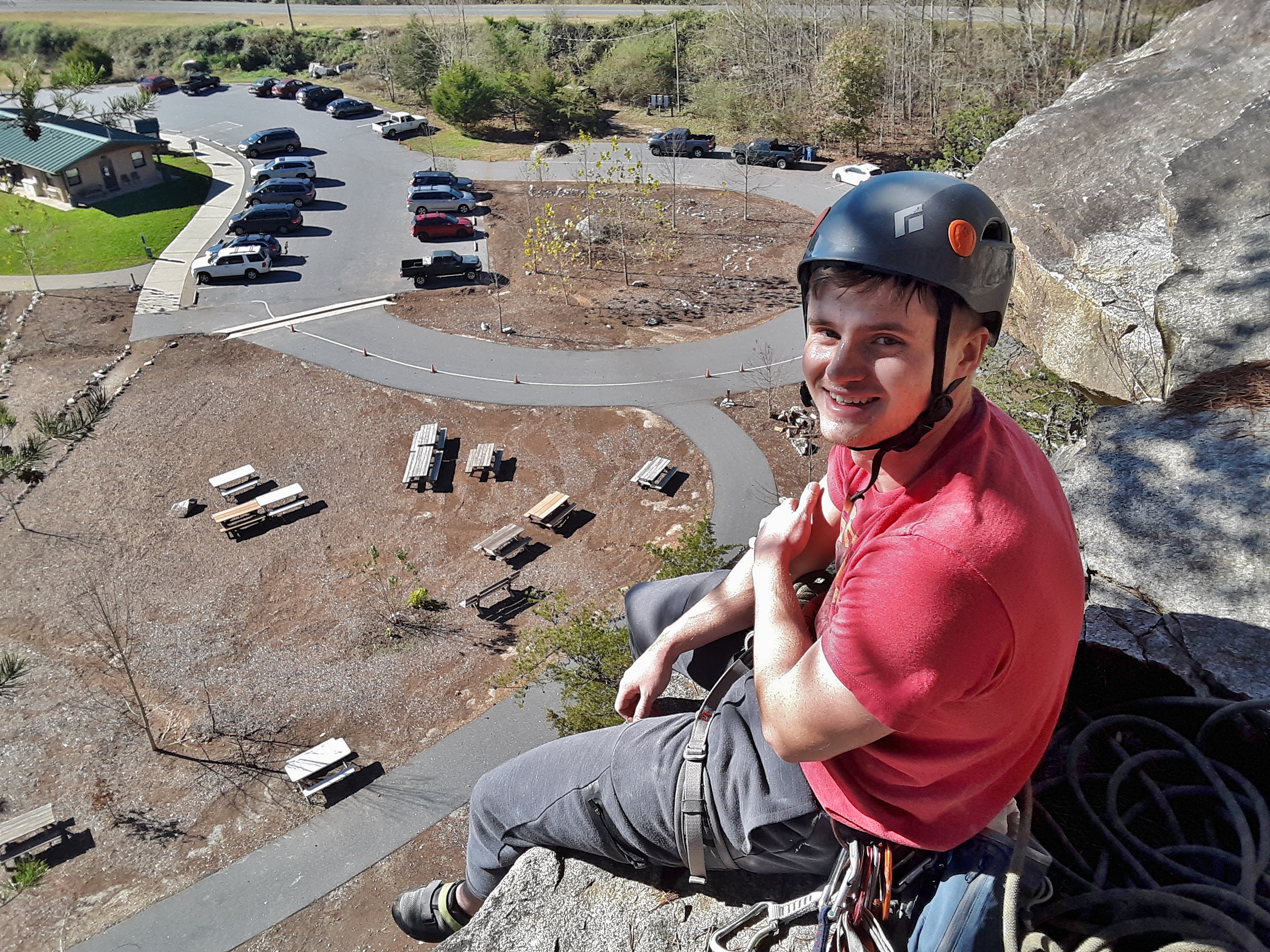
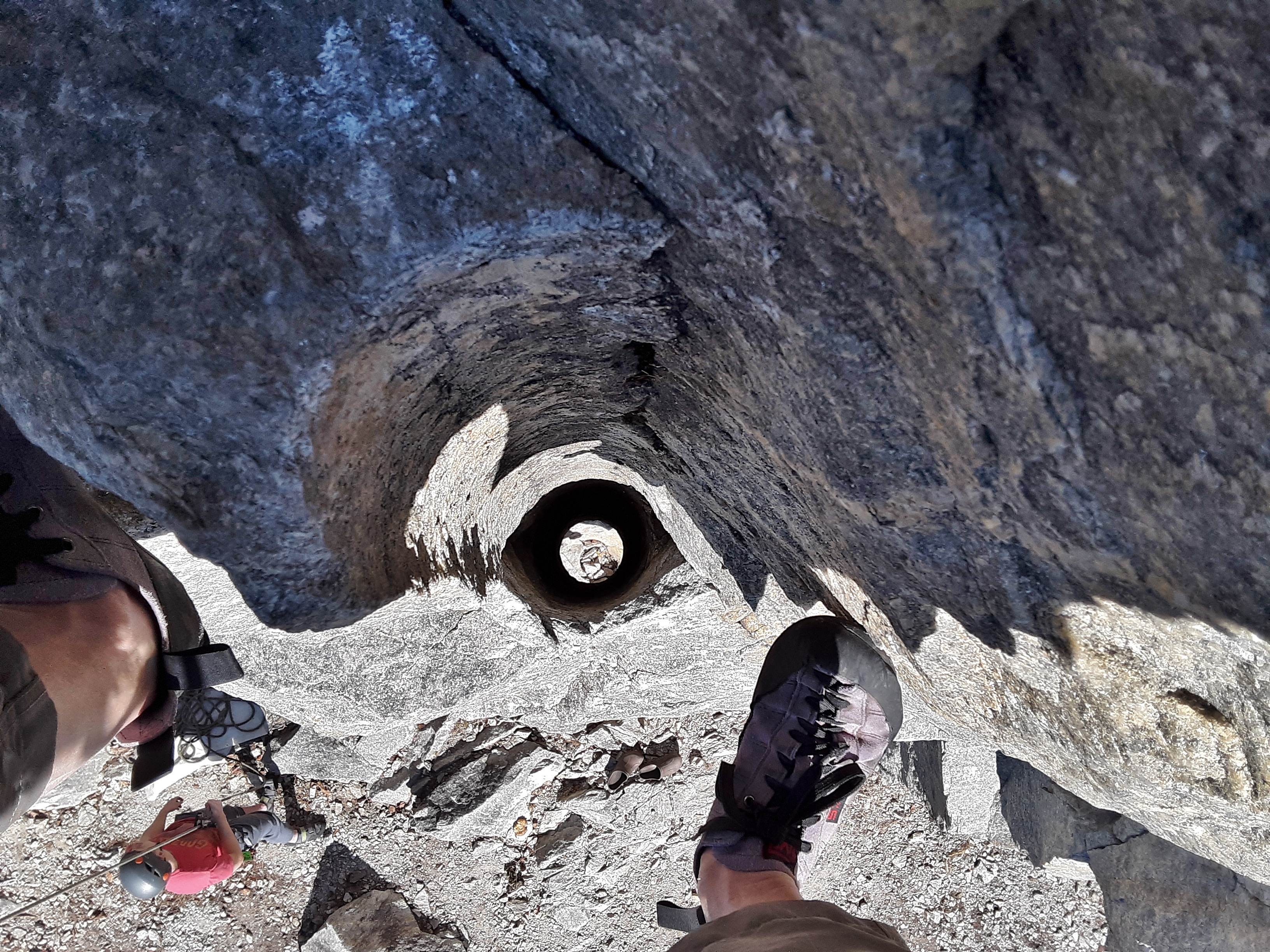
As I said earlier, this climbing area was an old quarry. One of the biggest needs for infrastructure is gravel and stone. The hole pictured below between my feet is the remnants of a bore hole. It is an added boost to perspective to see both my feet and my belayer on the ground.
For the next climber, climbing is no big deal with the right equipment. I think that it is an Eastern Fence Lizard, though arguably out of its habitat if that be so.
*Yes, we are tied in to rope and/or anchors the who time for safety.
**The temperature changed from mid-thirties when we arrived to lower sixties with high solar gain. I am actually getting ready to rappel down, so I have two shirts that I took off stuffed into the shirt I am wearing, giving the appearance of a beer belly.
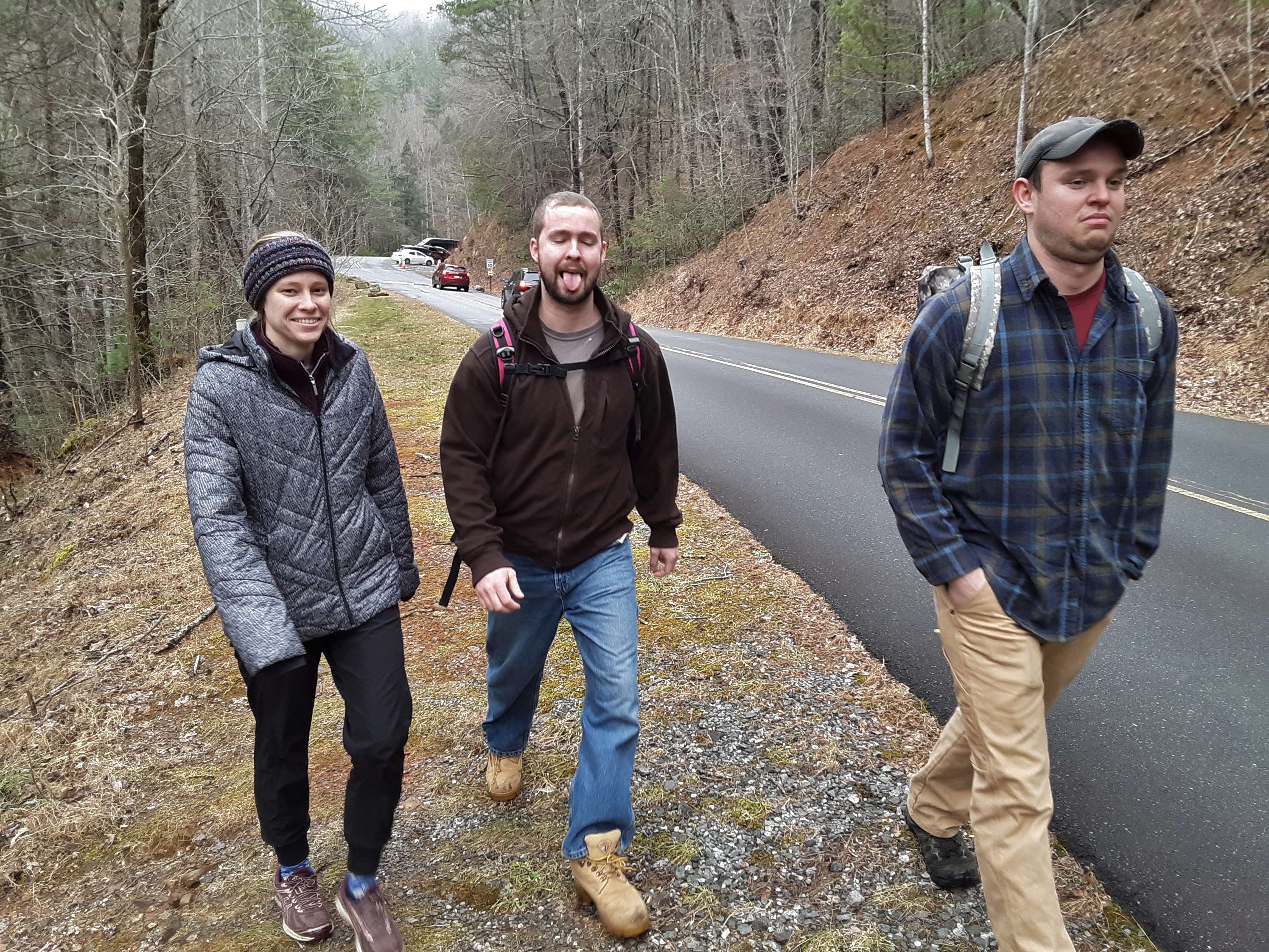
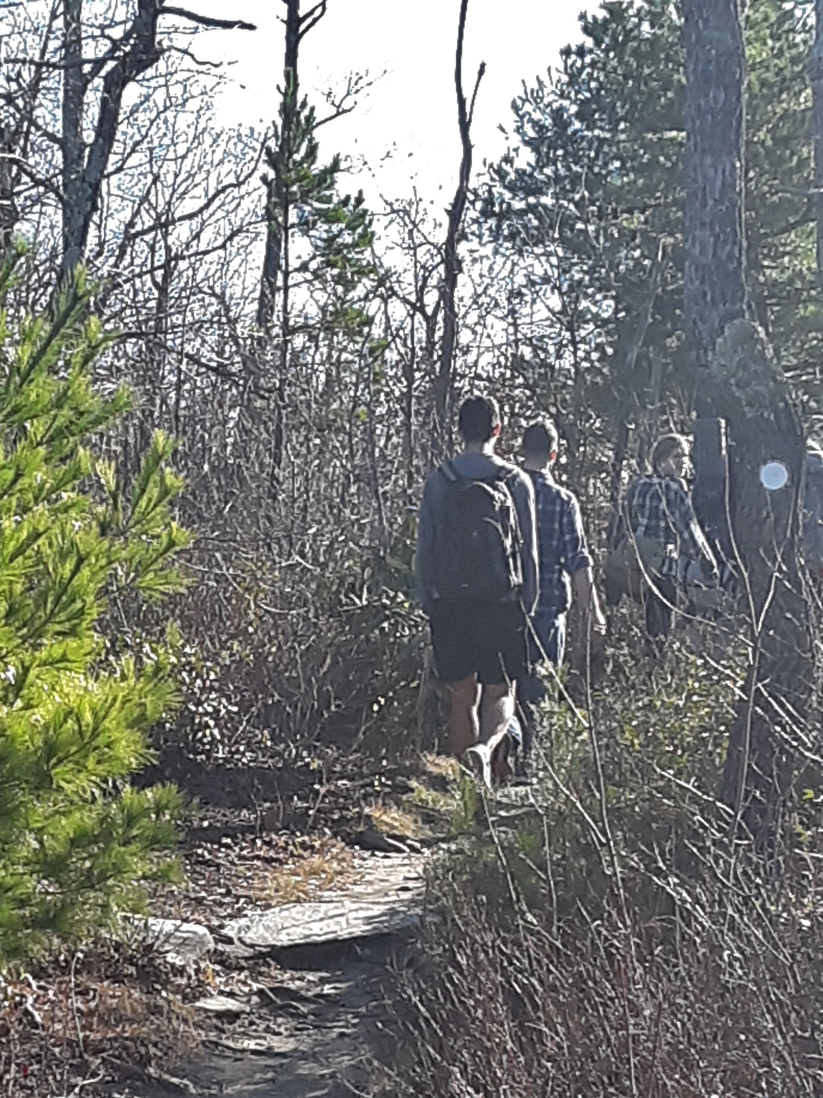
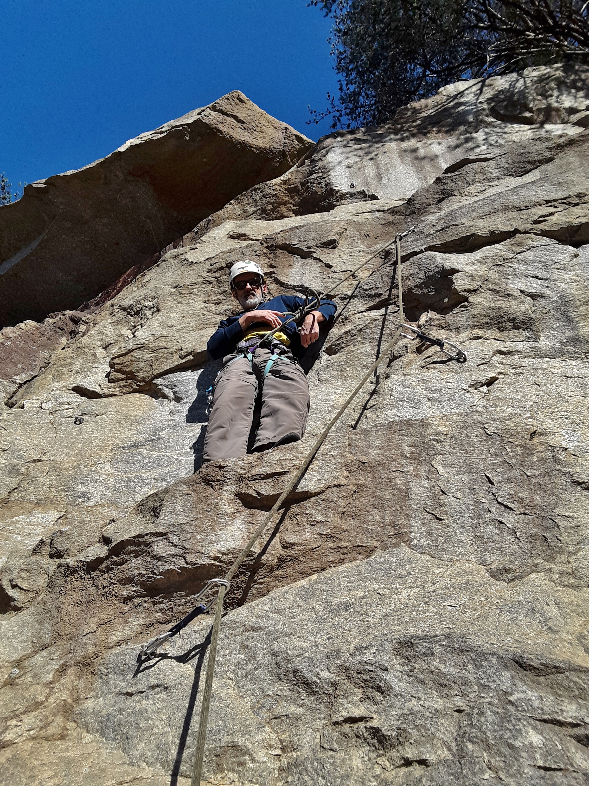
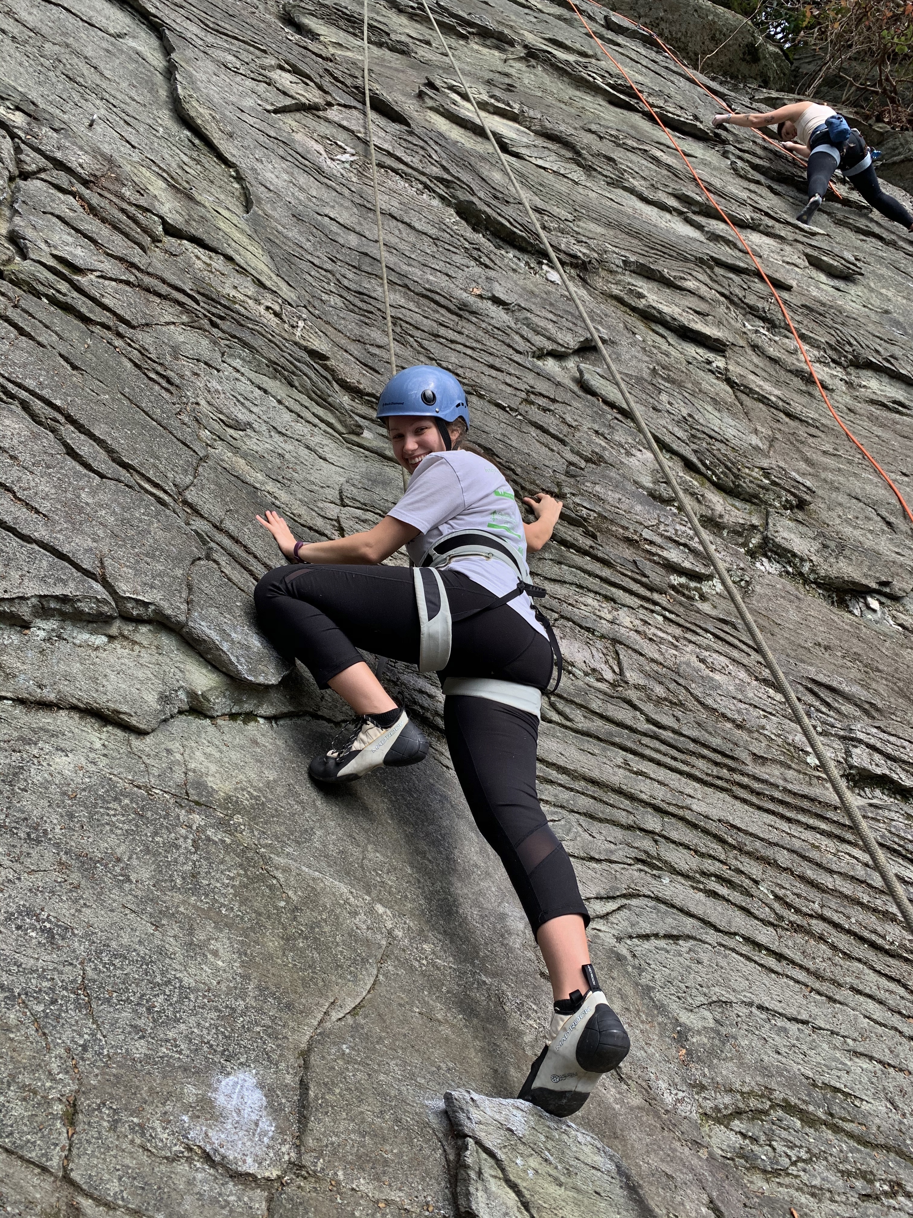
What, you may ask, do those two words have to do with one another? Well, I’m the dinosaur who took two newbies out to go climbing. As they described it, they had climbed two or three times each indoors but never outdoor and I was the “pro”*. There was a little fear of heights, a little curiosity, some determination, and a good amount of enthusiasm. Father and I attend the same church. His daughter came in to town specifically for this outing. It was cloudy and uncertain when we met at the rendezvous point, but as we traveled up the mountain we could see the sun shining on the side of the mountain where I knew we would be climbing. It turned out to be both a beautiful and pleasant day with plenty of challenge and a measure of success.
Flaking the rope; grinning for the cameraFather and Daughter; yeah, definitely relatedEnthusiastic StartWorking it.Always good to have an attentive belayer
The next picture is very instructive to those who have not climbed before. At any level of climbing, you reach a challenge point. The pose reveals the intensity. The facial expression shows the focus and goal. Sometimes it is fun to just cruise up a climb, but challenge, getting shut down, and overcoming the by problem solving and focus are major draws to climbing. Add to that training for strength and technique in order to up your game, and you have many of the central components of good climbing.
Seeps Keep GreenChallenge can be fun!
I must give credit to the young lady with the iPhone for the great pictures. Indulge me for a moment in a sequence of shots on one climb that I did.
In this next shot, notice the rope going through the carabiner at my left hip. The carabiners and “dogbone” in combination are called a quickdraw. It is attached to a bolt in the wall that protected my move over this small roof. This style of climbing is called sport climbing. You can see other bolts of an adjacent climb at the right.
The next few moves involve crimpers, small fingertip holds for one to four fingers.
The picture below gives a sense of pause which actually happened. Sequence of which hand or foot and in which order the holds are used is important in climbing.
At least the foothold was huge.
The hardest part of the climb, upon which the climb is rated, is called the crux (from crux ansata, literally “cross with a handle”; very appropriate for a difficult move on a difficult hold). This one relates to the smallness of holds as well as the long reach up left to a crimp. Don’t be impressed since it is only a 5.10b climb, far below world class 5.16.
Got it!Topping outBuilding an anchor
Everyone was all smiles and we enjoyed the day. They even said they would like to go again.
Later
*”You are to us”, the protested when I said I was nowhere near that.
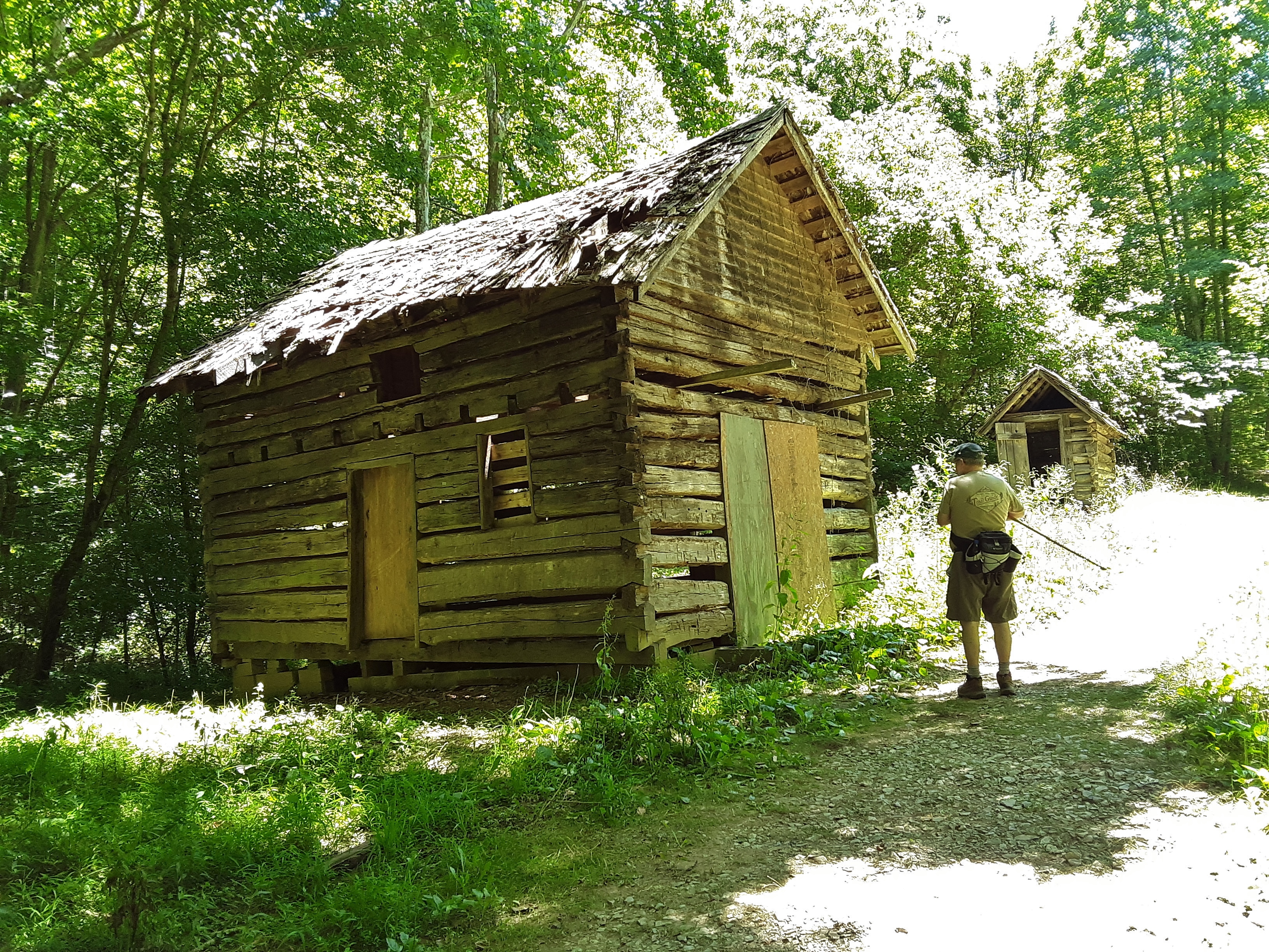
You wonder how some terms came to be. Then there are others so descriptive of their meaning and utility as to need no further explanation. An example is a Lean-To. Enough said.
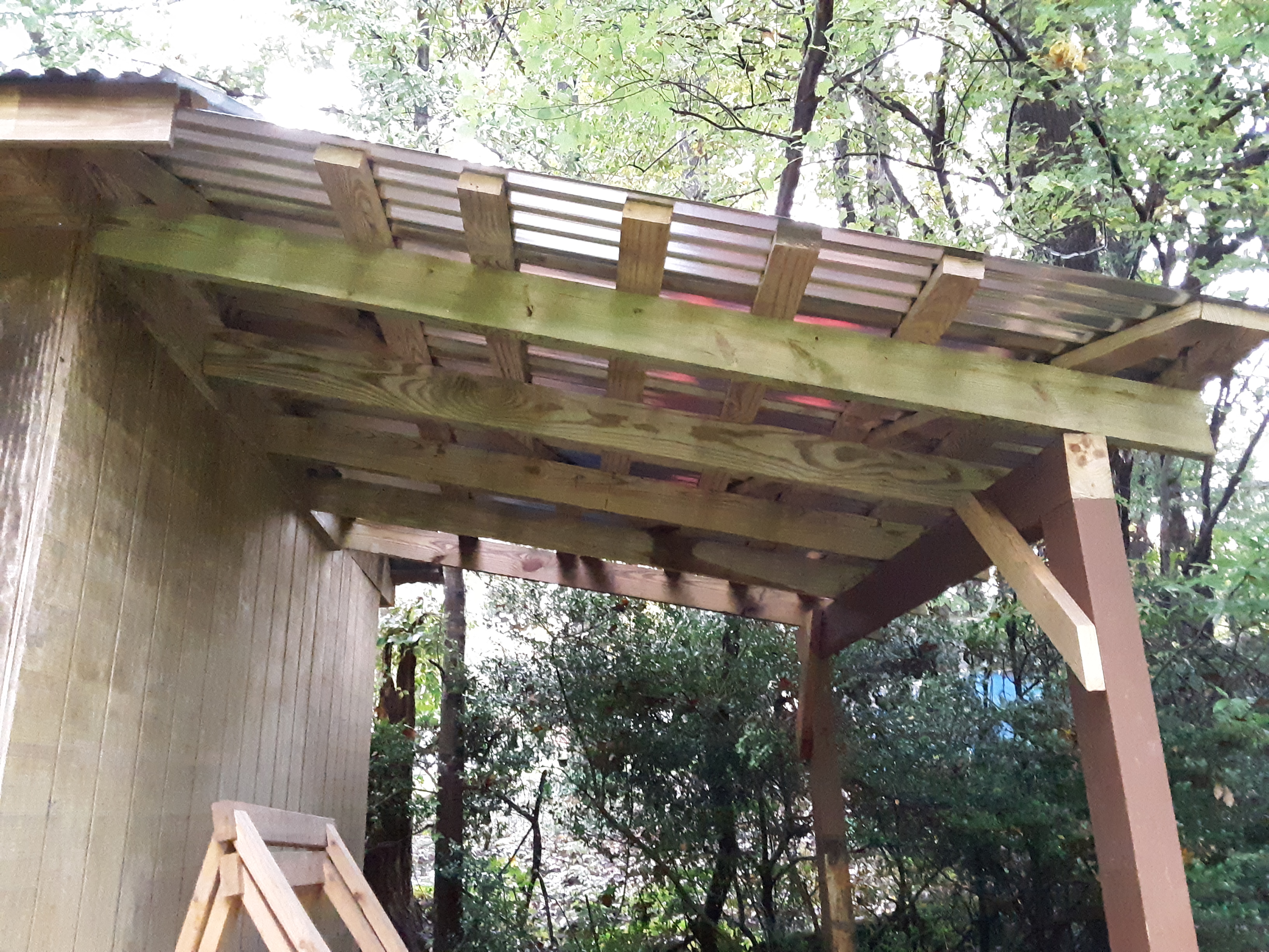
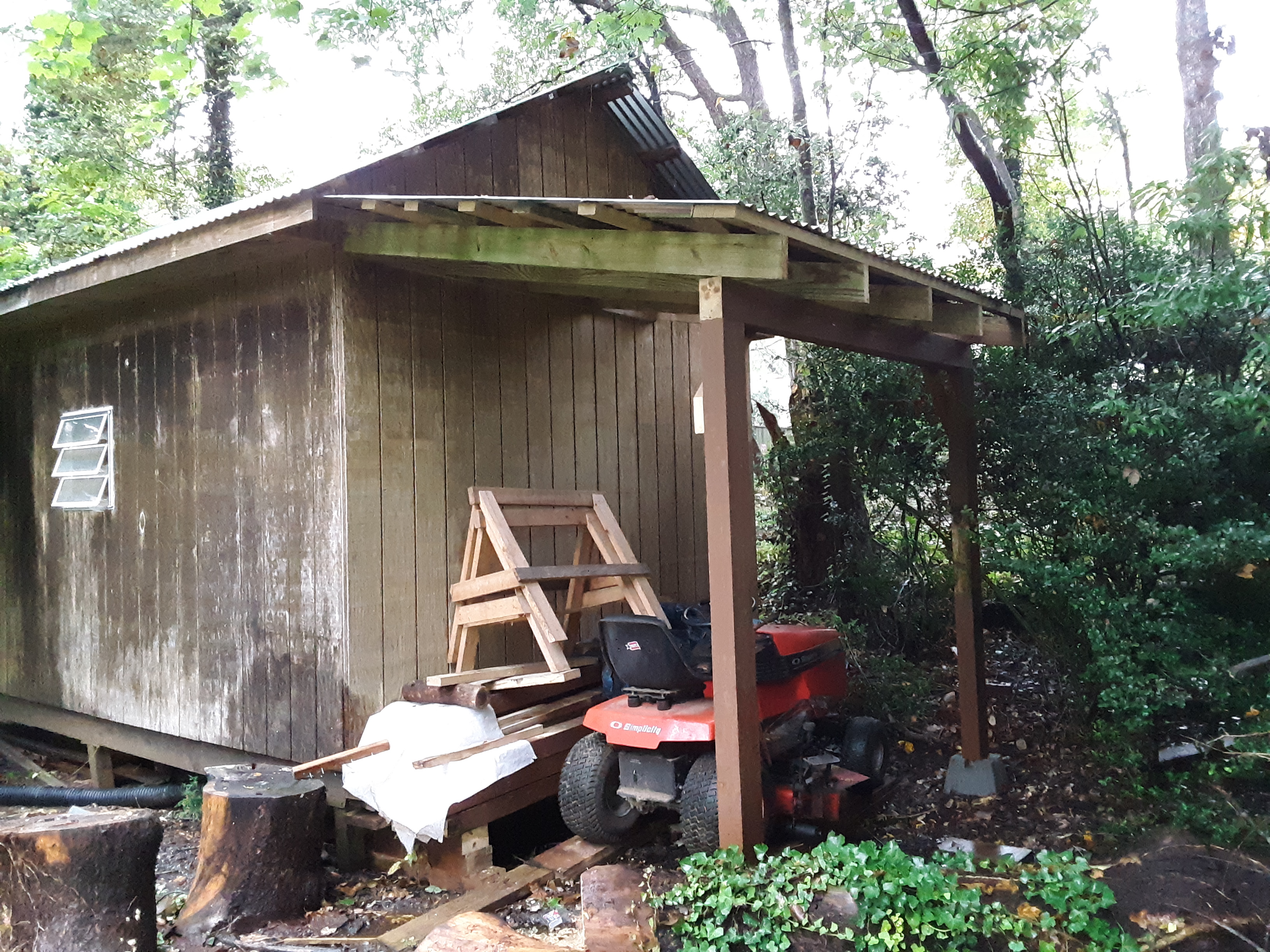
I had bought a used riding mower in exchange for labor earlier in the summer. At 60 years of age, mowing a 3/4 acre lot with a push mower was becoming daunting rather than jaunty. When I first got the mower I parked it under my firewood shed to keep the seat dry and deck from further rust. But as Autumn approached I began considering where to put firewood in the dry if I should ever find any. So, I decided to build a lean to onto the side of my shed. The double doors of the shed were not wide enough for the deck of the mower and would require a tedious rework for the purpose of parking the behemoth in the already crowded storage/workspace. I did not want to buy the lumber since it has gone up considerably of late and this was just used mower. When a job required taking down an old deck, I put the better, slightly deteriorated boards aside into my truck for homegoing. One of my sons thought it impressive that I did the lean to in one day. I really took 3 hours of previous day to clear the space of shrubbery and set up the posts, but my wife did not tell him that. I did not think to catch quite the whole process, but following is my lean to build:
Some of the lumber was quite nice to be used. I had built the shed years before. I had hand built roof trusses that allowed a vaulted ceiling over the middle half of the 20′ long shed. I had plywood gussets at the top and ends of the trusses. It had a large Virginia Pine behind it at one point. On the a Friday after Thanksgiving several years ago while we were away at an extended family gathering, my third son was awakened by a loud crash. He looked outside to see everything covered in copious amounts of ice and the Virginia Pine snapped about three feet up its trunk and lying on the shed. The two foot diameter tree and ice broke one truss which slowed it down enough to only crack others. It was a tedious repair job. The new sheets of roofing did not hold onto the forest green Rustoleum paint very well. I need to sand it and try again.
Tools are not toys as some proclaim.
The shed sits in a very wet spot, a fact I did not know when I built it there. For that reason I had to plant the lean to posts on concrete bases, “feet” if you will. The last two years have been very wet, even record wet last year.
The perspective in this picture makes the posts appear kicked out at the bottom. They were definitely plumb.Diagonals prevent racking.I decided mid-stream to make the roof one sheet wider, so I will have to go buy another sheet of metal roofing.I still have a bit of clean up but the mower and lumber are in the dry.
Geometrically, a cascade is a type of waterfall that drops along the contour of a slope rather than freefalls over a precipice. Catawba Falls is a massive cascade at the base of Black Mountain near Old Fort, NC. A group of 22 from my church made the relaxed walk to the base today. In the group were people from about 4 years old to nearly 70. Some children waded and swam, others held hands. There was much enjoyable talk and enjoyment of God’s creation. It has been very wet lately, so the cascade was flowing well. Muddy spots and rivulets cross the trail frequently. There are a few places to rock hop or wade tributaries. There are two large bridges to cross rougher stream crossings. Even in mid-September the leaves are all still green and mushrooms abound. The day was cloudy and cool, but this nor the cold water prevented most of us getting some part of our bodies wet from feet to head.
A StartA 1920’s hydroelectric generation structure near the first bridgeTributary cascade above the trailWell graded trail on steep groundA small tributary falls below the trailAt the old hydroelectric dam upstream of the powerhouseSecond BridgeA little friend I helped near the cascadeCatawba FallsFrom a rock about 1/3 up the cascadeFood is anything you can digestYes, it is cold!
While the group was proceeding back down at a leisurely pace, I decided to bushwhack a little. See what I found.
Where do all of the helium balloons come down?Mosses and Club MossesIn September this valued plant gives its location away by exhibiting its red berries. But I won’t give away its location.
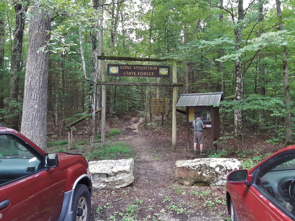
My oldest brother turned 72 years old this past Friday. He asked for a hike for his birthday. His wife, two brothers, his daughter, and two grandsons came along. It was an exceptionally humid September day, but not unreasonably hot, particularly because the hike was in the shade of a forest. The particular forest was Lone Mountain State Forest in Morgan County, Tennessee. I drove with my older brother. He pointed out a waterfall along the Hwy TN62 as you go up onto the plateau.
Roadside Waterfall
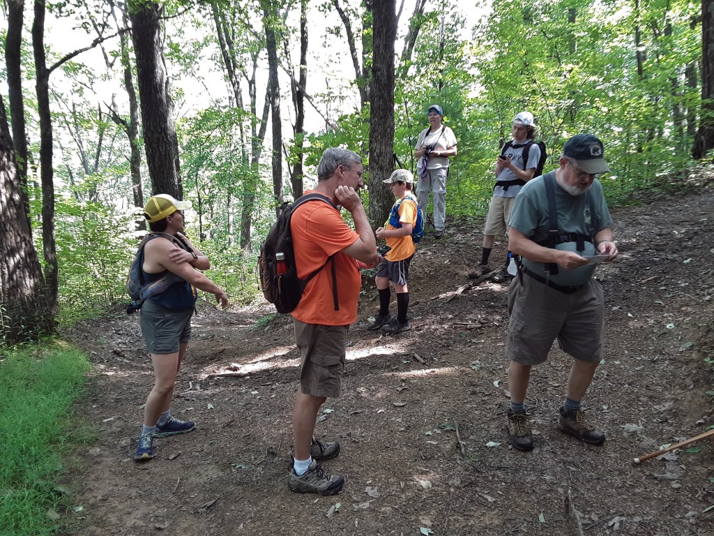
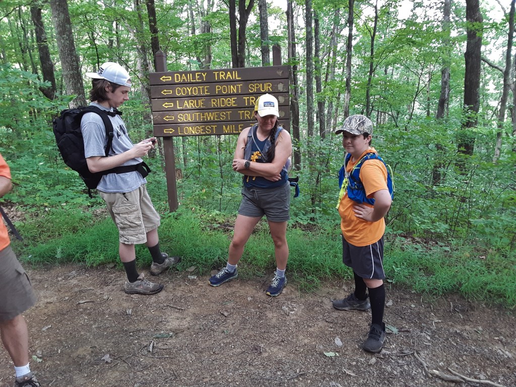
The signage at the parking area shows all of the trail names, distances, and marker colors. I wish that I had a map to indicate how these interconnect. We had planned a 7.0 mile out and back hike to Coyote Point Overlook.
Below is the crew minus my brother’s wife who is taking the picture. We all look fresh and ready to go.
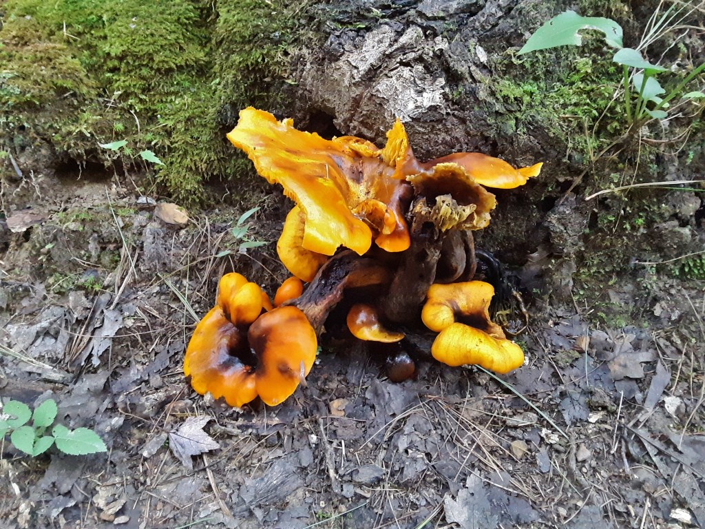
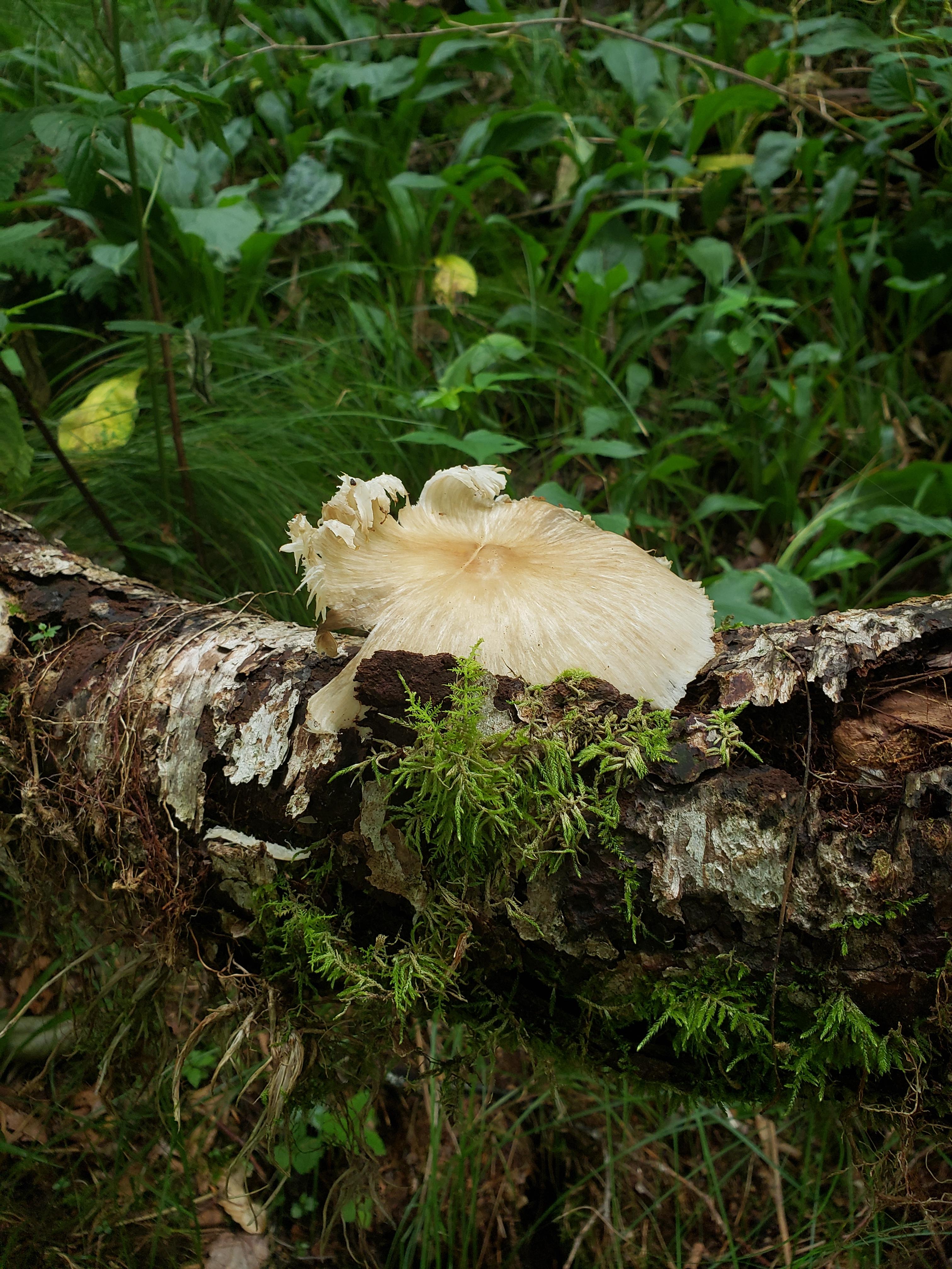
Some things, fungi in particular, have the ability to look both beautiful and ugly at the same time it seems to me.
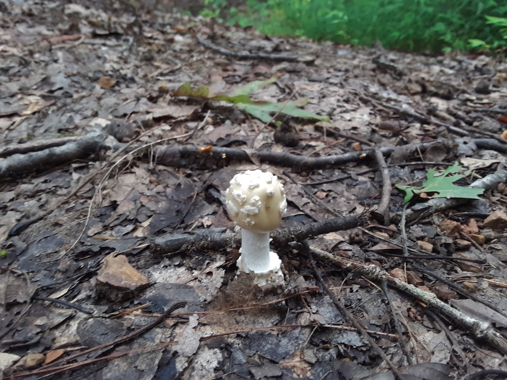
The next button of a mushroom seems to reveal the face of a proper English gentleman with Mutton Chop sideburns and lace collar.
The Cumberland Plateau has shallow, sandy soil that dries out quickly. In a normal year, August and September would see soaring temperatures and many days without rain. That has not been the case this year, resulting in the mushrooms popping up through the leaf litter in profusion.
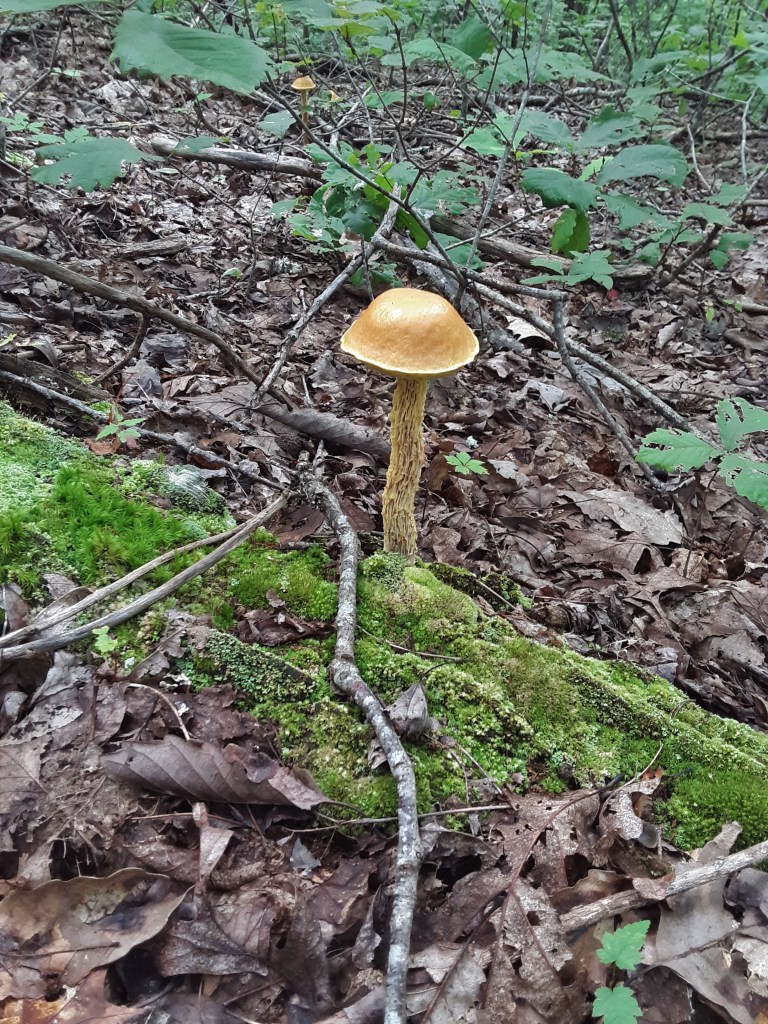
The next two pictures show an interesting variety with gill-like structures on the stalk. Do these shed spores like the cap? The second one looks to me like a bright version of a WWI army helmet set on top of the frilly stalk.
The ray of sunshine pointed out this next beauty to me. It looks like an overextended parasol. The green ribs were barely observable in the bright light and it was somewhat translucent.
The following Earth tones of decaying root and leaf and cap contrast nicely with the green of renewal.
At a trail intersection about three miles out from the parking lot, we stopped to reconsider the length and difficulty of the hike. GPS and seasoned legs told us this was farther than the signs said. We milled around and considered and ended up eating lunch here before continuing.
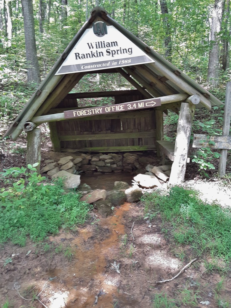
I am confused by this spring cover. It seems that it was built (or rebuilt?) crooked on purpose. The spring needed cleaned out, having an orange rust appearance in the water (Click here for an explanation.).
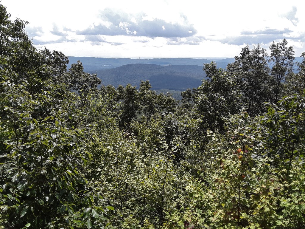
The distance to the overlook was over 4 miles, so that the GPS of several relatives indicated around eight and a half miles of hiking by the time we finished. There are several very steep sections of trail, though not terribly long. The view looked out over the ridges of the Cumberland Plateau. If you look closely, you can see two smoke stacks which we believe are Kingston Steam Plant at perhaps 15 miles away. Ridges far distant behind that were discernible to the eye.
View from Coyote Point
So common to this area is the sandstone cap rock over limestone. This point is a flat area ending in a sandstone outcropping of perhaps 20 feet in height at the top of a ridge, sufficient for a decent view.
Coyote PointWith my older brother at the overlook (photo credit: my niece)At the local mud puddle
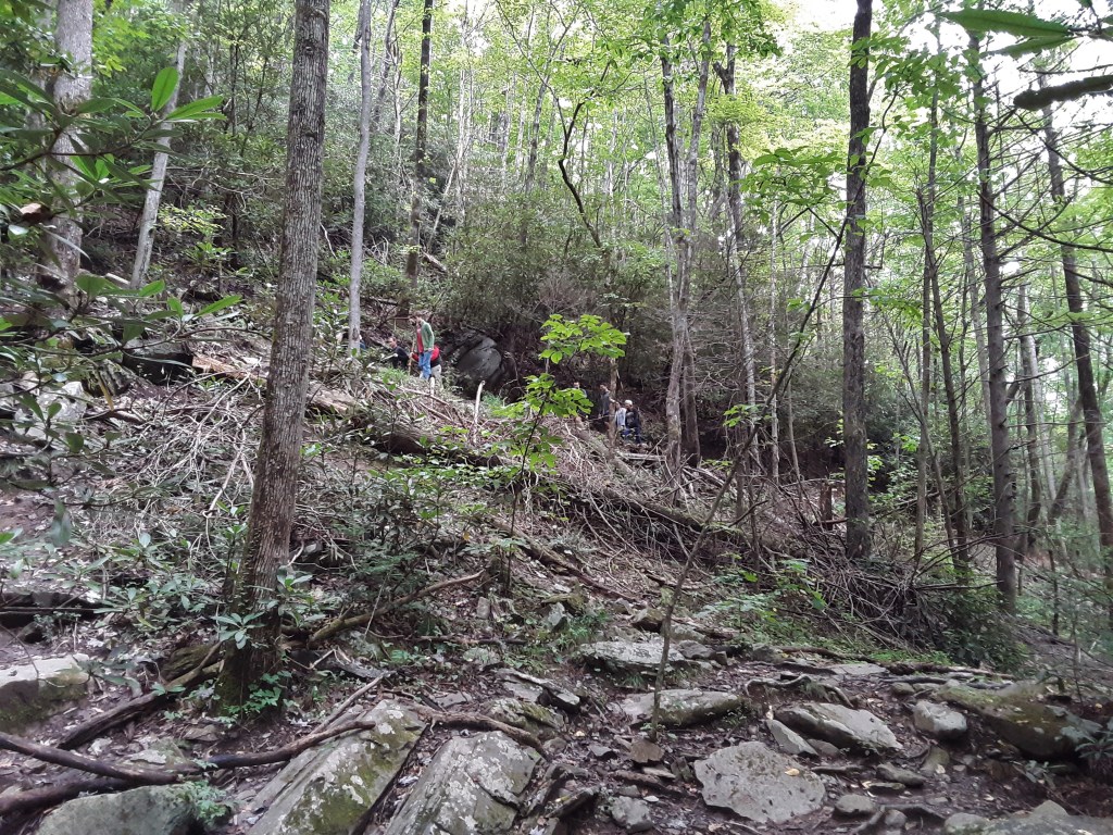
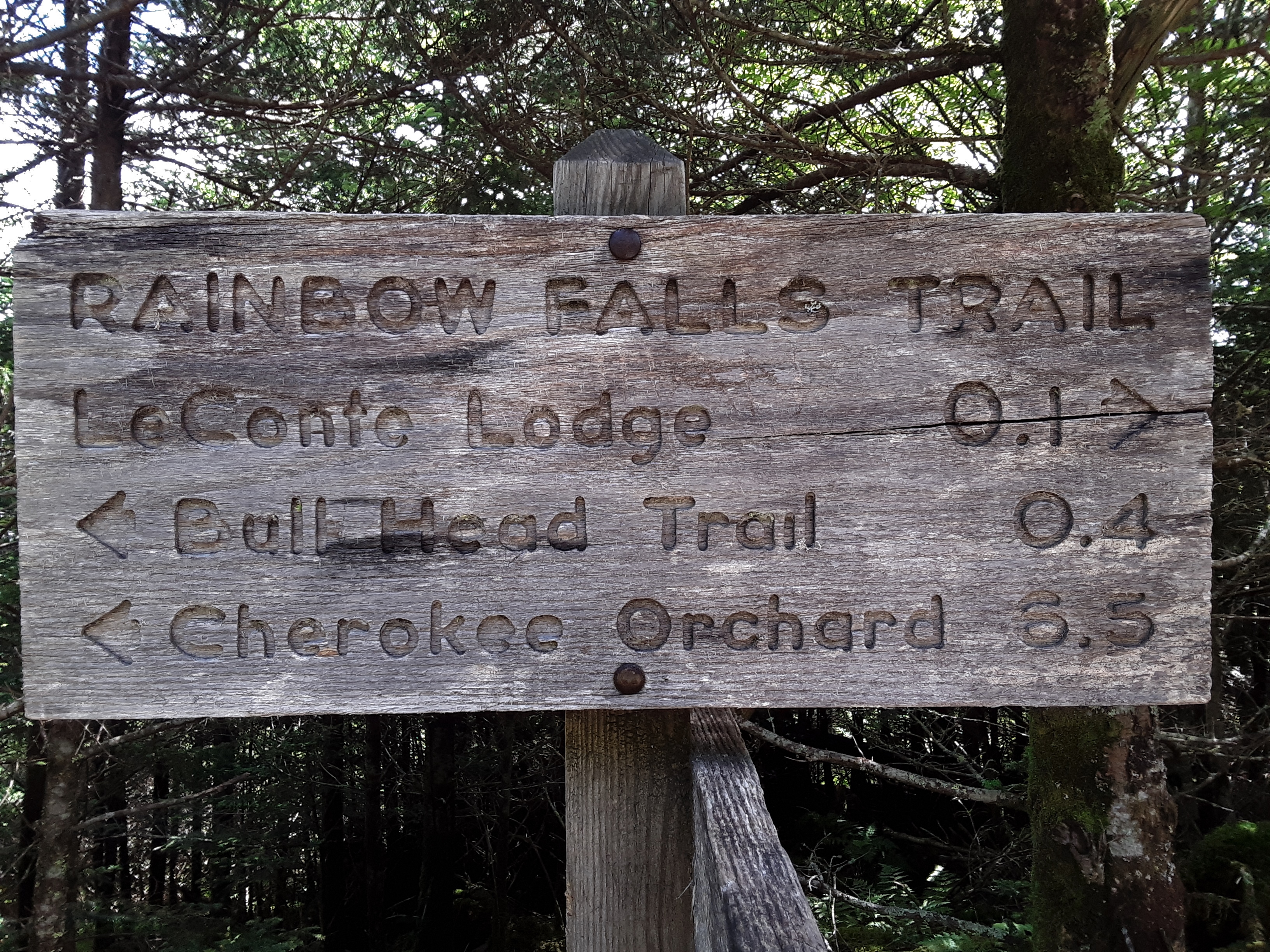
For various reasons the hike schedule I had intended to keep with my great-nephew has been delayed. But this Monday we got out on our 3rd day hike, this time to Mount LeConte in the Great Smoky Mountains National Park. Many years ago I had attempted a winter assault via the Bulls Head Trail with a college friend, only to be shut down by icy trail across slides. The thought of slipping down the thousand foot plus slope of cleared forest covered in ice on rock, runs shivers up my spine even now. We crossed one slide ever so tenuously only to be confronted by a second one a short distance later. We turned back, knowing we still had to recross the first one to be delivered to safety. For all of those many years I had wanted to complete this trail. Now my young relative was getting to go up Mt. LeConte for his first time while I completed the only way I hadn’t been to the top. The trail starts in Cherokee Orchard above Gatlinburg. Both of us having stayed at my oldest brother’s house in Knoxville and getting up early, we were on the trail at 7:15. There were actually two cars in the parking lot and one man and son starting up the Grotto Falls Trail as we left. From there you take a 0.4 mile jog on the Old Sugarlands Trail to Bulls Head Trail. It is obvious from the pictures that this has been a high precipitation season.
Short way over to the turn up the mountain
Log bridges are a staple in the park. The one pictured is longer than usual and the nearness to the road means that gravel is put down to reduce rutting and erosion.
first bridge
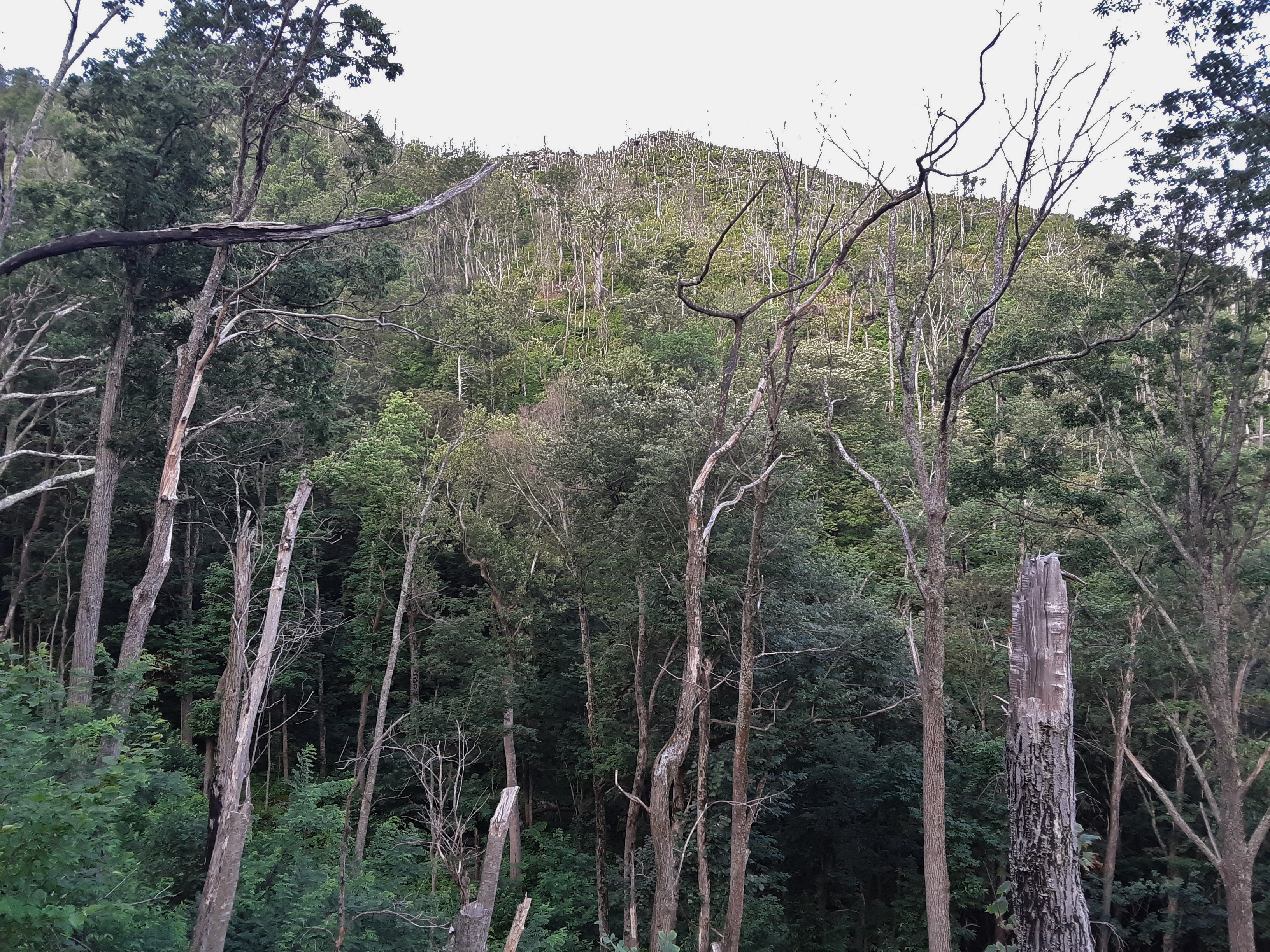
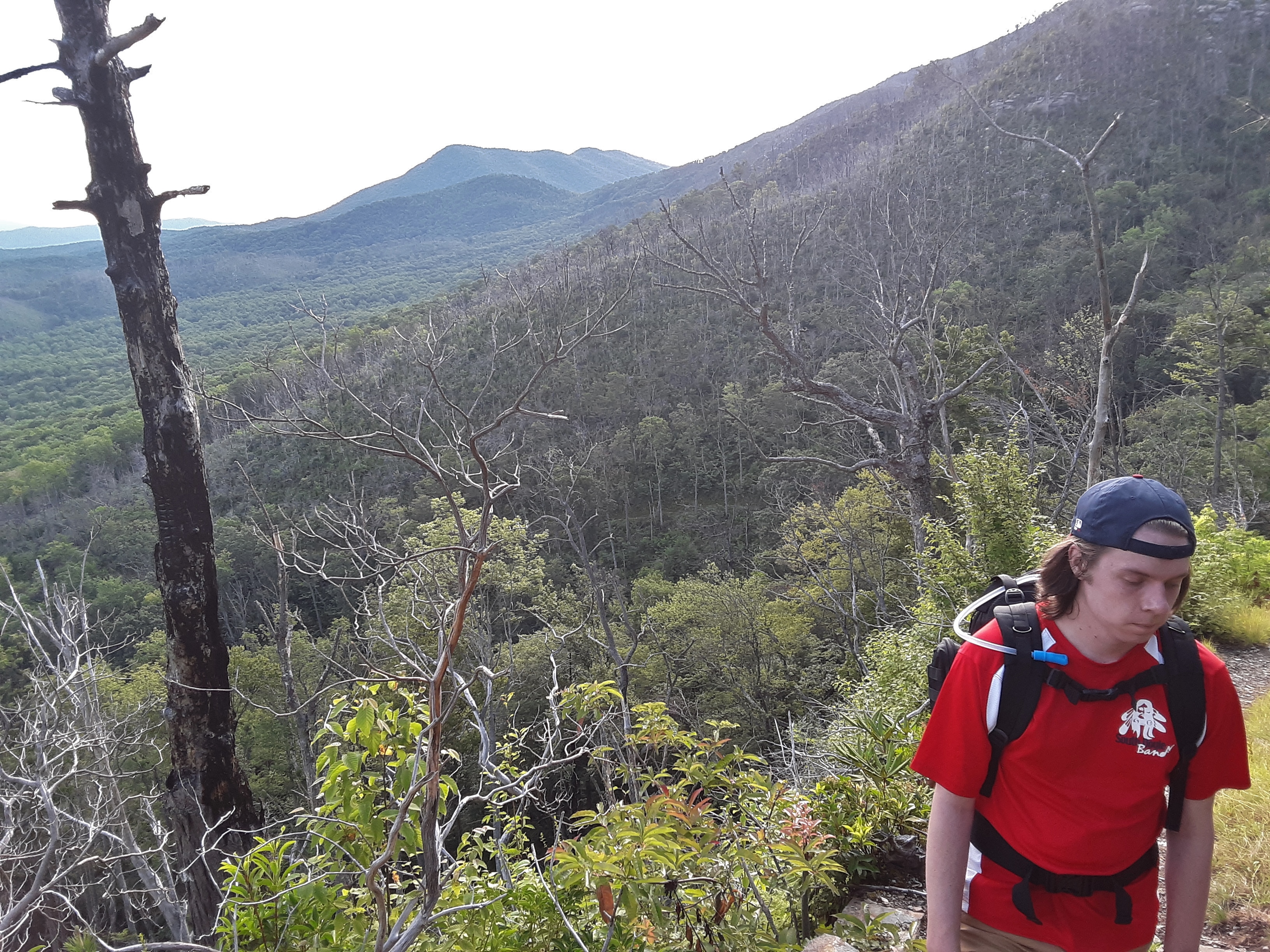
I remember well the pictures of Gatlinburg burning in the fires of 2016. I also knew that the national park had sustained damage. Of the 16,000 acres that burned, 10,000 were in the park. We were about to see the remnants of those fires.
Contrast
There were great swathes of mountain slope that no tree was left alive by the fire along side other areas where no damage seemed to exist. Very few areas had brush fires that didn’t get up in the treetops. There was a goodly amount of natural charcoal. Secondary Succession is in full swing these four years after the fires. Root sprouts of trees, seedlings of Table Mountain Pine whose cones need fire to open, and abundant annuals covered the ground.
Death and renewal
All of this clearing results in non-stop views around every corner. You can see in the next picture the large cylindrical hotel that is built just outside of the park at the entrance to Cherokee Orchard. Two ridges beyond that hotel you can see the strip that is Pigeon Forge. This line of sight convinces me that the far ridges on the horizon are toward a stretch of mountains on the far side of the Tennessee Valley from LaFollete northward to at least Cumberland Gap.
Gatlinburg, Pigeon Forge, and beyond
Wooly Tops Mountain?
The exclusively mineral soil speaks strongly of the degree of erosion that took place on these slopes that receive over 100 inches of rain a year. It saddened me to consider what had been lost. As I discussed this with my sister-in-law in the evening, she reminded me that when my father was young, the area had been logged extensively*, rendering it much the same as these smaller areas now. Some 80 to 100 years later it was the lush forest I so loved. It can repair again.
bare, mineral soil
Secondary Succession well under way
continuous views
some type of wild grapes
Lampshade Spiders
glimpse of the top
gap between Bulls Head and Balsam Point
Oswego Tea
I asked myself why some places were completely burned and others seemingly untouched. When we entered the woods from a burned over area, there were almost always coneflower and Oswego Tea which grow in wet seeps. Even in significant drought like was occurring when the wildfires hit, these areas have abundant water under the surface. The fire was doused by the seeps, preventing wholesale destruction.
Where there were seeps, no fire
There is a constant battle for resources in the forest. When life is good- abundant sunlight, rainfall, nutrients, temperate climate- the battle is intense. Parasites are opportunistic. When life is good or when it is stressed, parasites find resources that are being squandered or difficult to use, and they rob them from other organisms. A common example of plant parasite in the mountains is Dodder.
Dodder (Cuscate sp.) on Stinging Nettles
Lichen comes in deliciously diverse forms. The texture and variety in this next picture could keep my eyes busy for hours.
Love the texture
If you can’t find anything else interesting to look at, check out the mushrooms. They come in so many shades and sizes.
Caught in the forest on the run
Classic Toadstool look
Ancient looking Yellow Birch all fern and moss decorated
Spruce, fern, and moss! We must be above 5000 feet.
The lush, highland forest
The fir trees persist
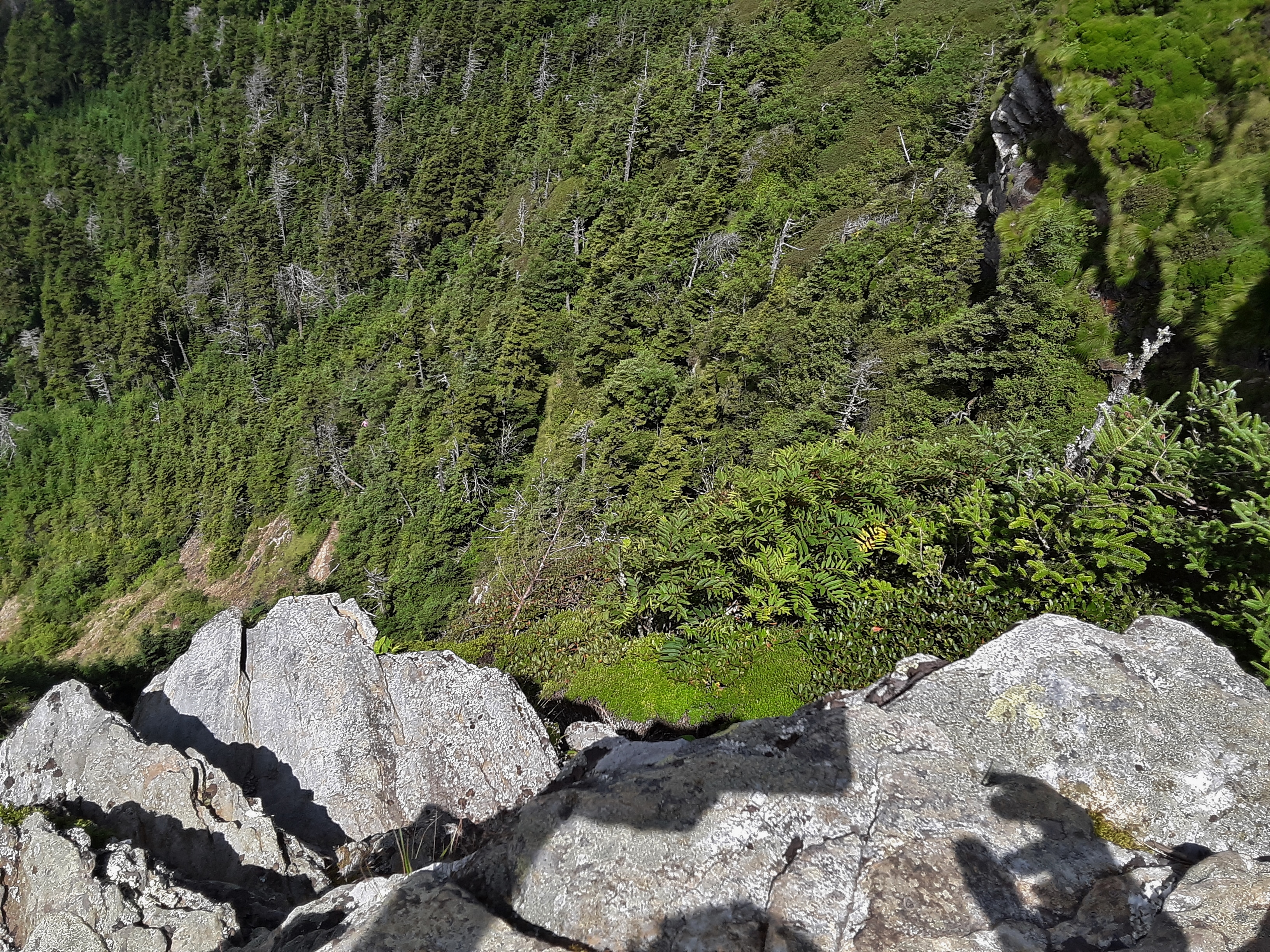
Balsam Firs! Now we are above 6000 feet. A bit of the Canadian Boreal Forest in the Southern Appalachians (There are no long a’s in that word.) Clifftop is not quite the highest point on Mt. LeConte, but it is the most visited for the views of steep, cloud cloaked ridges beyond.
near the edge
Over the Alum Cave Bluff Trail ridge
over the edge
My phone camera is not the latest generation and digital zoom is pitiful, but sometimes you have to emphasize what you are taking a picture of.
Newfound Gap
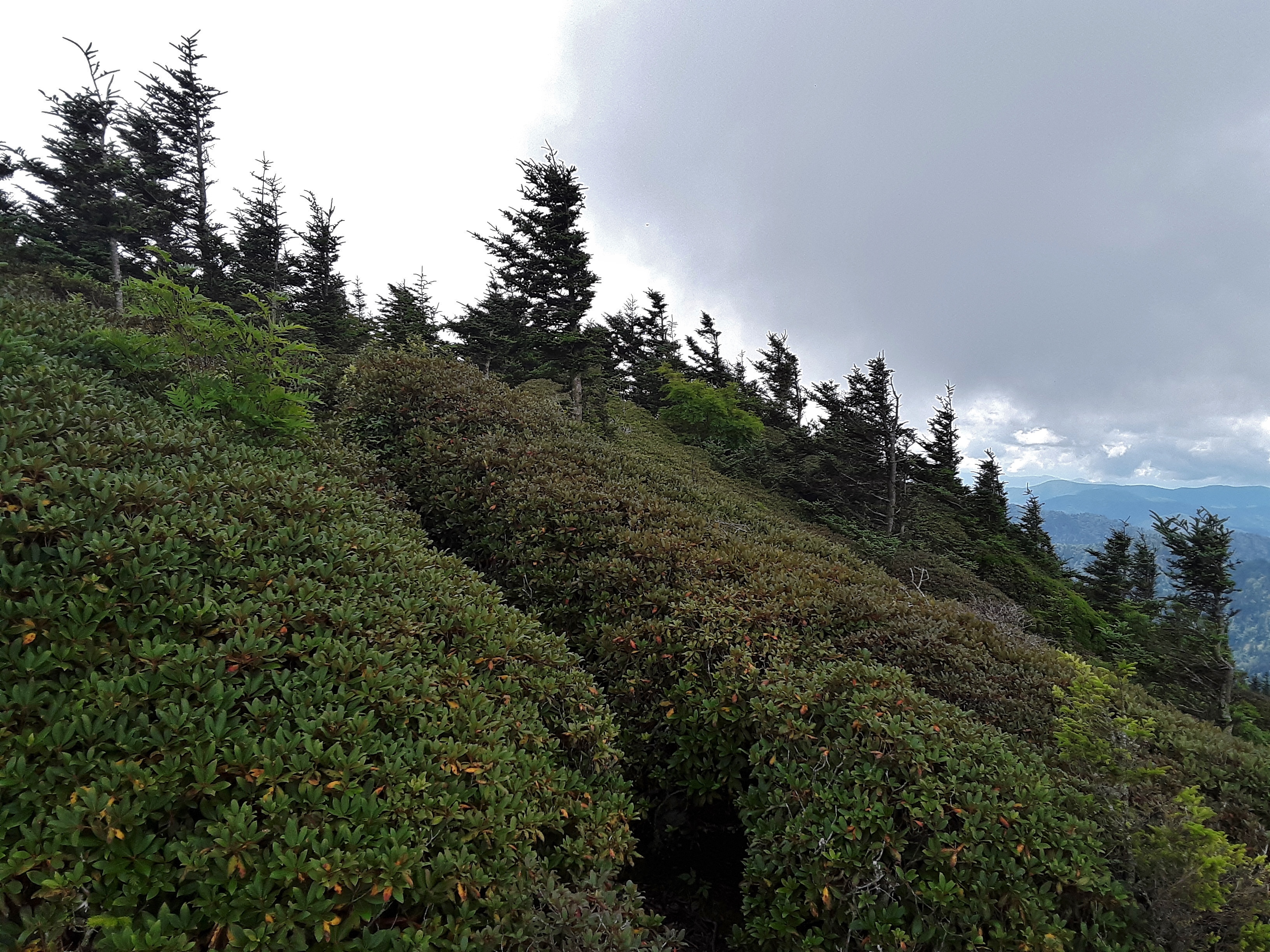
windblown Heather and Spruce
Clingsman’s Dome almost revealed
LeConte Lodge
Mountain Boomer
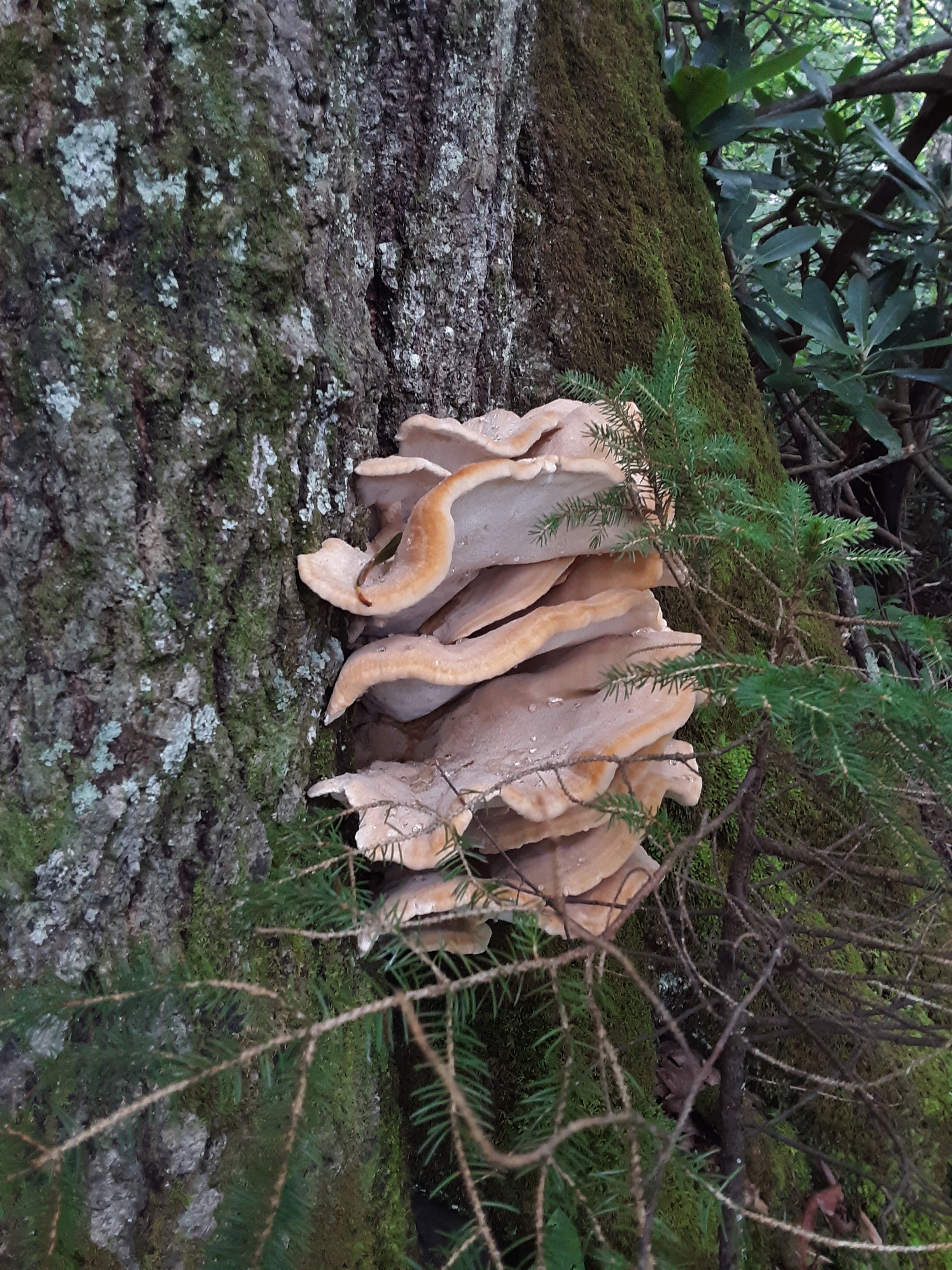
Shelf Fungus
Rainbow Falls
There are few healthy Hemlocks after the wooly adelgid, but the park service treats some of the tree to preserve them.
A healthy Hemlock
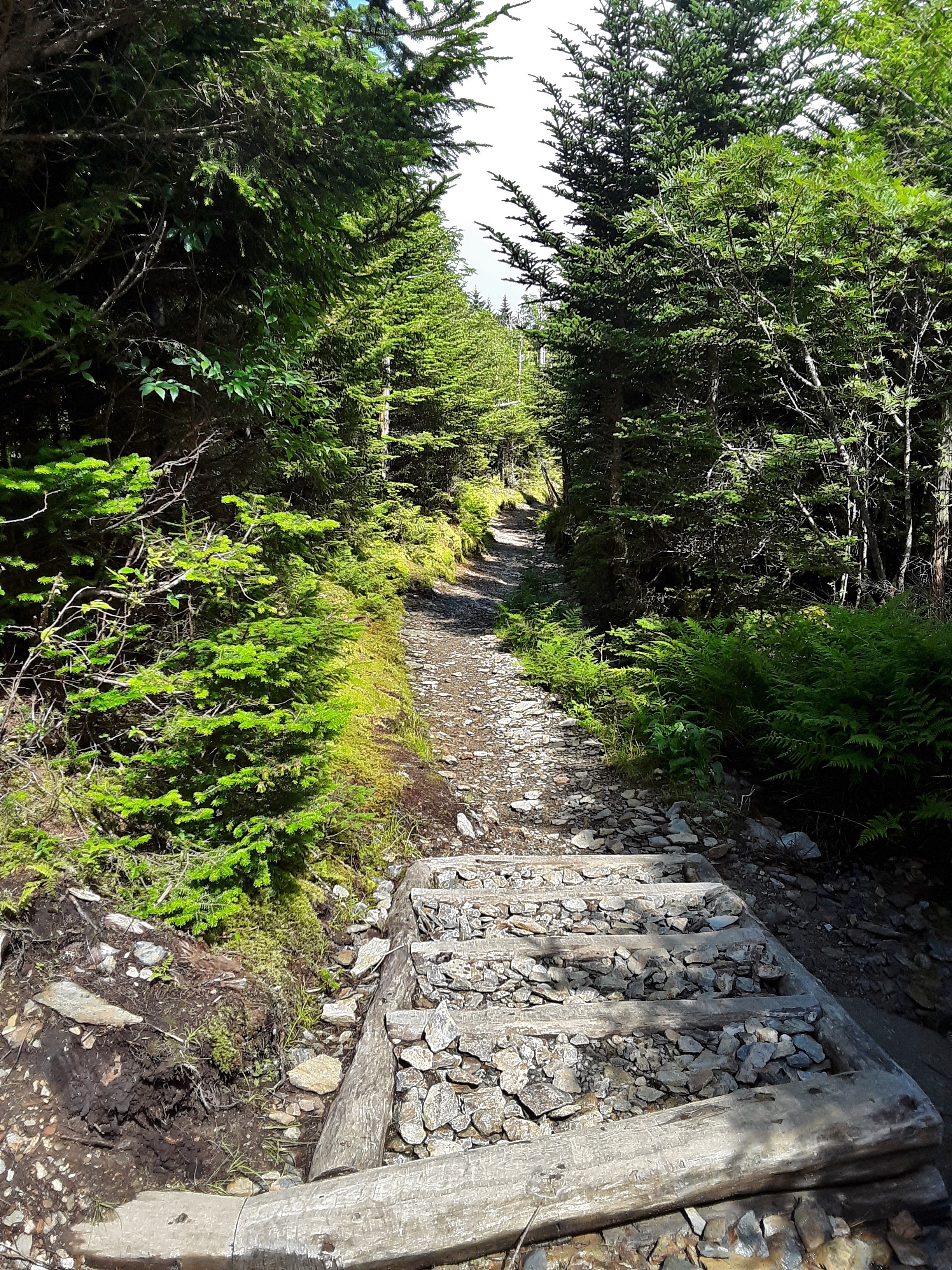
The lower part of the Rainbow Falls Trail may be one of the most heavily traveled stretches of trail in the park due to the large waterfall and distance from Gatlinburg. To prevent the erosion from destroying this segment of the forest the park service has put in segments of permanent rock steps. I’m thinking these had to be placed by small skid-stears (like a Bobcat, etc.). I don’t know if even four stout men could lift many of these stones.
The hike was 14 miles on a high overcast day with thunder on either side of us as we neared the end. It was a good outing, a goal accomplished, an enjoyment of God’s green earth that can so well repair itself and be beautiful in the process and at the conclusion.
I end this entry with a little camera envy. I have an older version cellphone. My great-nephew has one with a far superior camera. I guess when my first blog entry goes viral and get requests to have sponsors, I’ll get some good camera equipment. Anyway here are the pictures I asked him to take mostly of smaller things I knew my camera wasn’t up to:
I had small amount of business out town early this week, hardly seeming worth the 3 1/2 hours of driving I would have to do to accomplish it. I decided to make more of a trip out of it.
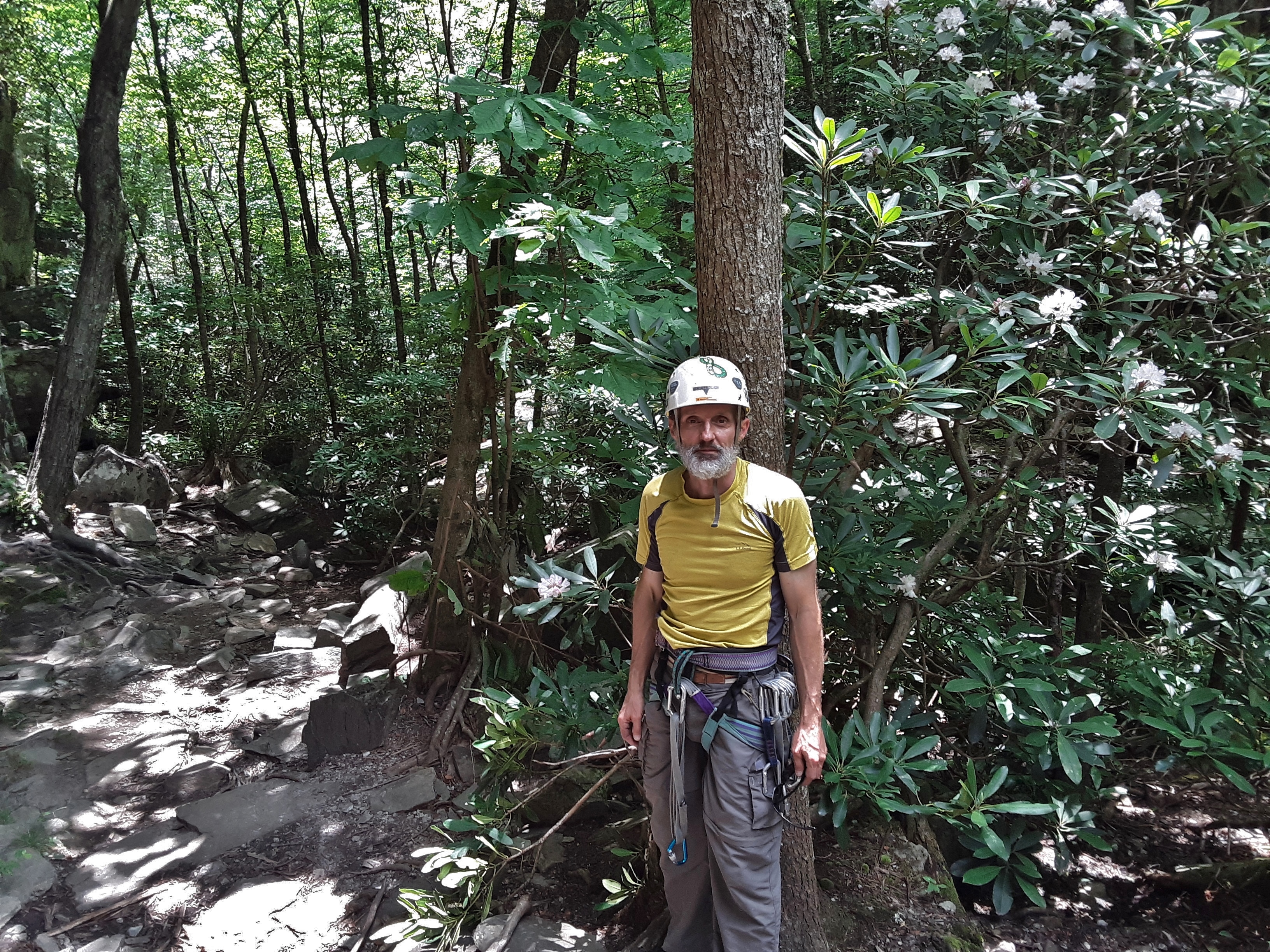
Firstly, I connected up with my present climbing partner for a quick outing to a hidden crag. You have to hike downhill a full mile to get to the creek side cliff. It is always cool and lush at ground level, but the wall dries fairly quickly. My partner led the 5.8 and an overhung 5.9. I followed by leading a 5.10 and we set up a 5.11 on toprope that I climbed clean on first try. As you may have discerned, the real workout is the 1 mile uphill hike after climbing. It is both cardio- and leg power intense. Our conversation reflected our different stages of life and our mutual love of God, truth, and the outdoors.
Setting up for the warm-up, Jigsaw (5.8)
“Belaying Blues”?
Lowering after cleaning the climb
Beautiful, cool setting for climbing
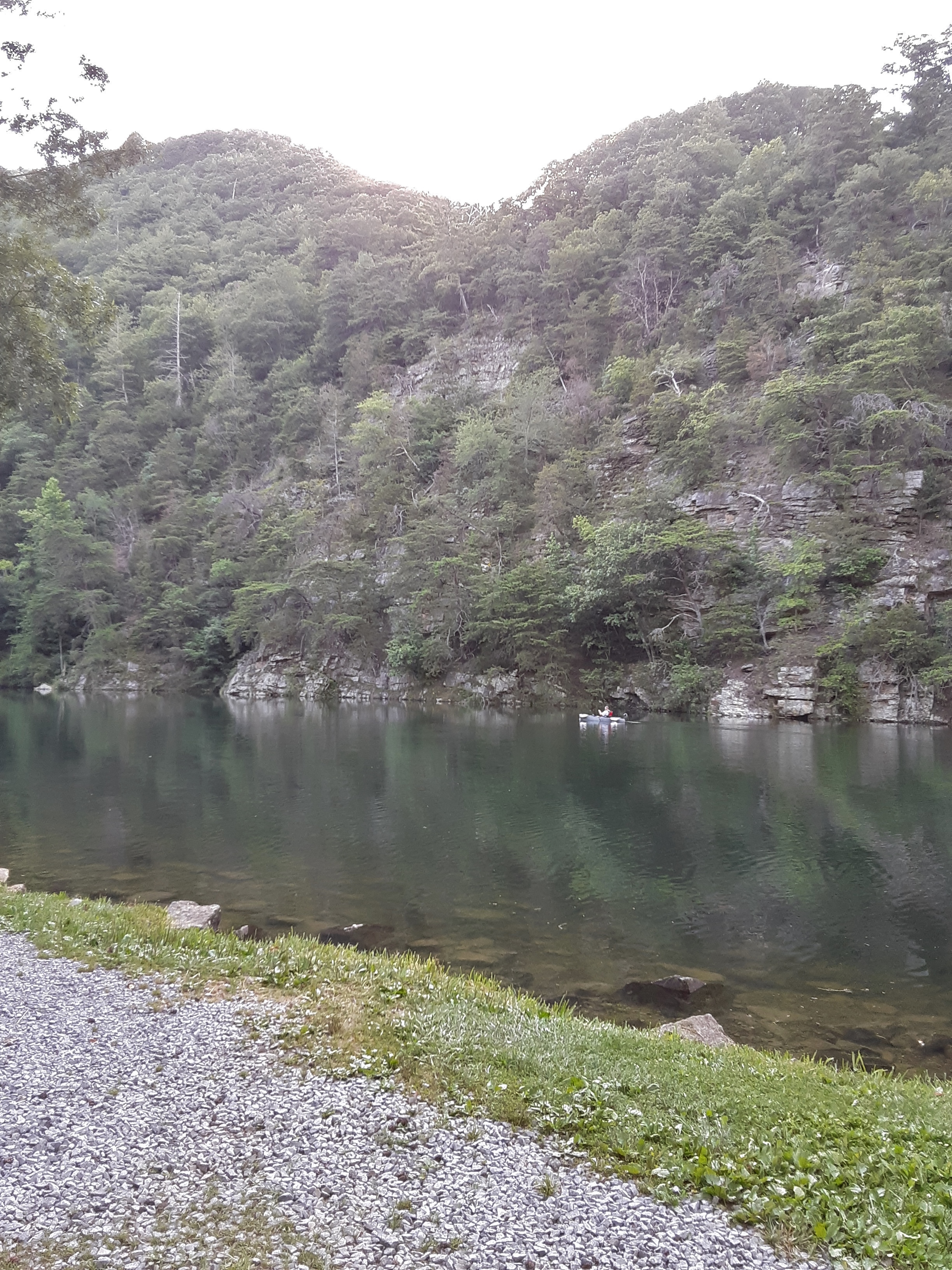
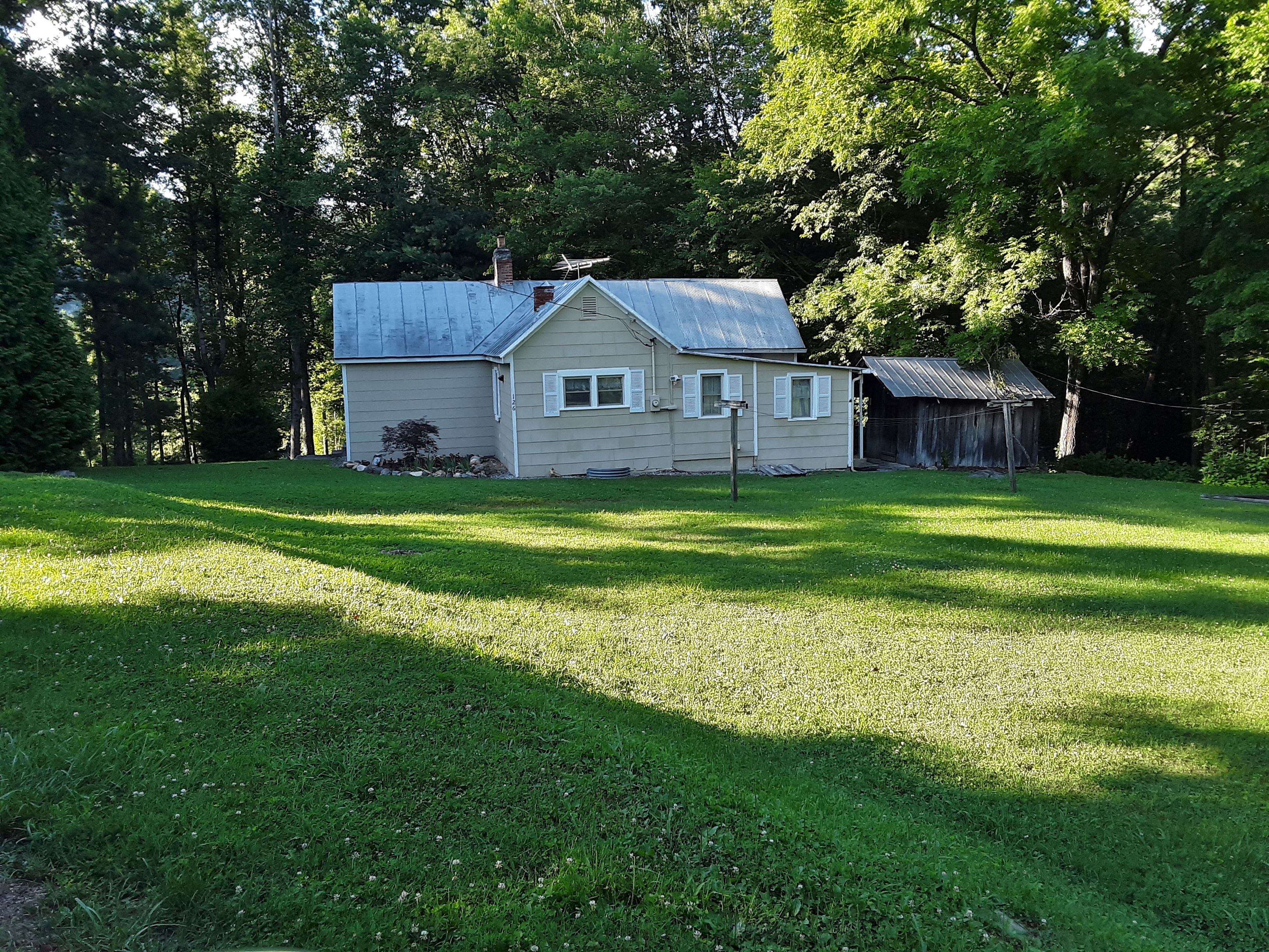
Secondly, I went to visit my middle son. I ordered Mexican to go and we went up to Wilbur Lake to eat at a picnic table at the boat ramp. People were pulling their canoes and Jon boats in and out and families were wading. The water comes off of the bottom of Watauga Lake above at about 40 degrees, bone aching cold. We waded and ate and talked and reminisced. We had left this area when he was just over 3 years old. I asked him if he remembered being here. He described it in an insightful way: “It was more like a snapshot than a video.” That pretty much pictured it. The area is called the Horseshoe because the Watauga River, now Wilbur Lake, has an extreme horseshoe shaped bend. The next picture shoes the late afternoon Sun shining over the central spine of the Horseshoe. If you walk up this spine, at one point you can look back and see both legs of the horseshoe below you. After supper he drove me up the short hill to the house we had lived in for those 7 years, 1986-1993. It was some of the best and worst times for our family. Best because of the closeness and nature and gardens and church and tangible provision of God. Worst because of the hard work and lack of money and difficulty in finding direction. In retrospect, I think the two correlate. Difficulty precipitates more trust in God and more awareness of His blessings. We went back to his house, watched a few Youtube videos, talked about his new job and went to bed early. He was up early and left earlier than he had said to get to another day of his job training. It was good to see his diligence and drive, not that I have ever seen it lacking.
Bone Chilling Wilbur Lake
Horseshoe Homeplace
Son’s new leased house
Thirdly, I met up with my brother and sister-in-law for two hikes, one to see wildflowers and trees at Warrior’s Path State Park and the other to see the same plus several small waterfalls in a little gorge at Laurel Run Park on the north flank of Bays Mountain in Hawkins County. The first hike was short in distance but long in time because on this limestone slope below the campground down to the lake I saw many varieties of trees that I just don’t see in NC. I was pointing them out and how to identify them to my sister-in-law and my brother as he took interest.
Three disparate barks
Though I use leaves as well, I was trained to recognize deciduous trees by their bark, learning them in the Fall mostly after the leaves had fallen off. The above three trees are from left to right, Black (or Wild) Cherry, Chincapin Oak (not common and the bark very nearly resembles White Oak), and Hickory (Mockernut or Shagbark most likely though it is hard to tell at this early stage). Before we left the park we had identified 36 trees species, only one not native.
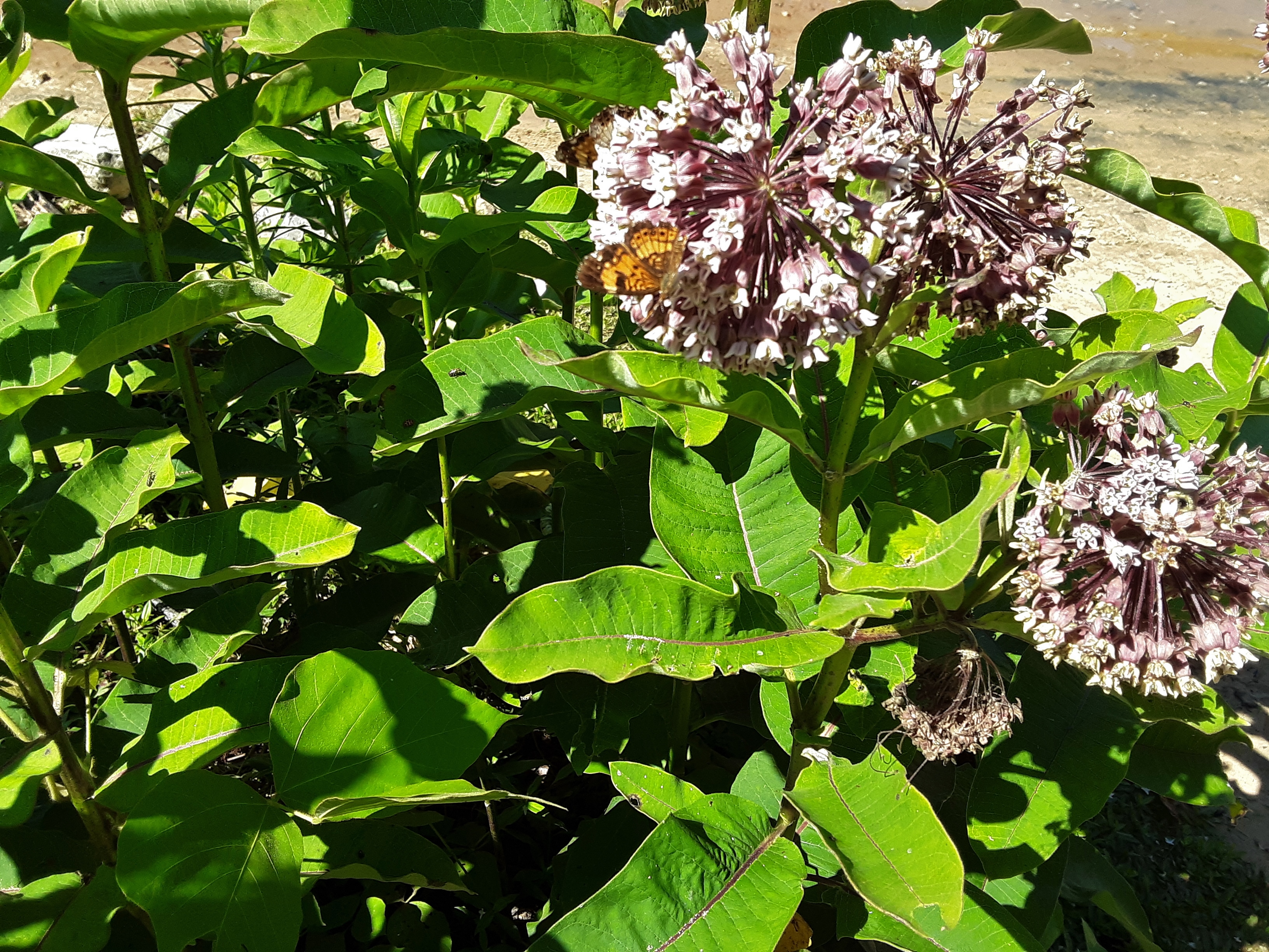
Butterflies and Mildweeds
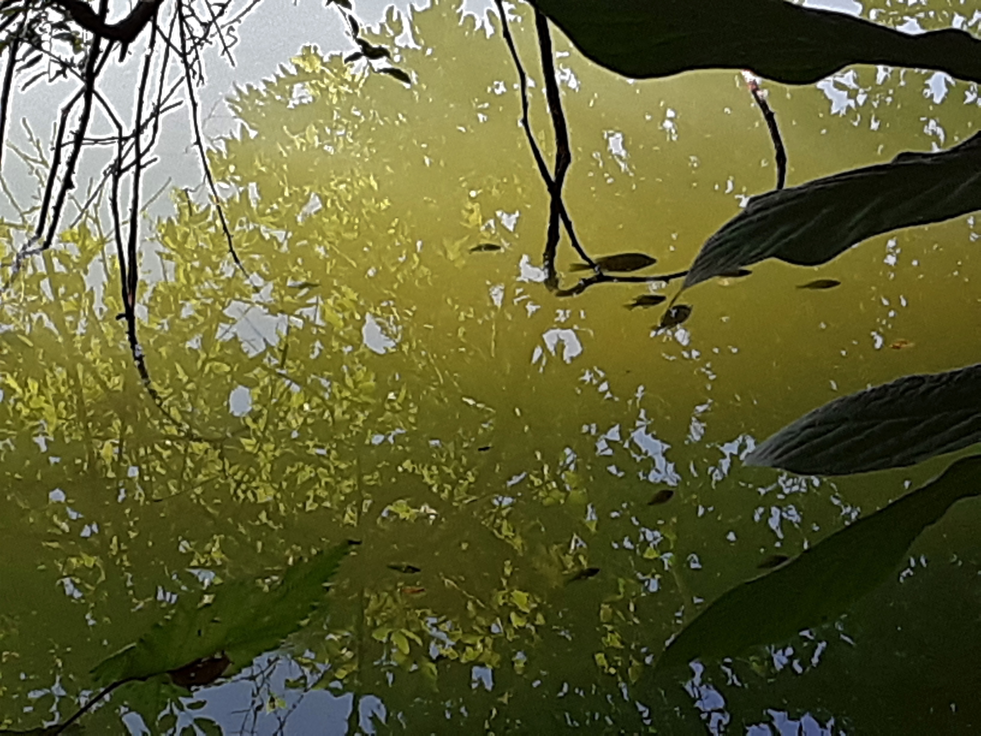
One of those, “Which do you see first” pictures: 1) reflection of the tree 2) fish 3) foreground leaves and twigs.
Holston River
Some uncommon orchid late blooming.
The Laurel Run hike was a bit longer and steeper, but the shade and conversation were good. People had eked out living in these draws where they were left alone and used whatever resources were available. It is a pity that the American Chestnut was not one of the trees we saw. They exist here but are minuscule in size compared to the great trees of the past that supplied so much livestock with food. With the trip between parks and this second hike, my sister-in-law and I identified 52 species of trees with only 3 exotics. We are blessed with a bio-diverse area.
Cultural Residual
Sis and Bro
typical limestone layering and color; I wondered where the cave entrances are.
It seems most every wildflower is 10 days to two weeks late this year. We speculated that the warm March and very cool April may have been the cause.
Rattlesnake Plantain not quite ready to bloom.
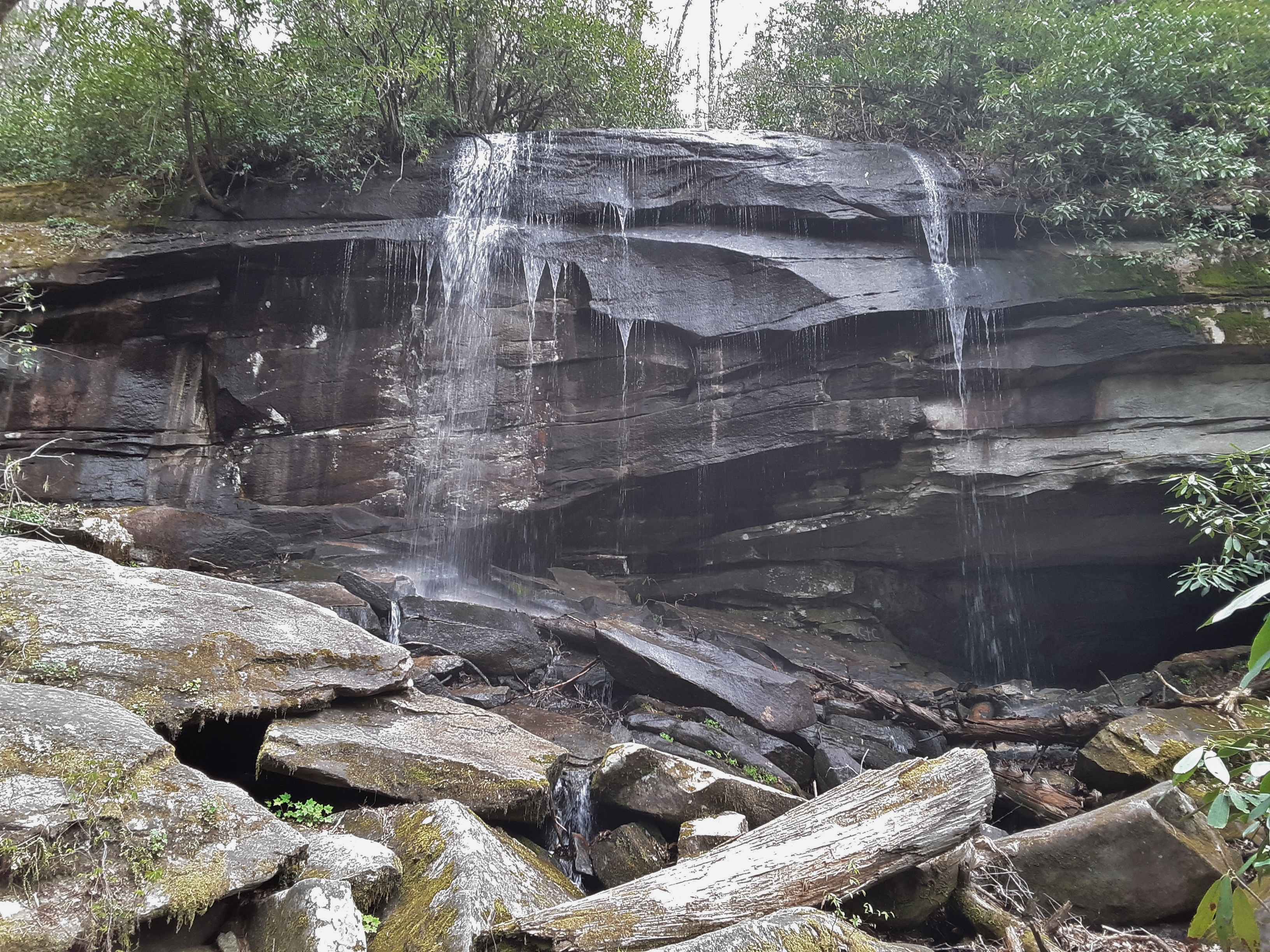
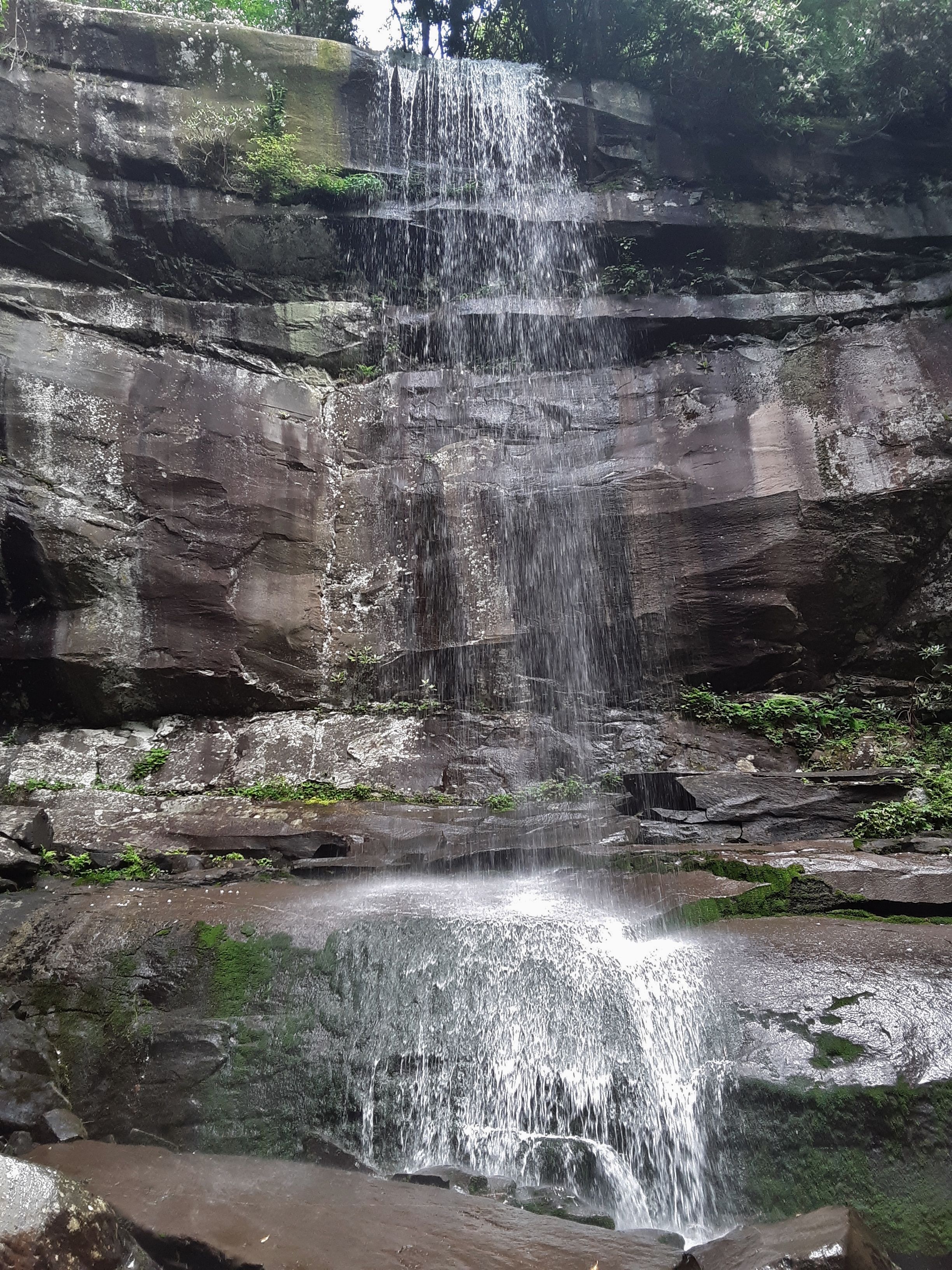
First waterfall- about 15 feet
“Waterfall” 2 was about 4 feet but with an inviting pool
Waterfall 3 was about 10 feet. These would be amazing looking after a good rain.
Sandstone overlaying Limestone?
Cultural Art: Tractor oil pan perhaps
Wild Flocks and Stinging Nettle and a Butterfly that moved too fast for my camera.
I find it amazing how you can fill up a 24 hour period with so much that feeds the mind, emotions, and body. These in turn bring a measure of rest to the spirit, best experienced as you thank and praise the Creator for the beauties before you, the health to enjoy them, and the relationships which are more permanent than either.
Experience is supposed to make us wiser and more prudent. Sometimes we heed lessons learned and sometime we don’t. It began with a seemingly innocent change of plans: “Oh, I can’t go overnight. We’ll just have to figure it out.” Next up was not taking a map. Then there was the part where I should have asked what the actual plans were. The trails are not well maintenanced, that is, cleared, so they can be hard to find. A new trail had been cut that was not on the map I had nor had I seen it, so we wasted some time going the wrong way. About 1/3 through the trip leg cramps ensued which caused us to change our route to avoid uphills that increased the cramps and pain, which then resulted in perhaps an extra 5 miles of hiking. We attempted to traverse a trail in the dark we had never been on. The trail passed through a field. In retrospect there were probably two exits, maybe more, from that field. After too much walking, we ended up on a road and knew where we were, which was about five miles from our vehicle. So we called in a rescue from an in-law. The final result of these multiple missteps was an estimated 25 miles in rough terrain, having left the house at 8 AM and returned at midnight.
On the up side, it was a beautiful day with cooler than usual June temperatures, partly cloudy and mostly tree covered to shield us from all day sun exposure. The river was cold and relaxing. The conversation was pleasant. We succeeded in hiking the length of the Gorge from Cabin Trail all the way to the lake and seeing several trails we’d not been on before. I took some good pictures and felt the beauty of God’s Creation. The stars shone brightly as we awaited the pick-up. My son asked me at one point how I could still be talking about plants. I had a two part response: 1) That’s just who I am, and 2) When you are hurting and in too deep, it’s best to focus your mind away from the difficulty onto more pleasant thoughts.
A few examples of Providential** assistance included finding a laminated map propped up against a tree at a campsite, a clean water source along the way, and an answer to prayer for assistance. I had told my son earlier in the day that I had prayed in the form of a daydream that a person would be standing in the river, fishing, who knew where to cross and would be willing to point out where the trail was on the other side. In actuality, the answer came in the form of two people who were camping and were just stepping out of the river after swimming. The man walked about a 1/4 mile up the river to show us where to cross and gave a detailed and accurate description of the turns to get on the trail we desired. The end of his description was as follows: “I don’t know what happens after the field because I haven’t gone any further.” (Reference earlier sentence about the two exits from the field for a small chuckle.)
Am I wiser for the experience? In one respect, no. I knew all of those things to do and had regularly done them in times past, except when I didn’t. In another respect, yes. For hopefully a long time, and perhaps permanently, I will ask questions of preparedness of my self and others before attempting something more than moderate. And, the moderate can become the strenuous, so take heed there, too. Now, a few of you are thinking how foolish the whole adventure was. I suspect you don’t have much adventure in your life. Some are saying, what’s the big deal since no one was hurt. Your adventures will likely be short-lived. The balance is to take calculated risks. That involves foresight, preparedness, physical and mental vigor, and a willingness to ask for help. I resolve to be better prepared next time rather than just stay home.
Father-Son Outing
Ferns have such a feel of richness
Never seen Galax so profusely blooming as on this trip
Mountain Laurel
Steep, poorly marked trails
Do you see the fisherman?
Sourwood sprouts and Table Mountain Pinecone
Steep terrain and sharp meanders
The reason the trail doesn’t always follow the river bank
Raccoon Tracks
Hawksbill
1 3/4 liter was not enough
Wild Ginger (Asarum sp?)
Refreshing
Chimneys
Japanese Meadowsweet. What is it doing here?
Solomon Seal with seed pods
???
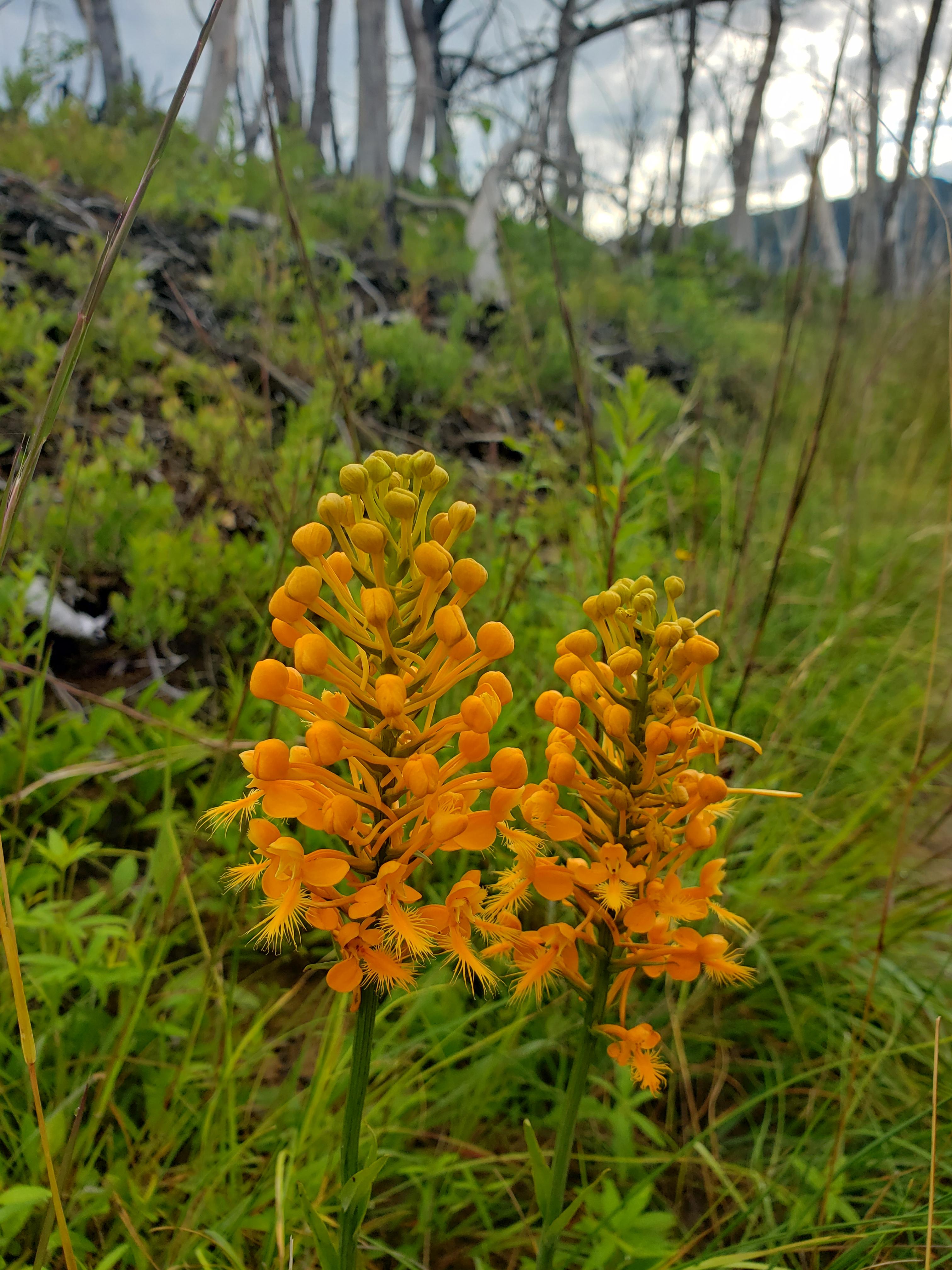
Fire Pink
???
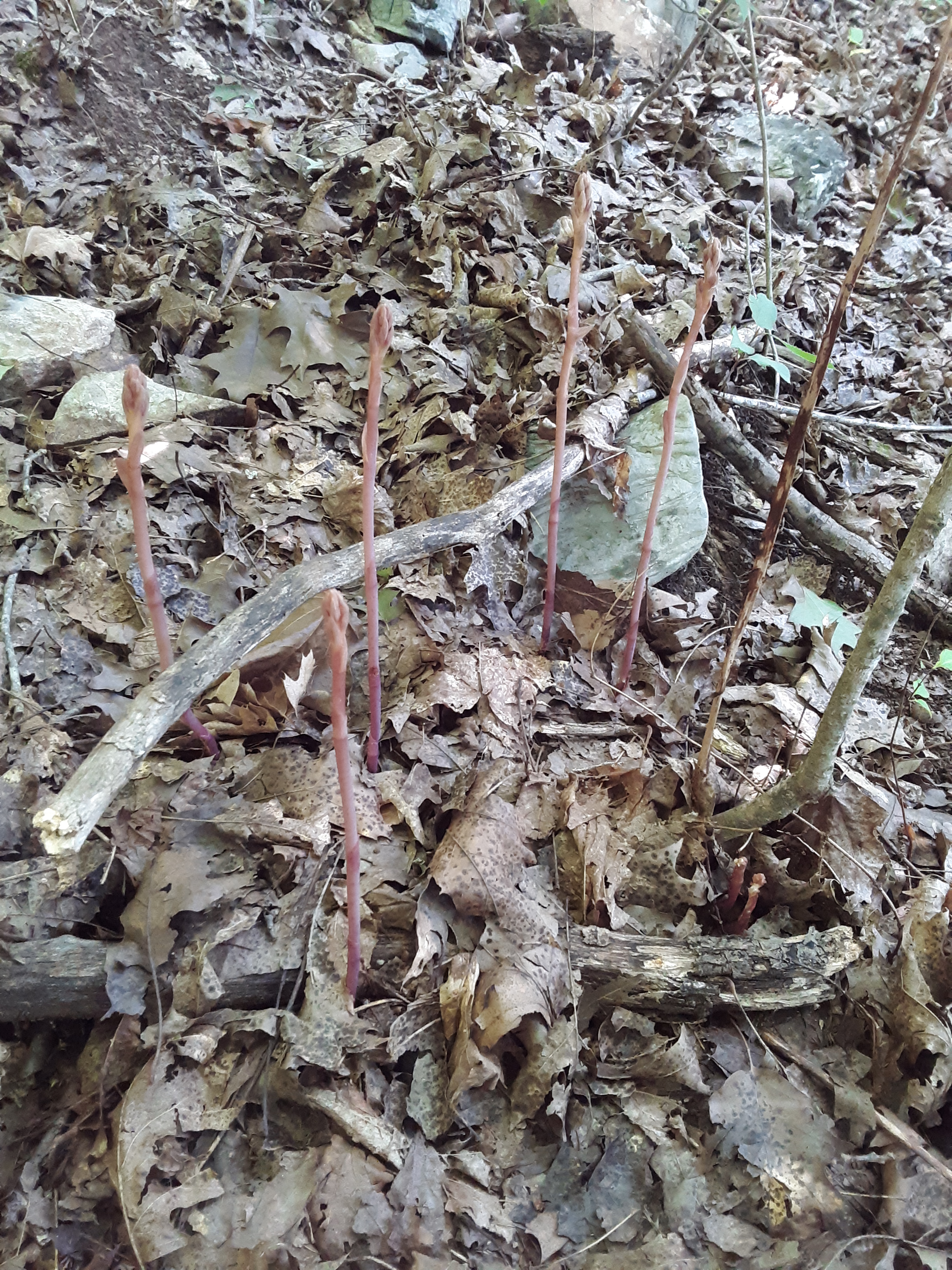
Indian Pipe
*Last lines of “Stopping By Woods On A Snowy Evening” by Robert Frost
**Answer to prayer is a Providential assistance, too, but is more direct, so I classify it differently from common grace (Matthew 5:45). God oversees all things in our lives.
I received an email today that left me chagrined. I am a 60 year old participant in outdoor activities, particularly climbing at the moment. Access to local national forest climbing areas may be threatened. I wrote a letter whose introductory paragraph read as follows:
“I am a native of East Tennessee and longtime resident of Western North Carolina who has spent many 1000’s of hours in the national forests of the Appalachians and Blue Ridge hiking and climbing and camping. The public lands and my use of them is my single most loved freedom and pursuit that retains me as a resident of these beloved mountains. For 50 years I have roamed these mountains for my mental and physical health, leaving as little trace as I could and taking many pictures and memories. As a family man, I have taught my family to appreciate and care for the mountains and as a teacher I have done the same both in the classroom and outdoors. I plead with you to not shut down the opportunities of young and old alike to enjoy the challenges of climbing by overly restrictive and one-size fits all statutes and procedures concerning climbing areas and their approaches. Educate people and see them rise to the challenge of protecting while utilizing these resources that belong to the American people. Don’t lock it away to be underutilized by preventing access to world class climbing areas in our beautiful forests.”
If you are interested in helping to keep the National Forests open to climbing both here, and ultimately nationwide, please spread the word and write a letter at the following site: Click on https://www.accessfund.org , and go to the bottom of the page for the quick help with the letter. It really only takes 5 minutes and may retain climbing access for years to come.
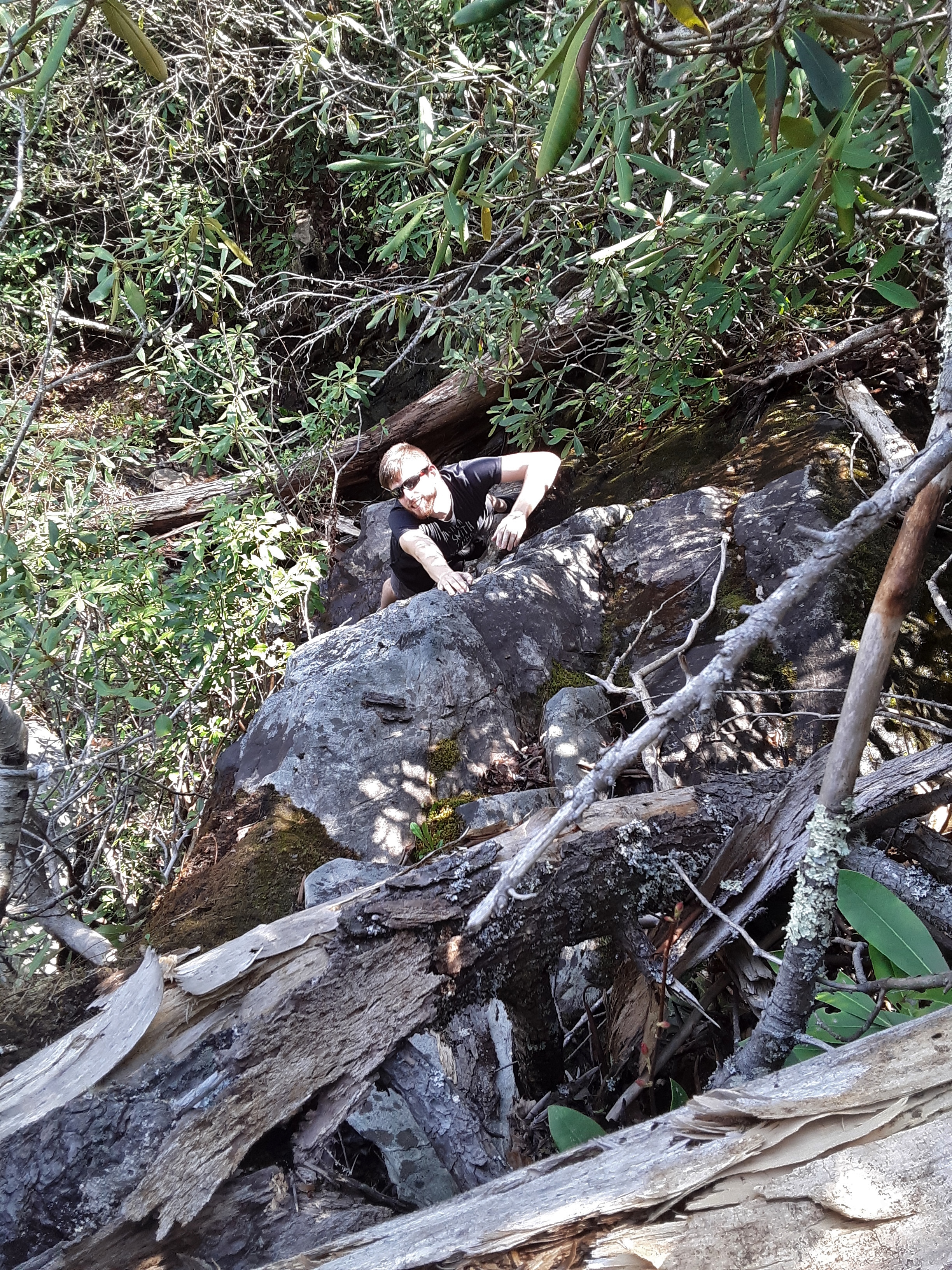
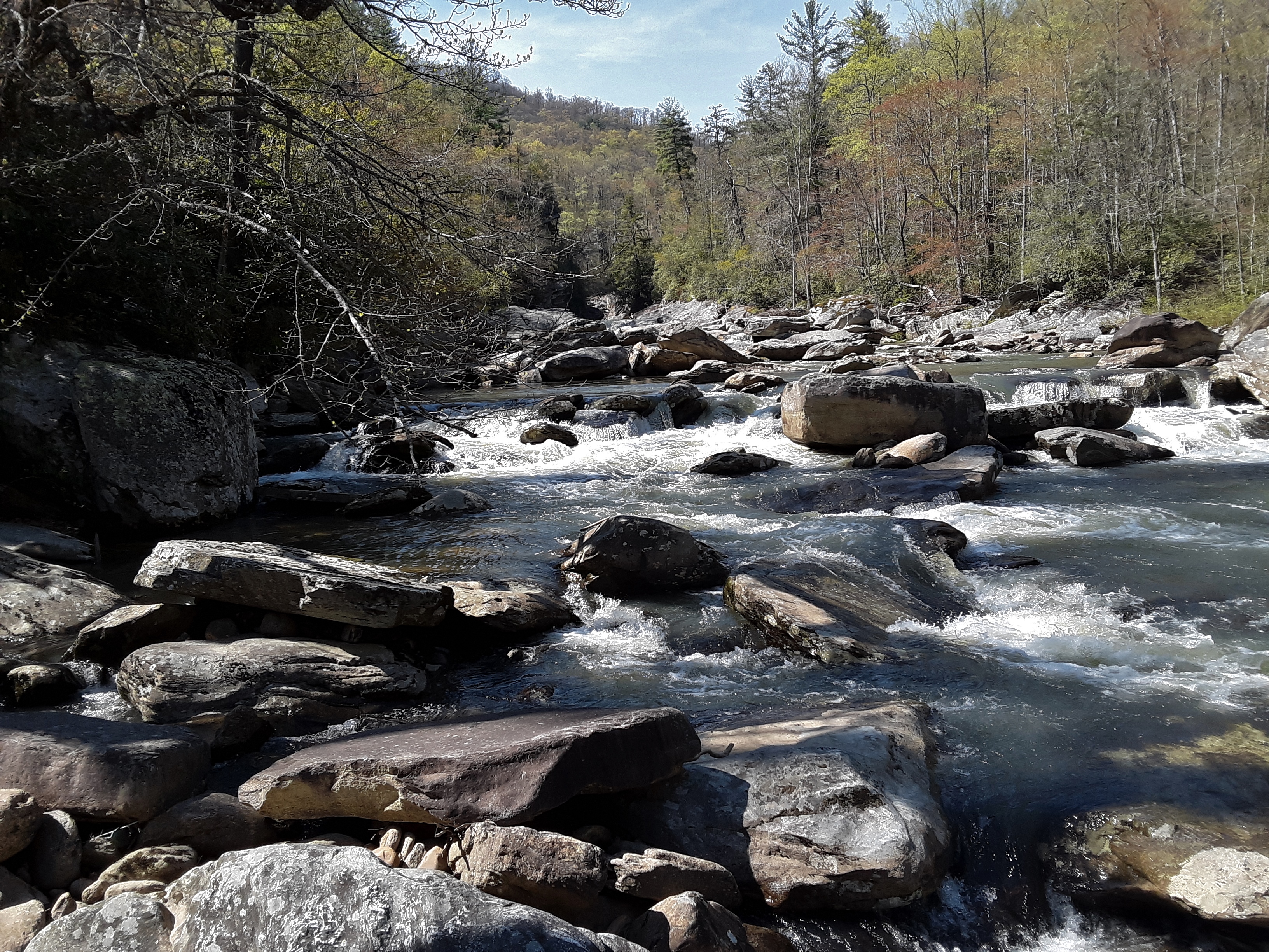
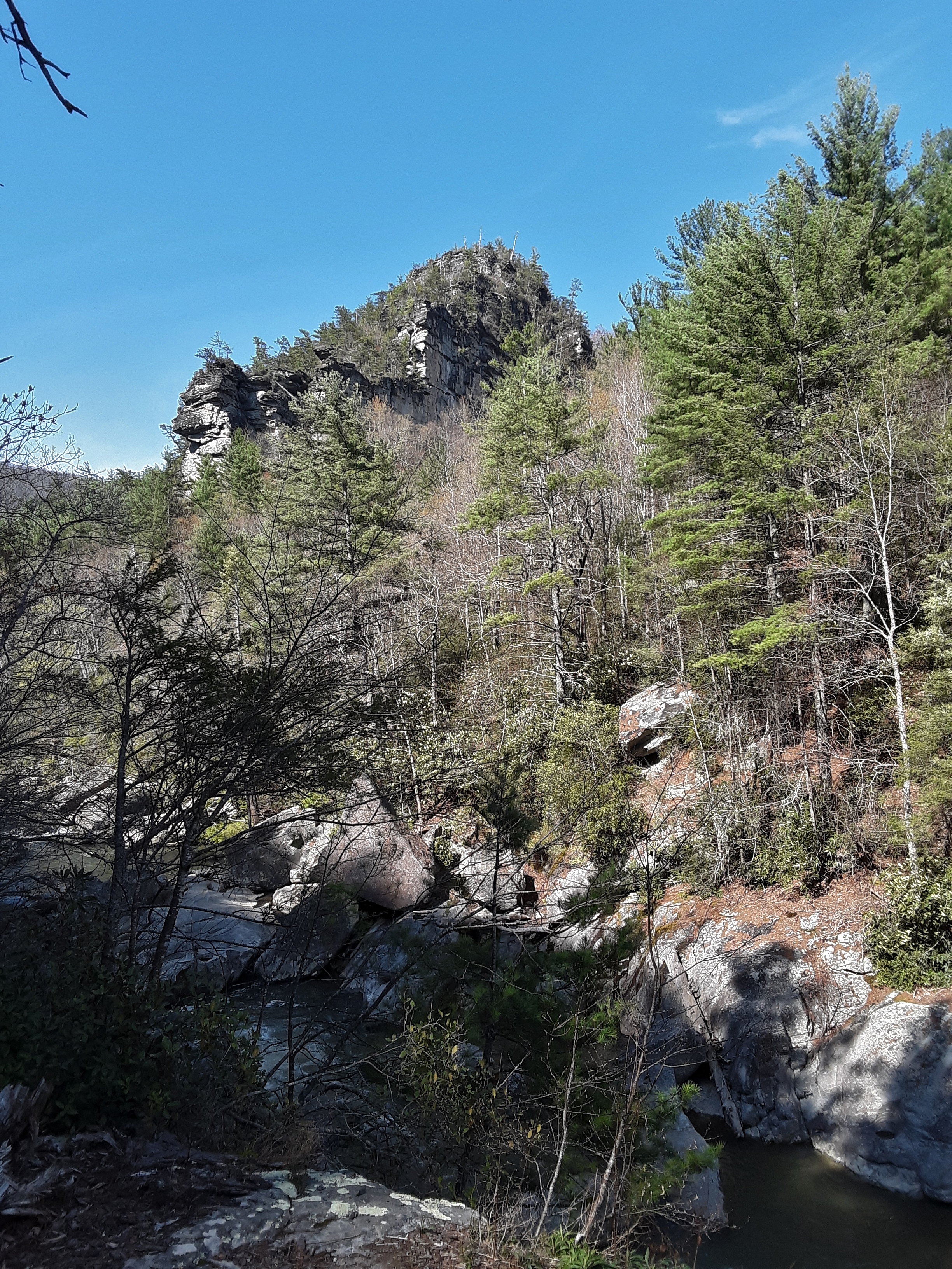
My son, his wife, a friend, and I went hiking in the Gorge last Friday. The temperature was perfect, the skies were deep blue, the wildflowers popping and beautiful, the conversation enjoyable, and the hiking strenuous. We went down by way of the Sandy Flats Trail which is on maps but no longer marked or maintained. In places the trail was easy to follow, but in others downed trees and shifting creek obscured any remnant. It was always extremely steep with actual rock scrambles in several places. I am glad that we went in this way instead of coming out this way, because we would have been discouraged when tired. Instead, it was an adventure with many undisturbed spots for wildflowers and jutting rock outcroppings.
Steep descent via Sandy Flats Trail next to Wiseman’s View
Newlyweds on a jaunt in the woods
Crazy Friend
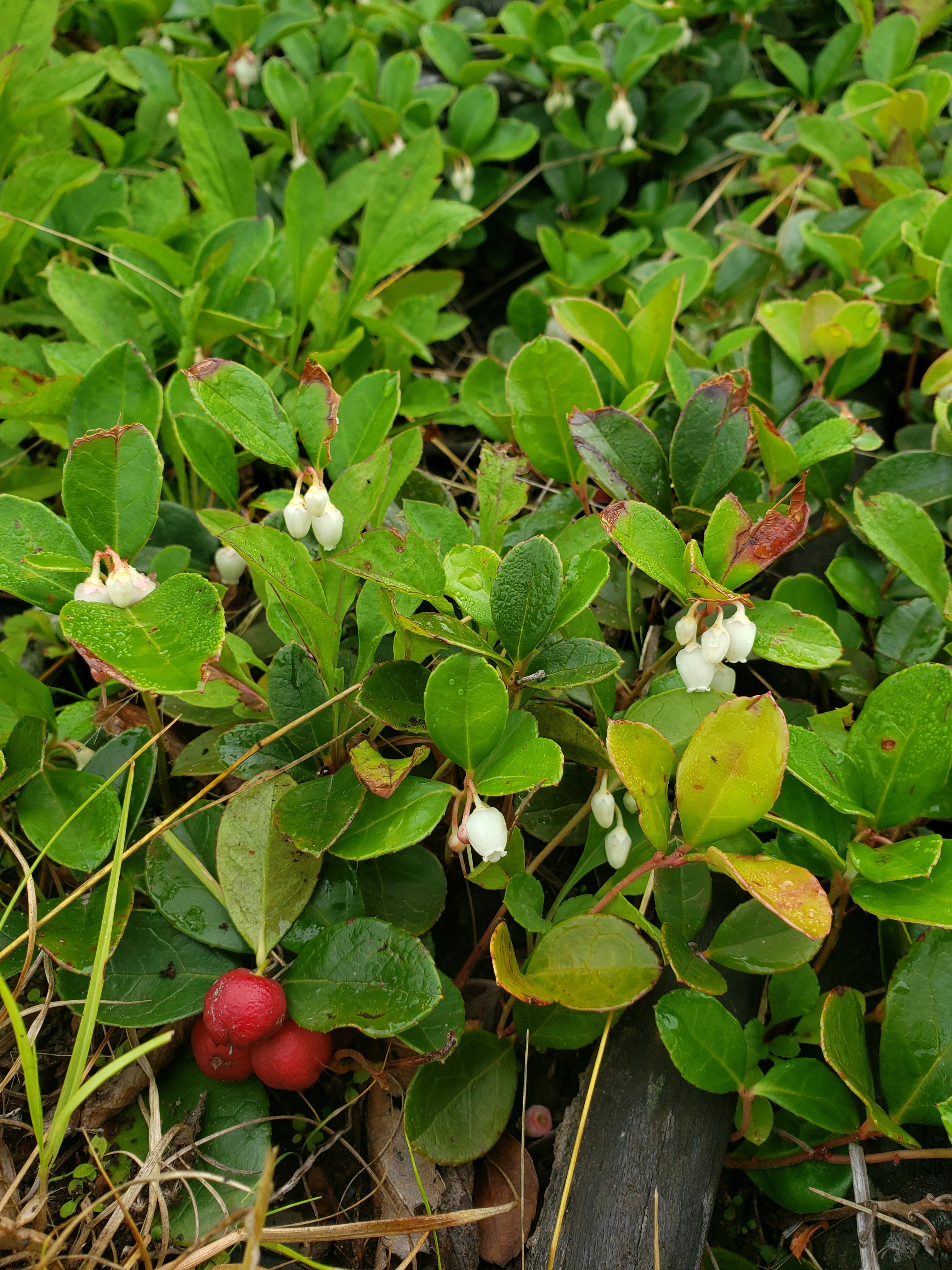
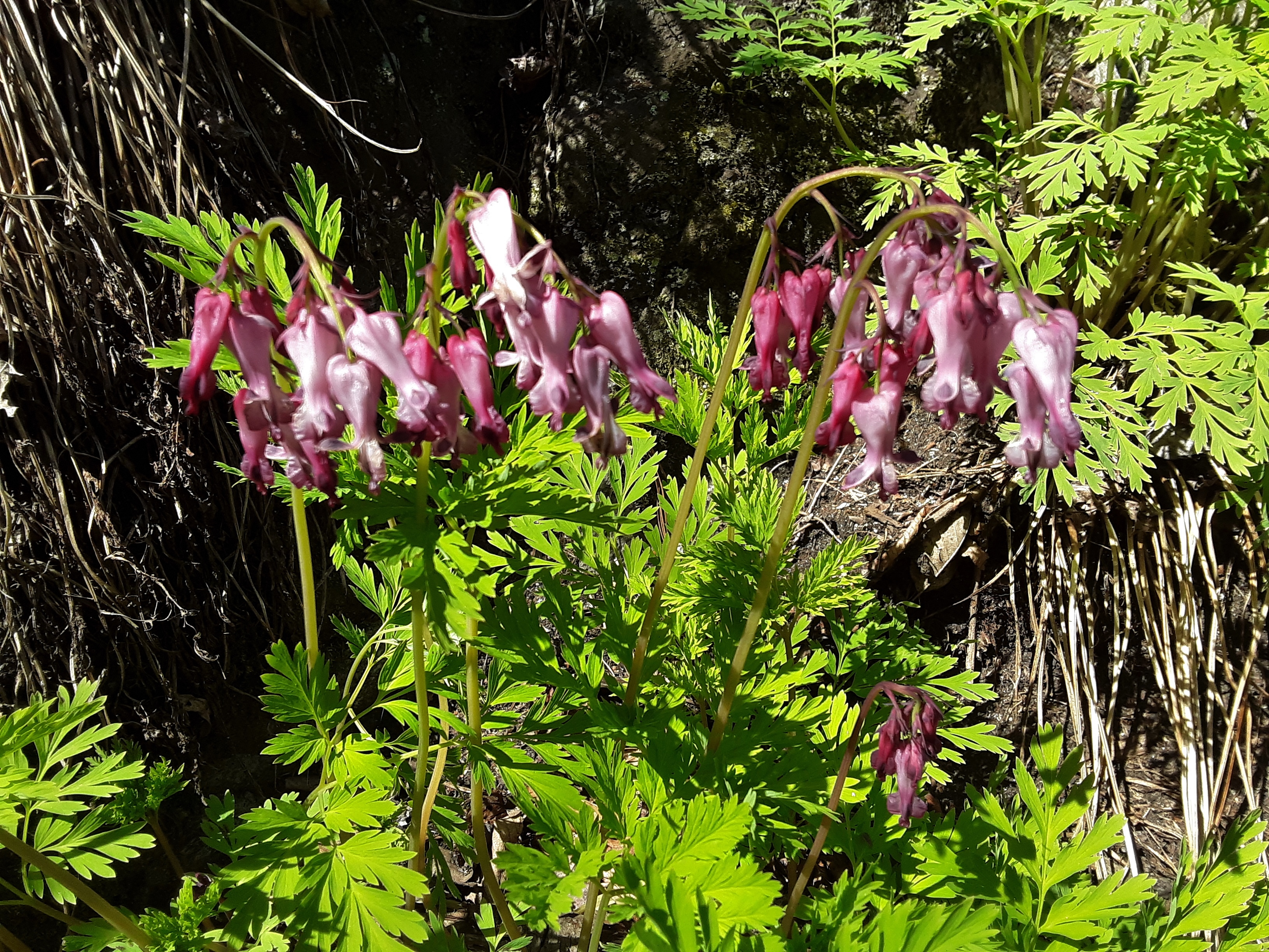
Bleeding Hearts (Dicentra eximia)
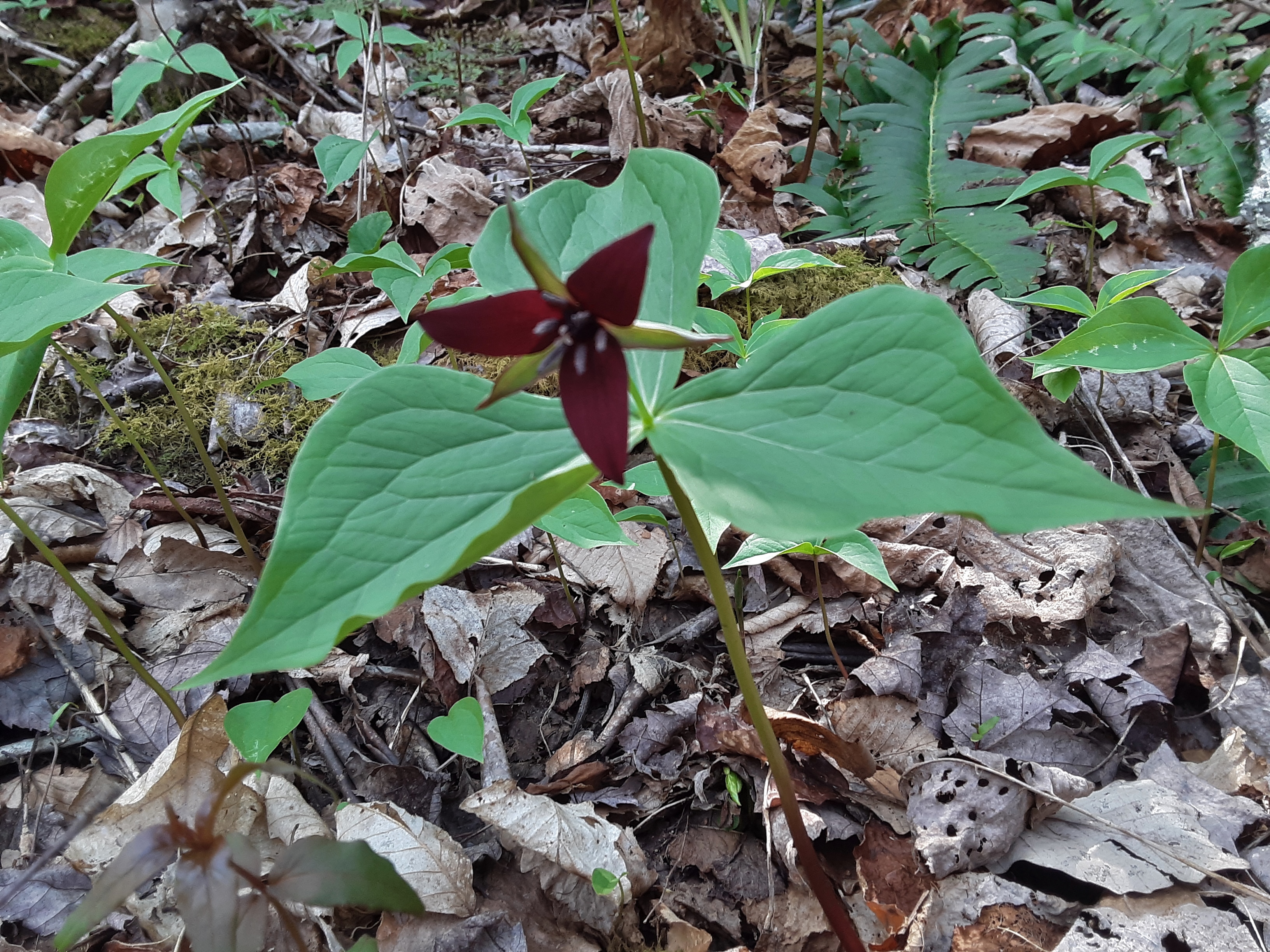
Wake-robin Trillium (Trillium erectum)
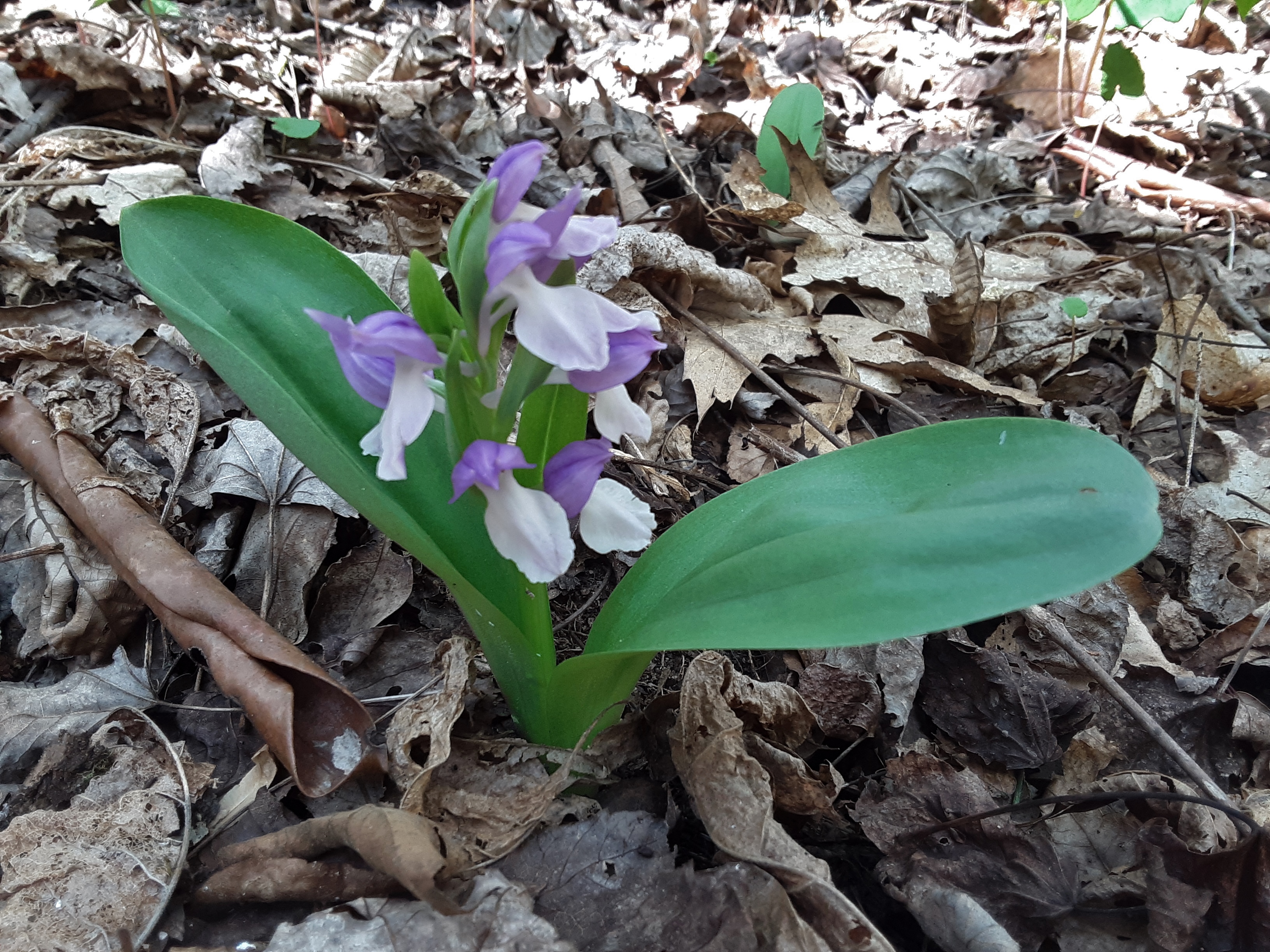
Showy Orchis (Gelaris spectablis)
expanding tree Shelf Fungus (or Bracket Fungus; Polypore)
Linville River
Sandy Flats?
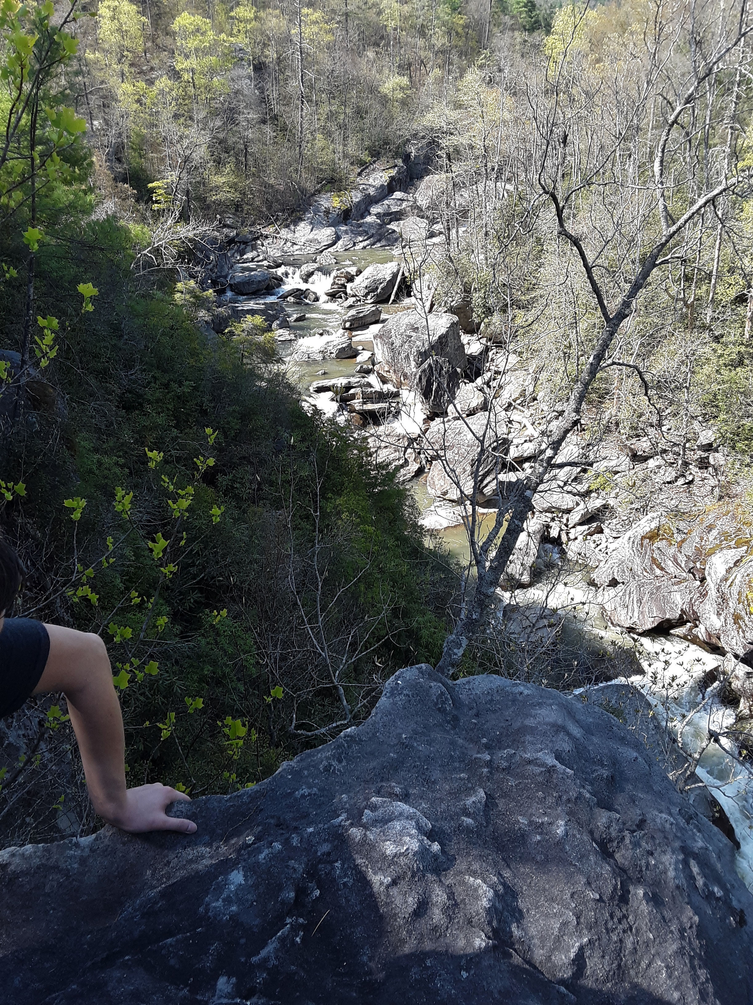
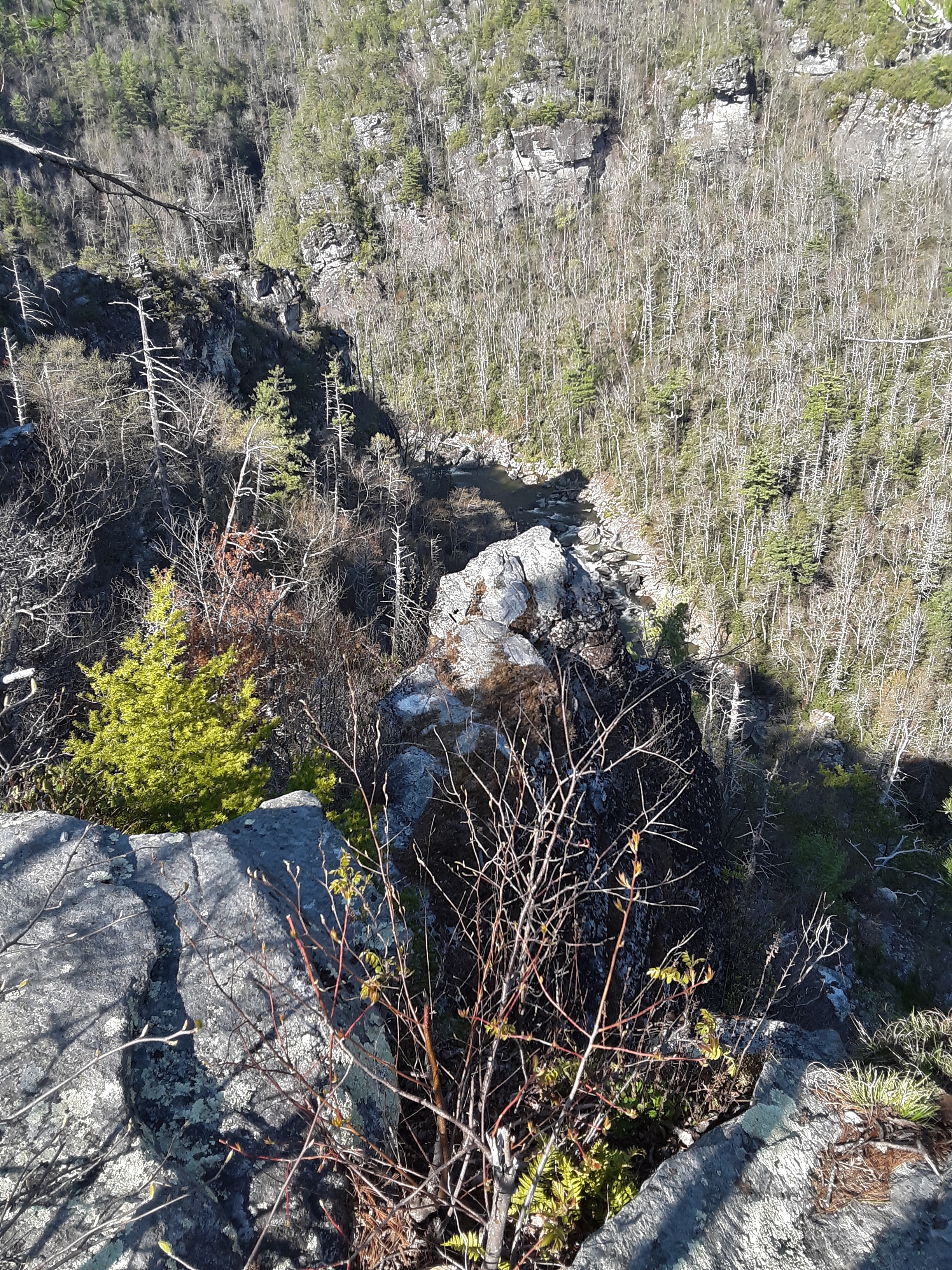
Next, we turned up gorge toward Babel Tower. My son felt like the Sun would beat us to our destination, so he set out on a fast pace. With taking pictures here and there, I had the hardest time keeping up. The Gorge is so narrow down by the river that at times you are only a few yards horizontal from the river but 1 to 2 hundred feet above it.
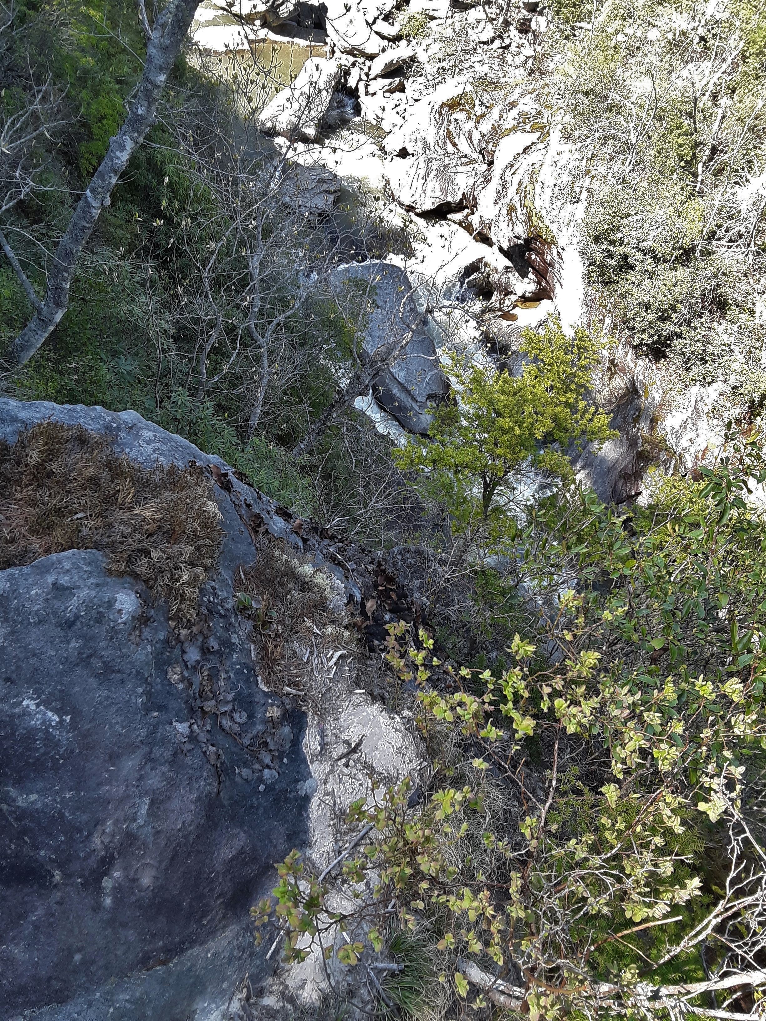
Trail on the Edge
Notice the rounded cut outs in the far bank from flood scouring.
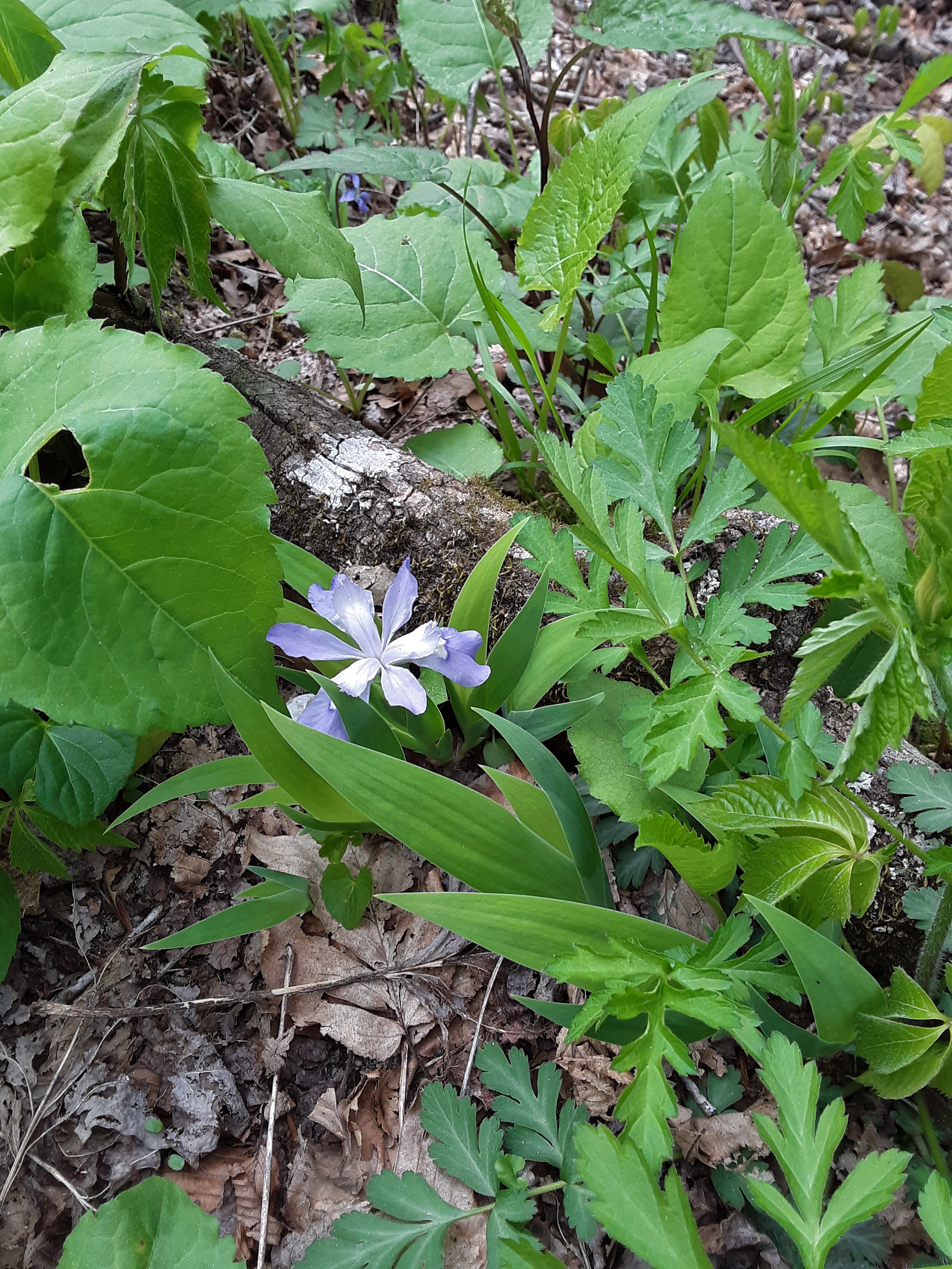
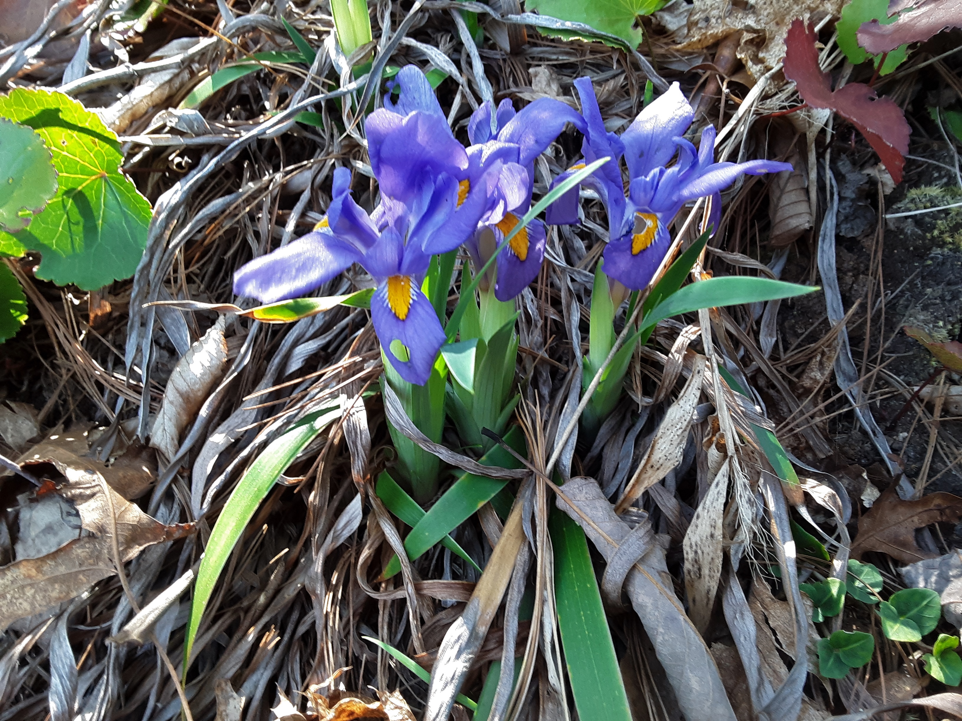
Blue-flag Iris (Iris versicolor)
Tower opposing Babel Tower
I am beyond frustrated with the autofocus. In one attempt, I even tried to put a large leaf in the immediate background to force the nearer focus and it still chose 1/5 of the field of view and focussed further away. But I did record a flower that I have not seen often. I saw several of these plants as we went along.
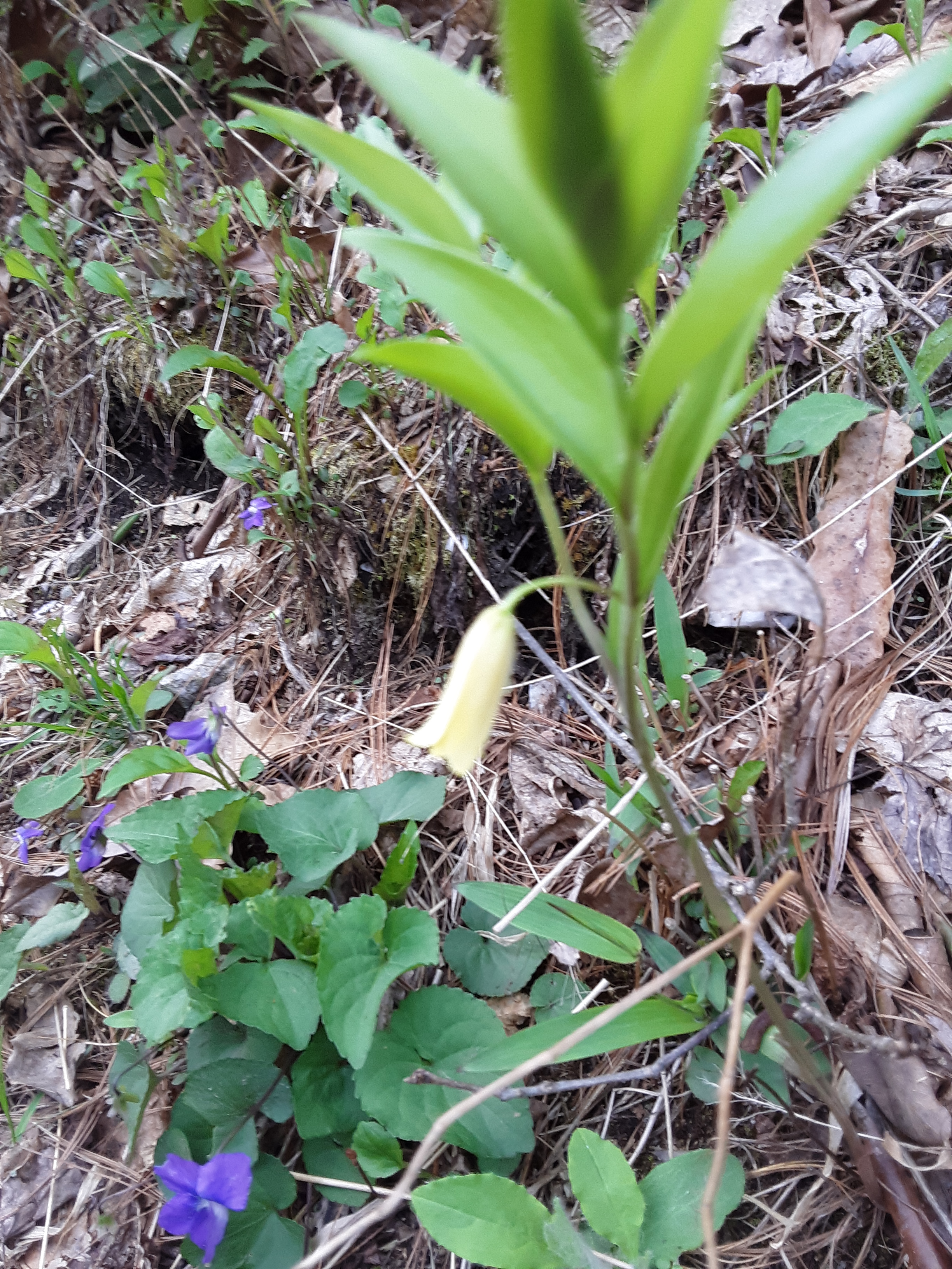
Sessileleaf Bellwort (Uvularia sessilifolia) with violets below
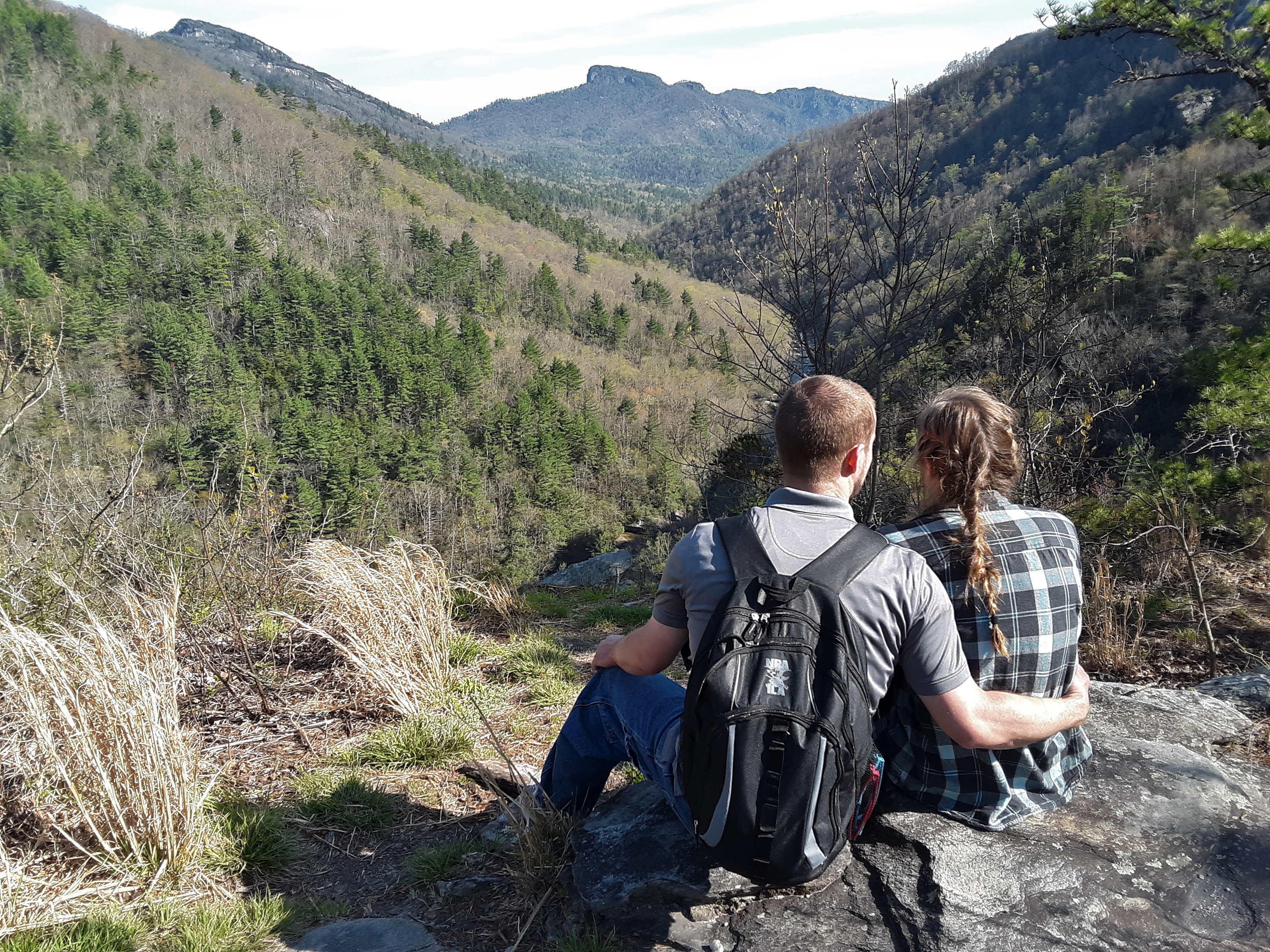
Perhaps the most classic and beautiful view of the Gorge is from Babel Tower toward Hawksbill, Table Rock, Little Table Rock, and Chimneys:
From Babel Tower downstream
The river goes around three sides of the rock outcropping called Babel Tower. A wide angle lens could record in 30 degrees of field of view the upstream and downstream river flowing at an angle about 60 degrees downward. This is extreme topography.
radical descent
It is always good to have someone to share the journey and the view with, whether the day be pleasant or strenuous, or both.
And to think, God is pleased to share the journey and the beauty with us and one day bring us to dwell with Him for eternity.


